|
|
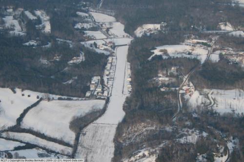 |
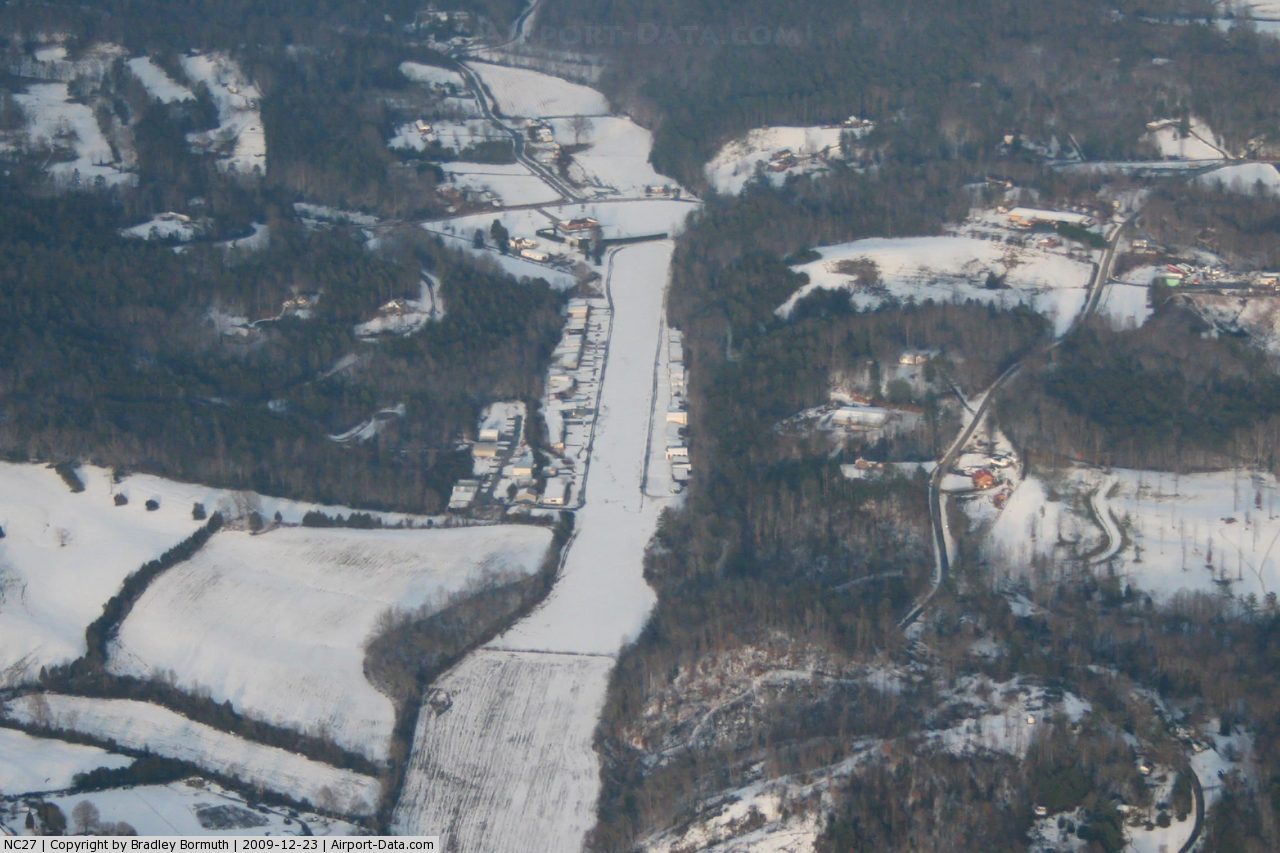
(Click on the photo to enlarge) |
Location & QuickFacts
| FAA Information Effective: | 2008-09-25 |
| Airport Identifier: | NC27 |
| Airport Status: | Operational |
| Longitude/Latitude: | 081-29-24.3400W/35-56-40.4700N
-81.490094/35.944575 (Estimated) |
| Elevation: | 1195 ft / 364.24 m (Surveyed) |
| Land: | 25 acres |
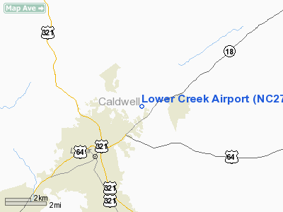
| From nearest city: | 3 nautical miles NE of Lenoir, NC |
| Location: | Caldwell County, NC |
| Magnetic Variation: | 05W (1985) |
Owner & Manager
| Ownership: | Privately owned |
| Owner: | Lenoir Aviation Club, Inc |
| Address: | Po Box 220
Lenoir, NC 28645 |
| Phone number: | 828-758-4524 |
| Manager: | Jim George |
| Address: | 2005 Wildwood Rd
Lenoir, NC 28645 |
| Phone number: | 828-758-2877 |
Airport Operations and Facilities
| Airport Use: | Private |
| Wind indicator: | Yes |
| Segmented Circle: | No |
| Control Tower: | No |
| Landing fee charge: | No |
| Sectional chart: | Atlanta |
| Region: | ASO - Southern |
| Boundary ARTCC: | ZTL - Atlanta |
| Tie-in FSS: | RDU - Raleigh |
| FSS on Airport: | No |
| FSS Toll Free: | 1-800-WX-BRIEF |
Airport Services
| Airframe Repair: | NONE |
| Power Plant Repair: | NONE |
Runway Information
Runway 05/23
| Dimension: | 3200 x 150 ft / 975.4 x 45.7 m |
| Surface: | TURF, |
| |
Runway 05 |
Runway 23 |
| Traffic Pattern: | Left | Right |
| Obstruction: | | 30 ft pline, 400.0 ft from runway |
|
Radio Navigation Aids
| ID |
Type |
Name |
Ch |
Freq |
Var |
Dist |
| MRN | FAN MARKER | Lenoir | | | 03W | 11.1 nm |
| HK | NDB | Tawba | | 332.00 | 06W | 13.1 nm |
| FIQ | NDB | Fiddlers | | 391.00 | 07W | 16.6 nm |
| UKF | NDB | Wilki | | 209.00 | 06W | 21.6 nm |
| BAR | NDB | Hemlock | | 320.00 | 02W | 22.7 nm |
| VW | NDB | Temky | | 280.00 | 05W | 23.1 nm |
| JU | NDB | Ashee | | 410.00 | 07W | 30.5 nm |
| IZN | NDB | Lincolnton | | 432.00 | 06W | 31.4 nm |
| JJO | NDB | Mountain City | | 396.00 | 04W | 32.7 nm |
| SLP | NDB | First River | | 417.00 | 06W | 41.9 nm |
| RFE | NDB | Rutherford | | 344.00 | 05W | 42.3 nm |
| ZEF | NDB | Zephyr | | 326.00 | 05W | 43.3 nm |
| EZT | NDB | Elizabethton | | 275.00 | 02W | 44.0 nm |
| GHJ | NDB | Stonia | | 260.00 | 06W | 48.1 nm |
| BZM | VOR/DME | Barretts Mountain | 045X | 110.80 | 06W | 13.0 nm |
| HMV | VORTAC | Holston Mountain | 093X | 114.60 | 04W | 42.9 nm |
| SUG | VORTAC | Sugarloaf Mountain | 059X | 112.20 | 02W | 49.9 nm |
| HKY | VOT | Hickory Regional | | 110.00 | | 13.2 nm |
Remarks
Images and information placed above are from
http://www.airport-data.com/airport/NC27/
We thank them for the data!
| General Info
|
| Country |
United States
|
| State |
NORTH CAROLINA
|
| FAA ID |
NC27
|
| Latitude |
35-56-40.470N
|
| Longitude |
081-29-24.340W
|
| Elevation |
1195 feet
|
| Near City |
LENOIR
|
We don't guarantee the information is fresh and accurate. The data may
be wrong or outdated.
For more up-to-date information please refer to other sources.
|
|