 |
|
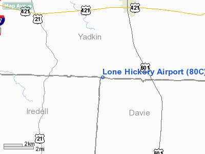
Location & QuickFacts
| FAA Information Effective: | 2008-09-25 |
| Airport Identifier: | 80C |
| Airport Status: | Operational |
| Longitude/Latitude: | 080-41-22.0000W/36-03-05.0000N
-80.689444/36.051389 (Estimated) |
| Elevation: | 1000 ft / 304.80 m (Estimated) |
| Land: | 0 acres |
| From nearest city: | 6 nautical miles S of Yadkinville, NC |
| Location: | Yadkin County, NC |
| Magnetic Variation: | 06W (1995) |
Owner & Manager
| Ownership: | Privately owned |
| Owner: | Harold Holcomb & Jeff Steele |
| Address: | 1205 Runway Trail
Yadkinville, NC 27055
JEFF STEELE ADDRESS |
| Phone number: | 336-463-2892
MR. STEELE PHONE 336-463-4680. |
| Manager: | Harold Dean Holcomb |
| Address: | 1205 Runway Trail
Yadkinville, NC 27055 |
| Phone number: | 336-463-2892 |
Airport Operations and Facilities
| Airport Use: | Open to public |
| Wind indicator: | Yes |
| Segmented Circle: | No |
| Control Tower: | No |
| Sectional chart: | Charlotte |
| Region: | ASO - Southern |
| Boundary ARTCC: | ZTL - Atlanta |
| Tie-in FSS: | RDU - Raleigh |
| FSS Toll Free: | 1-800-WX-BRIEF |
| NOTAMs Facility: | RDU |
Airport Communications
Runway Information
Runway 16/34
| Dimension: | 2000 x 60 ft / 609.6 x 18.3 m |
| Surface: | TURF, Good Condition |
| |
Runway 16 |
Runway 34 |
| Traffic Pattern: | Left | Left |
| Obstruction: | 15 ft road, 54L/ ft right of centerline | 31 ft trees, 210.0 ft from runway, 7 ft right of centerline, 6:1 slope to clear |
|
Radio Navigation Aids
| ID |
Type |
Name |
Ch |
Freq |
Var |
Dist |
| OQA | FAN MARKER | Rockingham County | | | | 47.4 nm |
| MRN | FAN MARKER | Lenoir | | | 03W | 48.0 nm |
| DVZ | NDB | Davie | | 354.00 | 06W | 14.1 nm |
| ZEF | NDB | Zephyr | | 326.00 | 05W | 15.8 nm |
| UKF | NDB | Wilki | | 209.00 | 06W | 20.2 nm |
| AZW | NDB | Mount Airy | | 223.00 | 07W | 21.1 nm |
| RU | NDB | Rovdy | | 275.00 | 06W | 21.5 nm |
| VW | NDB | Temky | | 280.00 | 05W | 24.7 nm |
| SEN | NDB | Swearing/dcmsnd | | 260.00 | 06W | 25.1 nm |
| HK | NDB | Tawba | | 332.00 | 06W | 34.0 nm |
| IZN | NDB | Lincolnton | | 432.00 | 06W | 36.4 nm |
| JU | NDB | Ashee | | 410.00 | 07W | 38.3 nm |
| HLX | NDB | Hillsville | | 269.00 | 06W | 43.2 nm |
| CQJ | NDB | City Lake | | 266.00 | 08W | 44.9 nm |
| VU | NDB | Aller | | 346.00 | 06W | 45.0 nm |
| SIF | NDB | Slammer | | 423.00 | 07W | 49.1 nm |
| UV | NDB | Bales | | 396.00 | 07W | 49.5 nm |
| BZM | VOR/DME | Barretts Mountain | 045X | 110.80 | 06W | 29.0 nm |
| GSO | VORTAC | Greensboro | 109X | 116.20 | 03W | 34.7 nm |
| HKY | VOT | Hickory Regional | | 110.00 | | 38.9 nm |
Remarks
- ACFT OPERATING FM PINEY RIDGE ARPT 1.3 MI NW.
- PLINES 500-1000 FT N RY 16 THLD.
- ACFT PARKED 100 FT FM CNTRLN AT RY MID POINT IN HANGAR.
- RY 16/34 HAS 3% GRADE; WINDS PERMITTING TKOF RY 34 LND RY 16.
- NO FLIGHT TRAINING OR STUDENT PILOTS; ONLY EXPERIENCED PILOTS PERMITTED.
- RY 34 DEPARTURES MAKE LEFT TURN FOR NOISE & OBSTRUCTION AVOIDANCE.
- PRVDD VFR; WIND INDICATOR IS MAINTAINED; NO NGT OPNS WITHOUT LIGHTING; WRITTEN AGREEMENT WITH PINEY RIDGE ARPT.
Images and information placed above are from
http://www.airport-data.com/airport/80C/
We thank them for the data!
| General Info
|
| Country |
United States
|
| State |
NORTH CAROLINA
|
| FAA ID |
80C
|
| Latitude |
36-03-05.000N
|
| Longitude |
080-41-22.000W
|
| Elevation |
1000 feet
|
| Near City |
YADKINVILLE
|
We don't guarantee the information is fresh and accurate. The data may
be wrong or outdated.
For more up-to-date information please refer to other sources.
|
|


