 |
|
Location & QuickFacts
| FAA Information Effective: | 2008-09-25 |
| Airport Identifier: | 98NC |
| Airport Status: | Operational |
| Longitude/Latitude: | 081-51-38.0700W/36-07-05.1800N
-81.860575/36.118106 (Estimated) |
| Elevation: | 4826 ft / 1470.96 m (Estimated) |
| Land: | 0 acres |
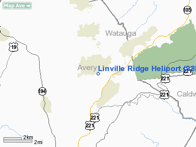
| From nearest city: | 1 nautical miles S of Linville, NC |
| Location: | Avery County, NC |
| Magnetic Variation: | () |
Owner & Manager
| Ownership: | Privately owned |
| Owner: | Scottsdale Company, D.b.a. Linville |
| Address: | P.o. Box 704
Linville, NC 28646 |
| Phone number: | 828-898-5151 |
| Manager: | Thomas Sheets |
| Address: | P.o. Box 704
Linville, NC 28646 |
| Phone number: | 828-898-5533 |
Airport Operations and Facilities
| Airport Use: | Private |
| Wind indicator: | Yes |
| Segmented Circle: | Yes |
| Control Tower: | No |
| Sectional chart: | Cincinnati |
| Region: | ASO - Southern |
| Boundary ARTCC: | ZTL - Atlanta |
| Tie-in FSS: | RDU - Raleigh |
| FSS Toll Free: | 1-800-WX-BRIEF |
Runway Information
Helipad H1
| Dimension: | 40 x 40 ft / 12.2 x 12.2 m |
| Surface: | CONC, |
| |
Runway H1 |
Runway |
| Traffic Pattern: | Left | Left |
|
Radio Navigation Aids
| ID |
Type |
Name |
Ch |
Freq |
Var |
Dist |
| MRN | FAN MARKER | Lenoir | | | 03W | 22.5 nm |
| BAR | NDB | Hemlock | | 320.00 | 02W | 2.3 nm |
| JJO | NDB | Mountain City | | 396.00 | 04W | 18.0 nm |
| EZT | NDB | Elizabethton | | 275.00 | 02W | 23.2 nm |
| FIQ | NDB | Fiddlers | | 391.00 | 07W | 26.2 nm |
| JU | NDB | Ashee | | 410.00 | 07W | 32.3 nm |
| HK | NDB | Tawba | | 332.00 | 06W | 33.6 nm |
| BO | NDB | Booie | | 221.00 | 04W | 35.1 nm |
| UKF | NDB | Wilki | | 209.00 | 06W | 37.0 nm |
| VJ | NDB | Whine | | 236.00 | 05W | 37.3 nm |
| VW | NDB | Temky | | 280.00 | 05W | 43.9 nm |
| RFE | NDB | Rutherford | | 344.00 | 05W | 46.4 nm |
| BZM | VOR/DME | Barretts Mountain | 045X | 110.80 | 06W | 33.7 nm |
| GZG | VOR/DME | Glade Spring | 039X | 110.20 | 02W | 43.8 nm |
| HMV | VORTAC | Holston Mountain | 093X | 114.60 | 04W | 23.2 nm |
| SUG | VORTAC | Sugarloaf Mountain | 059X | 112.20 | 02W | 47.2 nm |
| HKY | VOT | Hickory Regional | | 110.00 | | 32.2 nm |
Remarks
- PROVIDED VFR OPNS, PVT USE, AREA IS MARKED, AND WIND INDICATOR IS MAINTAINED.
Images and information placed above are from
http://www.airport-data.com/airport/98NC/
We thank them for the data!
|
|


