 |
|
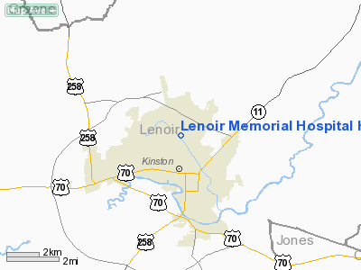
Lenoir Memorial Hospital Heliport |
Location & QuickFacts
| FAA Information Effective: | 2008-09-25 |
| Airport Identifier: | 55NC |
| Airport Status: | Operational |
| Longitude/Latitude: | 077-35-03.0000W/35-17-23.0000N
-77.584167/35.289722 (Estimated) |
| Elevation: | 80 ft / 24.38 m (Estimated) |
| Land: | 0 acres |
| From nearest city: | 0 nautical miles N of Kinston, NC |
| Location: | Lenoir County, NC |
| Magnetic Variation: | 09W (2000) |
Owner & Manager
| Ownership: | Privately owned |
| Owner: | Lenoir Memorial Hospital |
| Address: | Po Box 1678
Kinston, NC 18503-1678 |
| Phone number: | 252-522-7879 |
| Manager: | Glenn E. Clark |
| Address: | 100 Airport Road
Kinston, NC 28501-1604 |
| Phone number: | 252-522-7123 |
Airport Operations and Facilities
| Airport Use: | Private
MEDICAL USE. |
| Wind indicator: | Yes |
| Segmented Circle: | No |
| Control Tower: | No |
| Lighting Schedule: | PHONE REQ
HOSP REQS LGT SVC WHEN REQD. |
| Sectional chart: | Charlotte |
| Region: | ASO - Southern |
| Boundary ARTCC: | ZDC - Washington |
| Tie-in FSS: | RDU - Raleigh |
| FSS Toll Free: | 1-800-WX-BRIEF |
Runway Information
Helipad H1
| Dimension: | 75 x 75 ft / 22.9 x 22.9 m |
| Surface: | CONC, |
| |
Runway H1 |
Runway |
| Traffic Pattern: | Left | Left |
|
Radio Navigation Aids
| ID |
Type |
Name |
Ch |
Freq |
Var |
Dist |
| PGV | FAN MARKER | Belvoir | | | 06W | 23.3 nm |
| DKA | NDB | Kenan | | 332.00 | 07W | 21.0 nm |
| JYN | NDB | Wayne | | 208.00 | 08W | 21.0 nm |
| RNW | NDB | Chocowinity | | 388.00 | 07W | 26.9 nm |
| AQE | NDB | Alwood | | 230.00 | 09W | 27.1 nm |
| RW | NDB | Jambe | | 235.00 | 09W | 34.2 nm |
| NCA | NDB | New River | | 356.00 | 08W | 35.0 nm |
| ETC | NDB | Tarboro | | 257.00 | 08W | 38.9 nm |
| MCZ | NDB | Williamston | | 336.00 | 09W | 39.6 nm |
| ACZ | NDB | Pendy | | 379.00 | 09W | 40.2 nm |
| EUU | NDB | Jnall | | 251.00 | 07W | 42.3 nm |
| CTZ | NDB | Clinton | | 412.00 | 08W | 42.7 nm |
| JN | NDB | Jurly | | 263.00 | 09W | 42.7 nm |
| DIW | NDB/DME | Dixon | 107X | 198.00 | 08W | 43.8 nm |
| GSB | TACAN | Seymour Johnson | 112X | | 08W | 19.2 nm |
| NCA | TACAN | New River | 101X | | 08W | 35.7 nm |
| NKT | TACAN | Cherry Point | 075X | | 09W | 41.9 nm |
| NJM | TACAN | Bogue Mcalf | 067X | | 08W | 45.3 nm |
| EWN | VOR/DME | New Bern | 083X | 113.60 | 08W | 29.5 nm |
| ISO | VORTAC | Kinston | 033X | 109.60 | 05W | 5.0 nm |
| TYI | VORTAC | Tar River | 125X | 117.80 | 05W | 41.7 nm |
Remarks
- CORNERS OF HOSPITAL & BLDG ANT MKD WITH 24 HR RED OBSTR LGTS.
- PRVDD VFR OPNS, PVT USE, MAINTAIN CTC WITH KINSTON RGNL ATCT WHILE IN CLASS D ARSPC, AREA IS MKD, WIND INDICATOR IS MAINTAINED.
Images and information placed above are from
http://www.airport-data.com/airport/55NC/
We thank them for the data!
| General Info
|
| Country |
United States
|
| State |
NORTH CAROLINA
|
| FAA ID |
55NC
|
| Latitude |
35-17-23.000N
|
| Longitude |
077-35-03.000W
|
| Elevation |
80 feet
|
| Near City |
KINSTON
|
We don't guarantee the information is fresh and accurate. The data may
be wrong or outdated.
For more up-to-date information please refer to other sources.
|
|


