 |
|
 |
(Click on the photo to enlarge) |
Location & QuickFacts
| FAA Information Effective: | 2008-09-25 |
| Airport Identifier: | NC12 |
| Airport Status: | Operational |
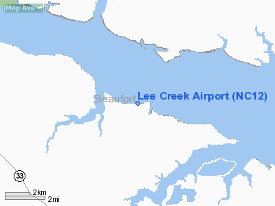
| Longitude/Latitude: | 076-47-04.7620W/35-23-22.6020N
-76.784656/35.389612 (Estimated) |
| Elevation: | 3 ft / 0.91 m (Estimated) |
| Land: | 0 acres |
| From nearest city: | 5 nautical miles N of Aurora, NC |
| Location: | Beaufort County, NC |
| Magnetic Variation: | 08W (1985) |
Owner & Manager
| Ownership: | Privately owned |
| Owner: | Pcs Phosphate |
| Address: | Po Box 48
Aurora, NC 27806 |
| Phone number: | 252-322-8147 |
| Manager: | Jayne Jones |
| Address: | 1530 Nc Hwy 306 South
Aurora, NC 27806 |
| Phone number: | 252-322-4111 |
Airport Operations and Facilities
| Airport Use: | Private |
| Wind indicator: | Yes |
| Segmented Circle: | No |
| Control Tower: | No |
| Lighting Schedule: | PHONE REQ
|
| Landing fee charge: | No |
| Sectional chart: | Charlotte |
| Region: | ASO - Southern |
| Boundary ARTCC: | ZDC - Washington |
| Tie-in FSS: | RDU - Raleigh |
| FSS on Airport: | No |
| FSS Toll Free: | 1-800-WX-BRIEF |
Airport Services
| Airframe Repair: | NONE |
| Power Plant Repair: | NONE |
Runway Information
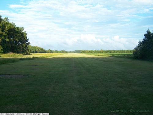
Runway 08/26
| Dimension: | 5815 x 75 ft / 1772.4 x 22.9 m |
| Surface: | ASPH, |
| Edge Lights: | Low |
| |
Runway 08 |
Runway 26 |
| Traffic Pattern: | Left | Left |
|
Radio Navigation Aids
| ID |
Type |
Name |
Ch |
Freq |
Var |
Dist |
| PGV | FAN MARKER | Belvoir | | | 06W | 32.9 nm |
| RNW | NDB | Chocowinity | | 388.00 | 07W | 17.3 nm |
| PMZ | NDB | Plymouth | | 221.00 | 10W | 25.3 nm |
| MCZ | NDB | Williamston | | 336.00 | 09W | 34.1 nm |
| AQE | NDB | Alwood | | 230.00 | 09W | 34.5 nm |
| EDE | NDB | Edenton | | 265.00 | 10W | 39.7 nm |
| MRH | NDB | Morehead | | 269.00 | 08W | 40.0 nm |
| ETC | NDB | Tarboro | | 257.00 | 08W | 49.6 nm |
| OUC | NDB/DME | Pamlico/dcmsnd | 034X | 404.00 | 09W | 42.4 nm |
| NKT | TACAN | Cherry Point | 075X | | 09W | 29.6 nm |
| NJM | TACAN | Bogue Mcalf | 067X | | 08W | 43.8 nm |
| EWN | VOR/DME | New Bern | 083X | 113.60 | 08W | 22.9 nm |
| ISO | VORTAC | Kinston | 033X | 109.60 | 05W | 37.9 nm |
Remarks
- LGTD AND UNMRKD PLINES EA SIDE OF CNTRLN RWY 8 AND BLDG ON LEFT SIDE APCH RWY 26.
Images and information placed above are from
http://www.airport-data.com/airport/NC12/
We thank them for the data!
| General Info
|
| Country |
United States
|
| State |
NORTH CAROLINA
|
| FAA ID |
NC12
|
| Latitude |
35-23-22.602N
|
| Longitude |
076-47-04.762W
|
| Elevation |
3 feet
|
| Near City |
AURORA
|
We don't guarantee the information is fresh and accurate. The data may
be wrong or outdated.
For more up-to-date information please refer to other sources.
|
|


