|
|
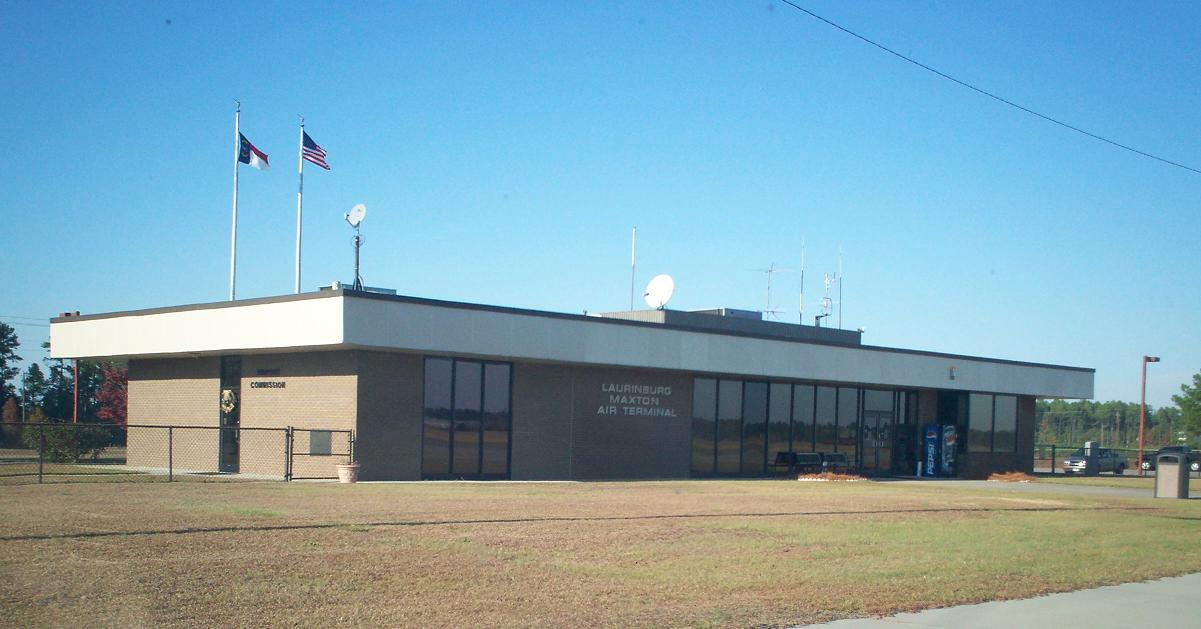
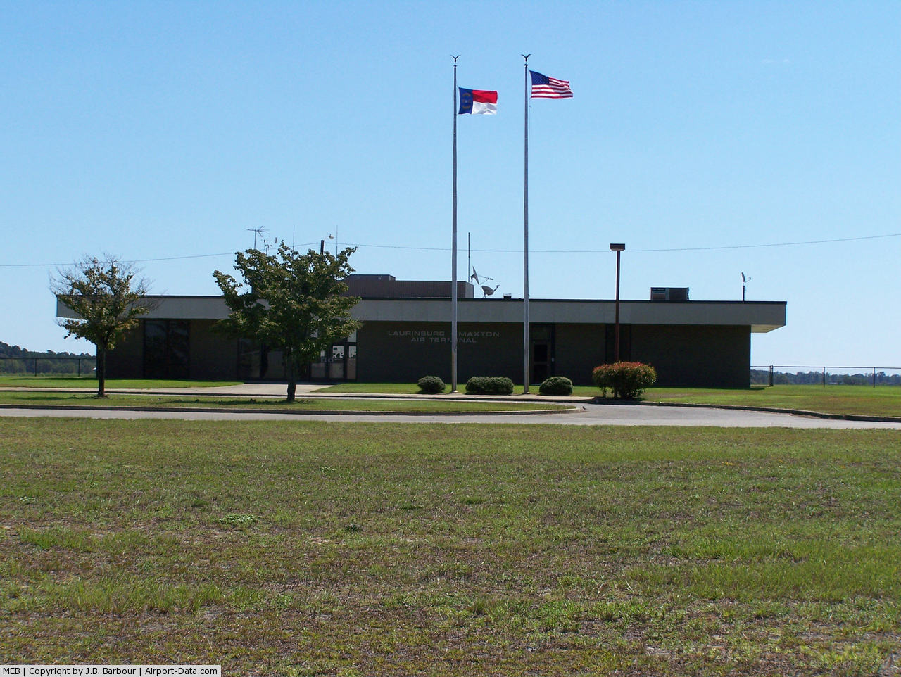
Laurinburg-maxton Airport |
| Laurinburg-Maxton Airport |
 |
| IATA: MXE – ICAO: KMEB – FAA LID: MEB |
| Summary |
| Airport type |
Public |
| Operator |
Laurinburg-Maxton Airport Commission |
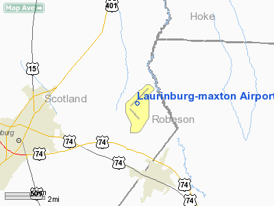
| Location |
Stewartsville Township, Scotland County, near Maxton, North Carolina |
| Elevation AMSL |
220 ft / 67.1 m |
| Coordinates |
34°47′31″N 079°21′57″W / 34.79194°N 79.36583°W / 34.79194; -79.36583Coordinates: 34°47′31″N 079°21′57″W / 34.79194°N 79.36583°W / 34.79194; -79.36583 |
| Runways |
| Direction |
Length |
Surface |
| ft |
m |
| 5/26 |
6,489 |
1,978 |
Concrete |
| 13/31 |
3,753 |
1,144 |
Concrete |
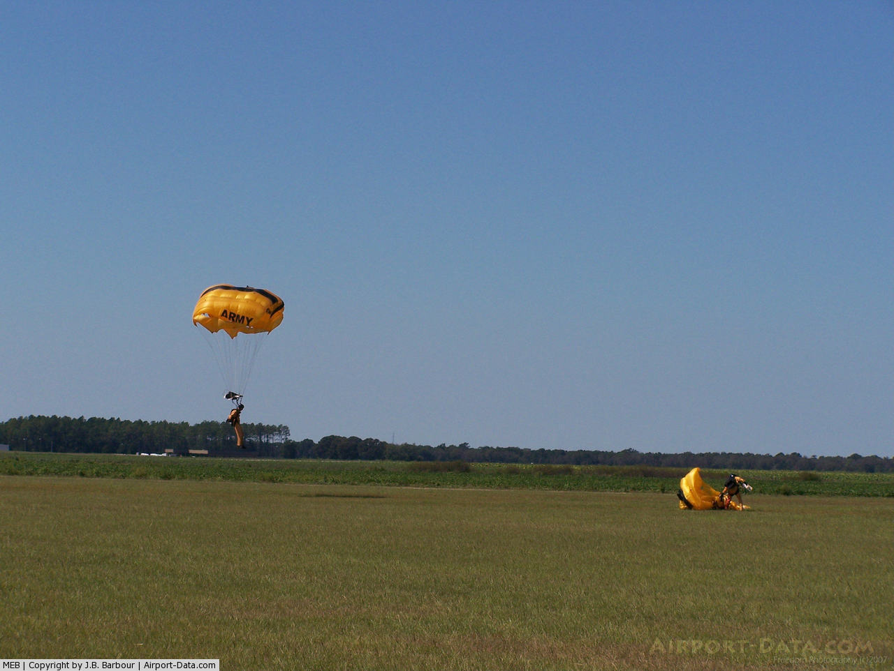
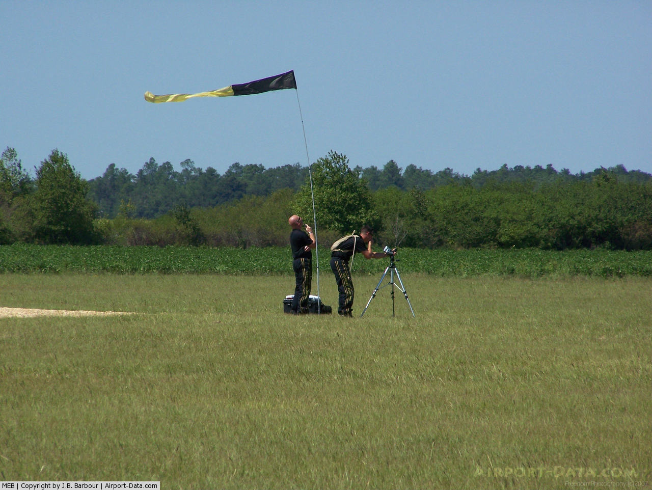
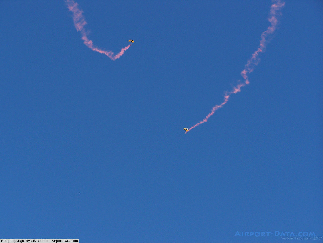
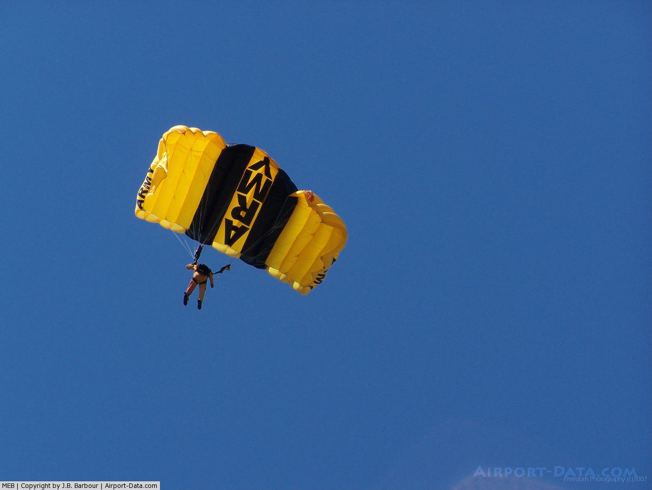
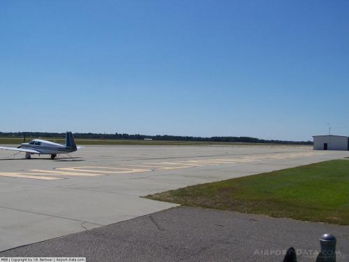
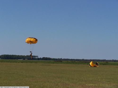
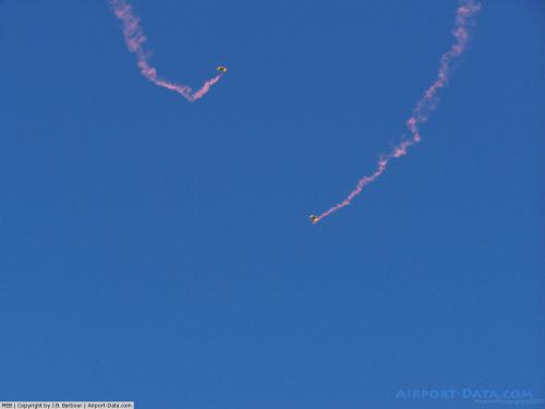
Laurinburg-Maxton Airport (IATA: MXE, ICAO: KMEB, FAA LID: MEB) is a public airport located three miles (5 km) north of the central business district (CBD) of Maxton and east of Laurinburg. Maxton is located primarily in Robeson County, North Carolina, USA while Laurinburg is in Scotland County, North Carolina, USA as is the airport proper. This general aviation airport covers 4,290 acres (1,736 ha) and has two runways. It is home of the United States Army Parachute team Golden Knights.
Although most U.S. airports use the same three-letter location identifier for the FAA and IATA, Laurinburg-Maxton Airport is assigned MEB by the FAA and MXE by the IATA (which assigned MEB to Essendon Airport in Melbourne, Victoria, Australia). The airport's ICAO identifier is KMEB.
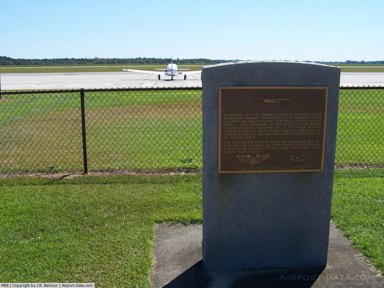
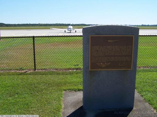
The airfield was constructed for the United States Army Air Force during WWII. During the war the airfield was a large training base for glider-towing aircraft.
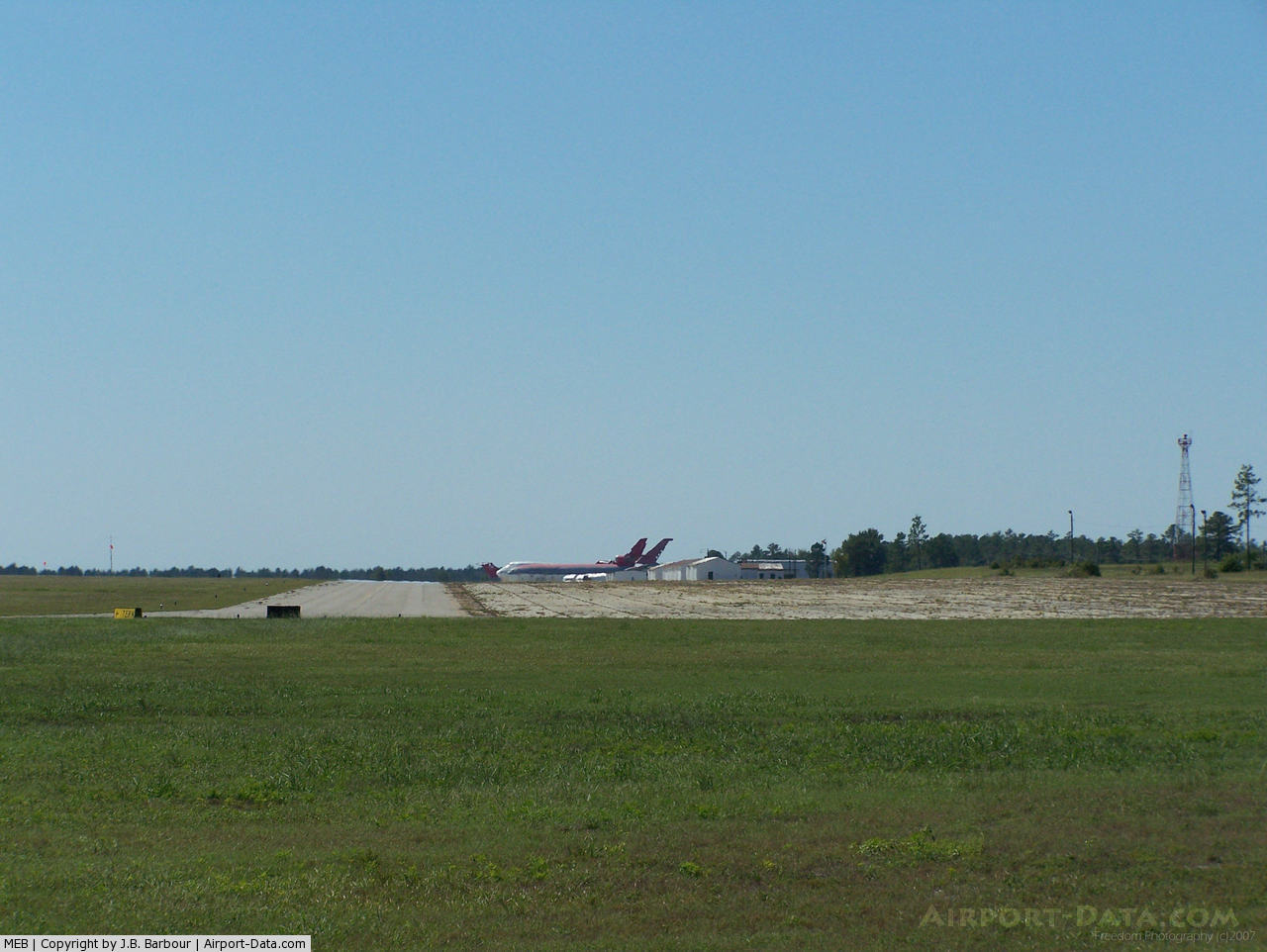
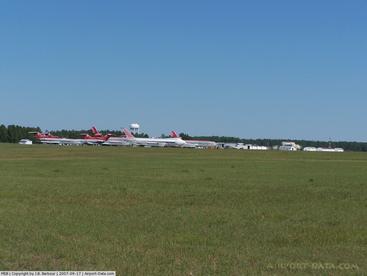
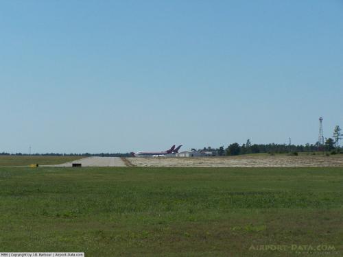
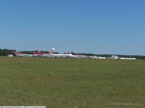
Today the airfield is noted for being the home of Charlotte Aircraft, a company which parts-out and scraps older aircraft. Visitors to the airfield can see a large number of 727s, 747s, DC-10s, and other aircraft in various stages of being dismantled and scrapped.
In 2006 the nose of Northwest Airline’s first 747-100 was removed from the aircraft at Maxton by Charlotte Aircraft and was sent Washington DC where it is now on display at the National Air and Space Museum on the Mall.
The above content comes from Wikipedia and is published under free licenses – click here to read more.
 |
(Click on the photo to enlarge) |
 |
(Click on the photo to enlarge) |
 |
(Click on the photo to enlarge) |
 |
(Click on the photo to enlarge) |
 |
(Click on the photo to enlarge) |
 |
(Click on the photo to enlarge) |
 |
(Click on the photo to enlarge) |
 |
(Click on the photo to enlarge) |
 |
(Click on the photo to enlarge) |
 |
(Click on the photo to enlarge) |
Location & QuickFacts
| FAA Information Effective: | 2008-09-25 |
| Airport Identifier: | MEB |
| Airport Status: | Operational |
| Longitude/Latitude: | 079-21-57.0520W/34-47-30.9810N
-79.365848/34.791939 (Estimated) |
| Elevation: | 220 ft / 67.06 m (Estimated) |
| Land: | 4290 acres |
| From nearest city: | 3 nautical miles N of Maxton, NC |
| Location: | Scotland County, NC |
| Magnetic Variation: | 08W (2005) |
Owner & Manager
| Ownership: | Publicly owned |
| Owner: | Town Of Laurinburg & Maxton |
| Address: | 16701 Airport Rd
Maxton, NC 28364 |
| Phone number: | 910-844-5081 |
| Manager: | Paul Davis |
| Address: | 16701 Airport Rd
Maxton, NC 28364 |
| Phone number: | 910-844-5081 |
Airport Operations and Facilities
| Airport Use: | Open to public |
| Wind indicator: | Yes |
| Segmented Circle: | Yes |
| Control Tower: | No |
| Lighting Schedule: | DUSK-DAWN
ACTVT VASI RYS 05 & 23; ODALS RY 05 - CTAF. FOR MIRL RY 13/31 CTC AMGR 910-844-3601 OR CTAF. |
| Beacon Color: | Clear-Green (lighted land airport) |
| Landing fee charge: | No |
| Sectional chart: | Charlotte |
| Region: | ASO - Southern |
| Boundary ARTCC: | ZDC - Washington |
| Tie-in FSS: | RDU - Raleigh |
| FSS on Airport: | No |
| FSS Toll Free: | 1-800-WX-BRIEF |
| NOTAMs Facility: | MEB (NOTAM-d service avaliable) |
| Federal Agreements: | NGPRY |
Airport Communications
| CTAF: | 122.800 |
| Unicom: | 122.800 |
Airport Services
| Fuel available: | 100LLA1+ |
| Airframe Repair: | MINOR |
| Power Plant Repair: | MINOR |
| Bottled Oxygen: | NONE |
| Bulk Oxygen: | NONE |
Runway Information
Runway 05/23
| Dimension: | 6489 x 150 ft / 1977.8 x 45.7 m
2750 FT CONC STOPWAY ON SE END. |
| Surface: | CONC, Fair Condition
RY13/31 LOOSE GRAVEL ON RWY DUE TO FAILED NUMEROUS PAVEMANT AREAS.
LOOSE GRAVEL ON RY. |
| Weight Limit: | Single wheel: 25000 lbs.
Dual wheel: 35000 lbs. |
| Edge Lights: | High |
| |
Runway 05 |
Runway 23 |
| Longitude: | 079-22-19.0870W | 079-21-23.3050W |
| Latitude: | 34-47-25.3260N | 34-48-10.0690N |
| Elevation: | 216.00 ft | 200.00 ft |
| Alignment: | 46 | 127 |
| ILS Type: | ILS
| |
| Traffic Pattern: | Left | Right |
| Markings: | Precision instrument, Fair Condition | Precision instrument, Good Condition |
| Crossing Height: | 51.00 ft | 50.00 ft |
| VASI: | 4-light PAPI on left side | 4-light PAPI on left side |
| Visual Glide Angle: | 3.00° | 3.00° |
| Approach lights: | ODALS
RY 05 ODALS OTS INDEFLY. | |
| Obstruction: | 30 ft tree, 1013.0 ft from runway, 514 ft left of centerline, 27:1 slope to clear | 67 ft trees, 1015.0 ft from runway, 473 ft left of centerline, 12:1 slope to clear |
|
Runway 13/31
| Dimension: | 3753 x 150 ft / 1143.9 x 45.7 m
2750 FT CONC STOPWAY ON SE END. |
| Surface: | CONC, Poor Condition
RY13/31 LOOSE GRAVEL ON RWY DUE TO FAILED NUMEROUS PAVEMANT AREAS.
LOOSE GRAVEL ON RY. |
| Weight Limit: | Single wheel: 25000 lbs.
Dual wheel: 35000 lbs. |
| Edge Lights: | Medium |
| |
Runway 13 |
Runway 31 |
| Longitude: | 079-22-23.0190W | 079-21-51.3360W |
| Latitude: | 34-47-15.2560N | 34-46-48.9010N |
| Elevation: | 217.00 ft | 208.00 ft |
| Alignment: | 127 | 127 |
| Traffic Pattern: | Right | Left |
| Markings: | Basic, Poor Condition
RY 13/31 MARKINGS FADED. | Basic, Poor Condition
RY 13/31 MARKING FADED. |
| Obstruction: | 54 ft tree, 1580.0 ft from runway, 155 ft left of centerline, 25:1 slope to clear | 58 ft acft, 762.0 ft from runway, 148 ft left of centerline, 9:1 slope to clear |
|
Radio Navigation Aids
| ID |
Type |
Name |
Ch |
Freq |
Var |
Dist |
| ME | NDB | Maxtn | | 257.00 | 08W | 5.2 nm |
| HFF | NDB | Mackall | | 278.00 | 06W | 15.4 nm |
| RCZ | NDB | Roscoe | | 375.00 | 07W | 16.6 nm |
| RSY | NDB | Robeson | | 359.00 | 08W | 18.5 nm |
| JB | NDB | Jigel | | 384.00 | 08W | 18.6 nm |
| DLC | NDB | Dillon | | 274.00 | 05W | 20.5 nm |
| BES | NDB | Bennettsville | | 230.00 | 07W | 20.9 nm |
| CQW | NDB | Cheraw | | 409.00 | 05W | 24.9 nm |
| POB | NDB | Pope | | 338.00 | 07W | 33.1 nm |
| UDG | NDB | Darlington | | 245.00 | 06W | 33.2 nm |
| FGP | NDB | Fort Bragg | | 393.00 | 07W | 34.3 nm |
| EEJ | NDB | Lee County/dcmsnd | | 428.00 | 07W | 35.6 nm |
| MAO | NDB | Marion | | 388.00 | 06W | 36.5 nm |
| AFP | NDB | Anson County | | 283.00 | 07W | 38.0 nm |
| TT | NDB | Leeco | | 406.00 | 08W | 43.8 nm |
| HVS | NDB | Hartsville | | 341.00 | 07W | 43.9 nm |
| TGQ | NDB | Elizabethtown | | 398.00 | 08W | 44.9 nm |
| CPC | NDB | Camp | | 227.00 | 07W | 44.9 nm |
| PYG | NDB | Pageland | | 270.00 | 06W | 48.1 nm |
| POB | TACAN | Pope | 085X | | 07W | 27.9 nm |
| LBT | VOR | Lumberton | | 110.00 | 08W | 18.8 nm |
| FAY | VOR/DME | Fayetteville | 025X | 108.80 | 04W | 26.9 nm |
| CTF | VOR/DME | Chesterfield | 019X | 108.20 | 03W | 45.7 nm |
| SDZ | VORTAC | Sandhills | 055X | 111.80 | 03W | 27.7 nm |
| FLO | VORTAC | Florence | 099X | 115.20 | 03W | 36.6 nm |
Remarks
- PARALLEL & CONNECTOR TWYS ON RWY 13/31 CLSD AND UNUSABLE.
- UPSLOPE FIRST 1000 FT RY 23 RSTRD SLIGHT DISTANCE TO SW END OF RY.
- MILITARY ACFT FREQUENTLY OPERATE FROM CLSD PORTION OF RWY 13/31 & CLSD RWY 18/36.
- HVY PAJA AT SOUTH END OF CLSD RY 18/36.
- GCO AVAILABLE ON FREQ 135.075 THRU FAY CLEARANCE DELIVERY.
- EXISTED PRIOR TO 1959
Images and information placed above are from
http://www.airport-data.com/airport/MEB/
We thank them for the data!
| General Info
|
| Country |
United States
|
| State |
NORTH CAROLINA
|
| FAA ID |
MEB
|
| Latitude |
34-47-30.981N
|
| Longitude |
079-21-57.052W
|
| Elevation |
220 feet
|
| Near City |
MAXTON
|
We don't guarantee the information is fresh and accurate. The data may
be wrong or outdated.
For more up-to-date information please refer to other sources.
|
|