 |
|
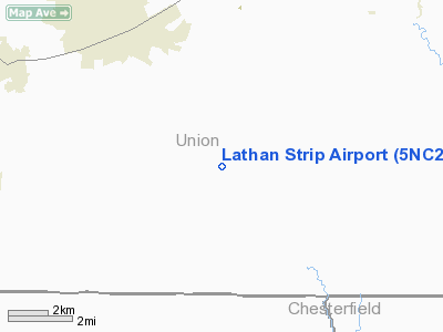
Location & QuickFacts
| FAA Information Effective: | 2008-09-25 |
| Airport Identifier: | 5NC2 |
| Airport Status: | Operational |
| Longitude/Latitude: | 080-37-09.2400W/34-52-34.5410N
-80.619233/34.876261 (Estimated) |
| Elevation: | 575 ft / 175.26 m (Estimated) |
| Land: | 70 acres |
| From nearest city: | 8 nautical miles S of Monroe, NC |
| Location: | Union County, NC |
| Magnetic Variation: | 05W (1985) |
Owner & Manager
| Ownership: | Privately owned |
| Owner: | Chris & Linda Helms |
| Address: | 5206 South Rocky River Rd
Monroe, NC 28112 |
| Phone number: | 704-764-5204 |
| Manager: | Michael & Luanna Lathan |
| Address: | 4805 South Rocky River Rd
Monroe, NC 28112-8050 |
| Phone number: | 704-764-7444 |
Airport Operations and Facilities
| Airport Use: | Private
PERSONAL USE. |
| Segmented Circle: | No |
| Control Tower: | No |
| Sectional chart: | Charlotte |
| Region: | ASO - Southern |
| Boundary ARTCC: | ZTL - Atlanta |
| Tie-in FSS: | RDU - Raleigh |
| FSS Toll Free: | 1-800-WX-BRIEF |
Runway Information
Runway 18/36
| Dimension: | 1700 x 30 ft / 518.2 x 9.1 m |
| Surface: | TURF, |
| |
Runway 18 |
Runway 36 |
| Traffic Pattern: | Left | Left |
| Obstruction: | | 40 ft pline, 50.0 ft from runway |
|
Radio Navigation Aids
| ID |
Type |
Name |
Ch |
Freq |
Var |
Dist |
| TWL | NDB | Wesley | | 204.00 | 06W | 6.3 nm |
| LKR | NDB | Lancaster | | 400.00 | 07W | 14.9 nm |
| PYG | NDB | Pageland | | 270.00 | 06W | 16.0 nm |
| UZ | NDB | Rally | | 227.00 | 05W | 22.8 nm |
| AFP | NDB | Anson County | | 283.00 | 07W | 27.9 nm |
| DCM | NDB | Chester | | 220.00 | 06W | 29.2 nm |
| GHJ | NDB | Stonia | | 260.00 | 06W | 32.5 nm |
| CDN | NDB | Camden | | 263.00 | 05W | 35.7 nm |
| HVS | NDB | Hartsville | | 341.00 | 07W | 37.5 nm |
| CQW | NDB | Cheraw | | 409.00 | 05W | 38.1 nm |
| FDW | NDB | Winnsboro | | 414.00 | 05W | 41.7 nm |
| UDG | NDB | Darlington | | 245.00 | 06W | 44.6 nm |
| VU | NDB | Aller | | 346.00 | 06W | 45.3 nm |
| RCZ | NDB | Roscoe | | 375.00 | 07W | 45.7 nm |
| IZN | NDB | Lincolnton | | 432.00 | 06W | 45.9 nm |
| BES | NDB | Bennettsville | | 230.00 | 07W | 46.4 nm |
| CTF | VOR/DME | Chesterfield | 019X | 108.20 | 03W | 21.8 nm |
| CLT | VOR/DME | Charlotte | 097X | 115.00 | 05W | 25.0 nm |
| FML | VORTAC | Fort Mill | 071X | 112.40 | 02W | 17.9 nm |
| CLT | VOT | Charlotte | | 112.00 | | 25.7 nm |
Remarks
- RWY GRASS HIGH OR NOT MOWED OFTEN.
- VFR,PERSONAL USE ONLY.
Images and information placed above are from
http://www.airport-data.com/airport/5NC2/
We thank them for the data!
| General Info
|
| Country |
United States
|
| State |
NORTH CAROLINA
|
| FAA ID |
5NC2
|
| Latitude |
34-52-34.541N
|
| Longitude |
080-37-09.240W
|
| Elevation |
575 feet
|
| Near City |
MONROE
|
We don't guarantee the information is fresh and accurate. The data may
be wrong or outdated.
For more up-to-date information please refer to other sources.
|
|


