|
|
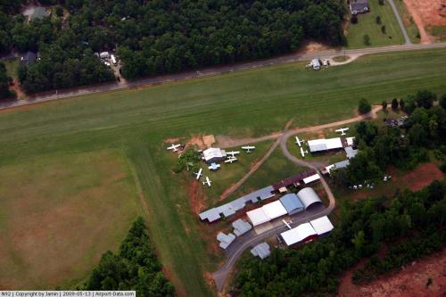 |
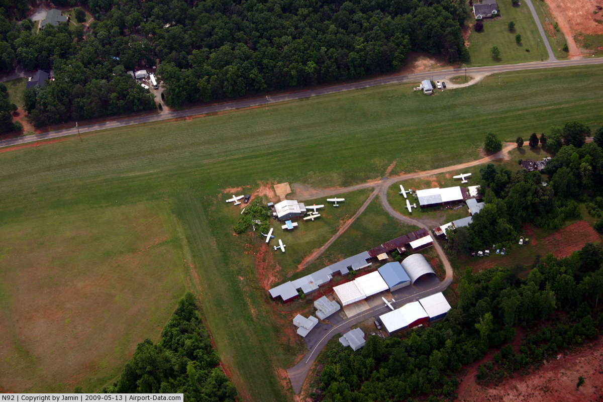
(Click on the photo to enlarge) |
Location & QuickFacts
| FAA Information Effective: | 2008-09-25 |
| Airport Identifier: | N92 |
| Airport Status: | Operational |
| Longitude/Latitude: | 081-07-02.2840W/35-34-27.4810N
-81.117301/35.574300 (Estimated) |
| Elevation: | 1025 ft / 312.42 m (Estimated) |
| Land: | 8 acres |
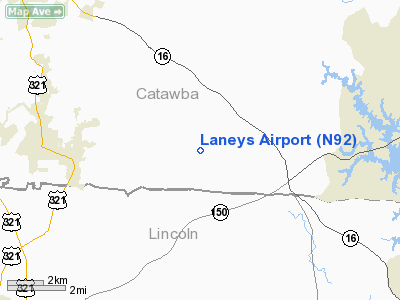
| From nearest city: | 3 nautical miles SE of Maiden, NC |
| Location: | Catawba County, NC |
| Magnetic Variation: | 05W (1985) |
Owner & Manager
| Ownership: | Privately owned |
| Owner: | Charles Laney |
| Address: | 4235 Pool View Dr
Maiden, NC 28650 |
| Phone number: | 828-428-8939 |
| Manager: | Charles Laney |
| Address: | 4235 Pool View Dr
Maiden, NC 28650 |
| Phone number: | 828-428-8939 |
Airport Operations and Facilities
| Airport Use: | Open to public |
| Wind indicator: | Yes |
| Segmented Circle: | No |
| Control Tower: | No |
| Landing fee charge: | No |
| Sectional chart: | Atlanta |
| Region: | ASO - Southern |
| Boundary ARTCC: | ZTL - Atlanta |
| Tie-in FSS: | RDU - Raleigh |
| FSS on Airport: | No |
| FSS Toll Free: | 1-800-WX-BRIEF |
| NOTAMs Facility: | RDU (NOTAM-d service avaliable) |
Airport Communications
| CTAF: | 122.800 |
| Unicom: | 122.800 |
Airport Services
| Airframe Repair: | NONE |
| Power Plant Repair: | NONE |
| Bottled Oxygen: | NONE |
| Bulk Oxygen: | NONE |
Runway Information
Runway 05/23
| Dimension: | 2000 x 100 ft / 609.6 x 30.5 m |
| Surface: | TURF, Fair Condition |
| |
Runway 05 |
Runway 23 |
| Traffic Pattern: | Left | Left |
| Obstruction: | 45 ft pline, 80 ft right of centerline | 29 ft pline, 60.0 ft from runway, 2:1 slope to clear |
|
Radio Navigation Aids
| ID |
Type |
Name |
Ch |
Freq |
Var |
Dist |
| MRN | FAN MARKER | Lenoir | | | 03W | 28.1 nm |
| IZN | NDB | Lincolnton | | 432.00 | 06W | 2.7 nm |
| VW | NDB | Temky | | 280.00 | 05W | 12.3 nm |
| HK | NDB | Tawba | | 332.00 | 06W | 15.7 nm |
| GHJ | NDB | Stonia | | 260.00 | 06W | 23.1 nm |
| FIQ | NDB | Fiddlers | | 391.00 | 07W | 28.3 nm |
| SLP | NDB | First River | | 417.00 | 06W | 30.5 nm |
| RU | NDB | Rovdy | | 275.00 | 06W | 32.1 nm |
| UKF | NDB | Wilki | | 209.00 | 06W | 32.4 nm |
| DVZ | NDB | Davie | | 354.00 | 06W | 38.2 nm |
| UZ | NDB | Rally | | 227.00 | 05W | 41.2 nm |
| SEN | NDB | Swearing/dcmsnd | | 260.00 | 06W | 41.9 nm |
| TWL | NDB | Wesley | | 204.00 | 06W | 42.5 nm |
| RFE | NDB | Rutherford | | 344.00 | 05W | 43.1 nm |
| DCM | NDB | Chester | | 220.00 | 06W | 47.5 nm |
| ZEF | NDB | Zephyr | | 326.00 | 05W | 48.4 nm |
| BZM | VOR/DME | Barretts Mountain | 045X | 110.80 | 06W | 18.7 nm |
| CLT | VOR/DME | Charlotte | 097X | 115.00 | 05W | 24.5 nm |
| FML | VORTAC | Fort Mill | 071X | 112.40 | 02W | 36.1 nm |
| HKY | VOT | Hickory Regional | | 110.00 | | 16.7 nm |
| CLT | VOT | Charlotte | | 112.00 | | 23.3 nm |
Remarks
- RWY 5 FOR LANDING (UPHILL) PREFERRED.
- UNMARKED PLINES ACROSS BOTH RY THRS.
- ULTRALIGHT AIRCRAFT OPERATING ON AND INVOF ARPT.
- VFR OPNS ONLY.
Images and information placed above are from
http://www.airport-data.com/airport/N92/
We thank them for the data!
| General Info
|
| Country |
United States
|
| State |
NORTH CAROLINA
|
| FAA ID |
N92
|
| Latitude |
35-34-27.481N
|
| Longitude |
081-07-02.284W
|
| Elevation |
1025 feet
|
| Near City |
MAIDEN
|
We don't guarantee the information is fresh and accurate. The data may
be wrong or outdated.
For more up-to-date information please refer to other sources.
|
|