|
|
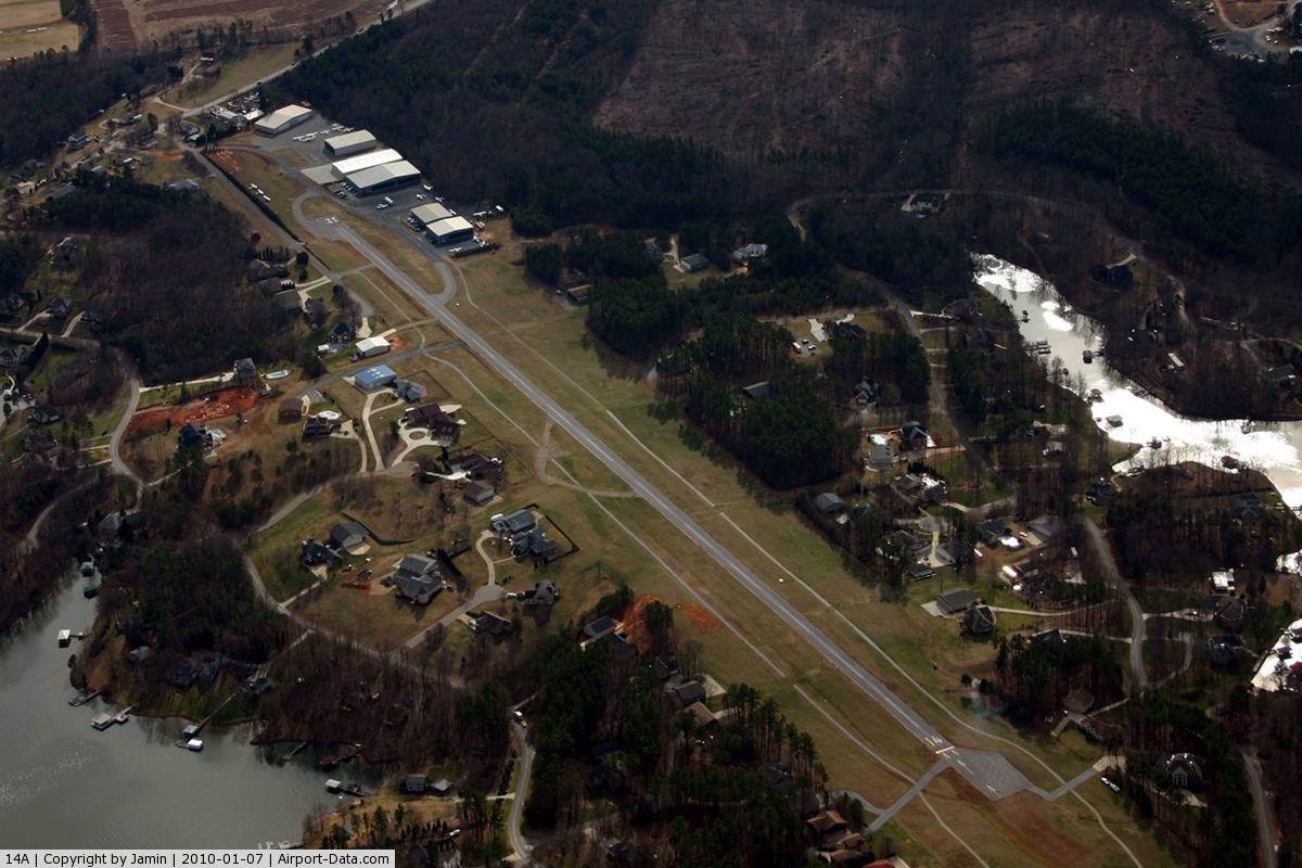
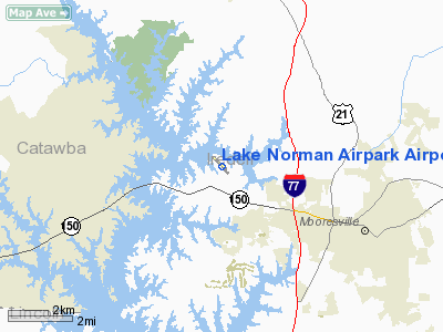
Lake Norman Airpark Airport |
 |
(Click on the photo to enlarge) |
Location & QuickFacts
| FAA Information Effective: | 2008-09-25 |
| Airport Identifier: | 14A |
| Airport Status: | Operational |
| Longitude/Latitude: | 080-53-57.9500W/35-36-49.9300N
-80.899431/35.613869 (Estimated) |
| Elevation: | 839 ft / 255.73 m (Surveyed) |
| Land: | 40 acres |
| From nearest city: | 5 nautical miles NW of Mooresville, NC |
| Location: | Iredell County, NC |
| Magnetic Variation: | 07W (2005) |
Owner & Manager
| Ownership: | Privately owned |
| Owner: | Thomas S. Wilson |
| Address: | Po Box 3732
Mooresville, NC 28117-3732 |
| Phone number: | 704-663-6227 |
| Manager: | Clinton Bauer |
| Address: | 149 Yeager Road
Mooresville, NC 28117 |
| Phone number: | 704-662-6227 |
Airport Operations and Facilities
| Airport Use: | Open to public |
| Wind indicator: | Yes |
| Segmented Circle: | Yes
UNLGTD SEGMENTED CIRCLE. |
| Control Tower: | No |
| Lighting Schedule: | DUSK-DAWN
ACTVT MIRL RY 14/32 - CTAF. PLASI OPER DUSK-DAWN. |
| Beacon Color: | Clear-Green (lighted land airport) |
| Landing fee charge: | No |
| Sectional chart: | Charlotte |
| Region: | ASO - Southern |
| Boundary ARTCC: | ZTL - Atlanta |
| Tie-in FSS: | RDU - Raleigh |
| FSS on Airport: | No |
| FSS Toll Free: | 1-800-WX-BRIEF |
| NOTAMs Facility: | RDU (NOTAM-d service avaliable) |
Airport Communications
| CTAF: | 122.800 |
| Unicom: | 122.800 |
Airport Services
| Fuel available: | 100LL |
| Airframe Repair: | MAJOR |
| Power Plant Repair: | MAJOR |
| Bottled Oxygen: | NONE |
| Bulk Oxygen: | NONE |
Runway Information
Runway 14/32
| Dimension: | 3147 x 40 ft / 959.2 x 12.2 m |
| Surface: | ASPH, Good Condition |
| Weight Limit: | Single wheel: 8000 lbs. |
| Edge Lights: | Medium |
| |
Runway 14 |
Runway 32 |
| Longitude: | 080-54-11.0500W | 080-53-44.8600W |
| Latitude: | 35-37-01.2400N | 35-36-38.6200N |
| Elevation: | 808.00 ft | 839.00 ft |
| Traffic Pattern: | Left | Left |
| Markings: | Nonstandard, Good Condition
RWY NUMBERS NON STANDARD. | , |
| Crossing Height: | 15.00 ft | 5.00 ft |
| Displaced threshold: | 185.00 ft | 0.00 ft |
| VASI: | pulsating/steady burning on right side | pulsating/steady burning on right side |
| Visual Glide Angle: | 4.00° | 4.00° |
| Runway End Identifier: | No | No |
| Centerline Lights: | No | No |
| Touchdown Lights: | No | No |
| Obstruction: | 43 ft trees, 378.0 ft from runway, 225 ft right of centerline, 4:1 slope to clear
43 FT TREES 378 FT RIGHT; 4:1 BASED ON DSPLCD THLD. APCH RATIO 8:1 TO DSPLCD THLD.
+10 FT TERRAIN 100 FT FM THLD, 50 FT LEFT OF CNTRLN, AND 20 FT SUPPL WINDSOCK 100 FT FM THLD, 100 FT LEFT OF CNTRLN. | 10 ft road, 200.0 ft from runway, 100 ft right of centerline
+8 FT ROAD 120 FT FM THLD 120 FT RIGHT. |
|
Radio Navigation Aids
| ID |
Type |
Name |
Ch |
Freq |
Var |
Dist |
| MRN | FAN MARKER | Lenoir | | | 03W | 37.0 nm |
| IZN | NDB | Lincolnton | | 432.00 | 06W | 10.2 nm |
| VW | NDB | Temky | | 280.00 | 05W | 12.6 nm |
| RU | NDB | Rovdy | | 275.00 | 06W | 21.3 nm |
| HK | NDB | Tawba | | 332.00 | 06W | 22.4 nm |
| DVZ | NDB | Davie | | 354.00 | 06W | 28.1 nm |
| GHJ | NDB | Stonia | | 260.00 | 06W | 28.4 nm |
| SEN | NDB | Swearing/dcmsnd | | 260.00 | 06W | 31.0 nm |
| UKF | NDB | Wilki | | 209.00 | 06W | 31.5 nm |
| FIQ | NDB | Fiddlers | | 391.00 | 07W | 38.1 nm |
| SLP | NDB | First River | | 417.00 | 06W | 40.6 nm |
| VU | NDB | Aller | | 346.00 | 06W | 40.8 nm |
| TWL | NDB | Wesley | | 204.00 | 06W | 40.9 nm |
| ZEF | NDB | Zephyr | | 326.00 | 05W | 42.9 nm |
| UZ | NDB | Rally | | 227.00 | 05W | 44.4 nm |
| AZW | NDB | Mount Airy | | 223.00 | 07W | 49.3 nm |
| BZM | VOR/DME | Barretts Mountain | 045X | 110.80 | 06W | 22.6 nm |
| CLT | VOR/DME | Charlotte | 097X | 115.00 | 05W | 25.6 nm |
| FML | VORTAC | Fort Mill | 071X | 112.40 | 02W | 37.7 nm |
| CLT | VOT | Charlotte | | 112.00 | | 24.1 nm |
| HKY | VOT | Hickory Regional | | 110.00 | | 25.2 nm |
Remarks
- ACFT TAXIING ON GRASS INVOF RESIDENTIAL AIRPARK HANGER ACCESS.
- FULL ACFT MAINT AVBL, CTC 704-662-6986.
- RY 14 HAS UPHILL GRADE.
- DEP RY 14 HEADING 160 DEGS TO AVOID SCHOOL.
- NOISE SENSITIVE AREA AVOID DEPS BTWN 2300 AND 0600 .
- RY 32 HAS 10 FT DROP OFF 5 FT FM LEFT SIDE OF PAVEMENT AND ACFT PARKED 200 FT FM END OF RY 100 FT RIGHT OF CNTRLN.
- PRVDD VFR; APCH SLOPE SFCS CLEAR FOR 20:1; LIGHTING FOR APCH END RY 14 CHGD TO SHOW GREEN ON APCH SIDE AND RED ON RY SIDE; RMK ADDED TO A/FD RE RY 32 APCH/LANDING & LIGHTING; AND HGRS OBSTRUCTION LGTD IF NIGHT APCHS/LANDING TO RY 32 AUTHORIZED.
Images and information placed above are from
http://www.airport-data.com/airport/14A/
We thank them for the data!
| General Info
|
| Country |
United States
|
| State |
NORTH CAROLINA
|
| FAA ID |
14A
|
| Latitude |
35-36-51.489N
|
| Longitude |
080-54-01.268W
|
| Elevation |
838 feet
|
| Near City |
MOORESVILLE
|
We don't guarantee the information is fresh and accurate. The data may
be wrong or outdated.
For more up-to-date information please refer to other sources.
|
|