 |
|
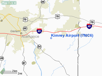
Location & QuickFacts
| FAA Information Effective: | 2008-09-25 |
| Airport Identifier: | 7NC6 |
| Airport Status: | Operational |
| Longitude/Latitude: | 079-19-36.0650W/36-03-19.4960N
-79.326685/36.055416 (Estimated) |
| Elevation: | 624 ft / 190.20 m (Estimated) |
| Land: | 0 acres |
| From nearest city: | 4 nautical miles SW of Mebane, NC |
| Location: | Alamance County, NC |
| Magnetic Variation: | 06W (1985) |
Owner & Manager
| Ownership: | Privately owned |
| Owner: | William R. Kimrey |
| Address: | Route 1 Box 196
Mebane, NC 27302 |
| Phone number: | 336-578-3583 |
| Manager: | William R. Kimrey |
| Address: | Route 1 Box 196
Mebane, NC 27302 |
| Phone number: | 336-578-3583 |
Airport Operations and Facilities
| Airport Use: | Private |
| Segmented Circle: | No |
| Control Tower: | No |
| Sectional chart: | Charlotte |
| Region: | ASO - Southern |
| Boundary ARTCC: | ZDC - Washington |
| Tie-in FSS: | RDU - Raleigh |
| FSS Toll Free: | 1-800-WX-BRIEF |
Runway Information
Runway 13/31
| Dimension: | 2400 x 100 ft / 731.5 x 30.5 m |
| Surface: | TURF, |
| |
Runway 13 |
Runway 31 |
| Traffic Pattern: | Left | Left |
|
Radio Navigation Aids
| ID |
Type |
Name |
Ch |
Freq |
Var |
Dist |
| OQA | FAN MARKER | Rockingham County | | | | 33.1 nm |
| HB | NDB | Himun | | 361.00 | 08W | 13.4 nm |
| HUR | NDB | Person | | 220.00 | 08W | 16.6 nm |
| TOX | NDB | Siler City | | 371.00 | 07W | 18.9 nm |
| SIF | NDB | Slammer | | 423.00 | 07W | 28.9 nm |
| LE | NDB | Leevy | | 350.00 | 07W | 30.4 nm |
| CQJ | NDB | City Lake | | 266.00 | 08W | 33.2 nm |
| TT | NDB | Leeco | | 406.00 | 08W | 34.8 nm |
| HXO | NDB | Huntsboro | | 271.00 | 07W | 37.4 nm |
| EEJ | NDB | Lee County/dcmsnd | | 428.00 | 07W | 41.3 nm |
| UV | NDB | Bales | | 396.00 | 07W | 43.0 nm |
| HQT | NDB | Harnett | | 417.00 | 08W | 49.1 nm |
| DAN | VOR | Danville | | 113.10 | 06W | 30.9 nm |
| LIB | VORTAC | Liberty | 077X | 113.00 | 03W | 20.2 nm |
| RDU | VORTAC | Raleigh/durham | 119X | 117.20 | 04W | 28.6 nm |
| GSO | VORTAC | Greensboro | 109X | 116.20 | 03W | 31.6 nm |
| SBV | VORTAC | South Boston | 041X | 110.40 | 05W | 40.2 nm |
Remarks
- VFR, PVT USE; TFC PATS ARE SW OF RY CNTRLN.
Images and information placed above are from
http://www.airport-data.com/airport/7NC6/
We thank them for the data!
| General Info
|
| Country |
United States
|
| State |
NORTH CAROLINA
|
| FAA ID |
7NC6
|
| Latitude |
36-03-19.496N
|
| Longitude |
079-19-36.065W
|
| Elevation |
624 feet
|
| Near City |
MEBANE
|
We don't guarantee the information is fresh and accurate. The data may
be wrong or outdated.
For more up-to-date information please refer to other sources.
|
|


