 |
|
Location & QuickFacts
| FAA Information Effective: | 2008-09-25 |
| Airport Identifier: | 75NC |
| Airport Status: | Operational |
| Longitude/Latitude: | 078-11-00.9770W/35-50-57.5570N
-78.183605/35.849321 (Estimated) |
| Elevation: | 246 ft / 74.98 m (Surveyed) |
| Land: | 5 acres |
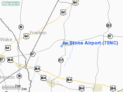
| From nearest city: | 3 nautical miles N of Middlesex, NC |
| Location: | Nash County, NC |
| Magnetic Variation: | 07W (1985) |
Owner & Manager
| Ownership: | Privately owned |
| Owner: | J. W. Stone |
| Address: |
Bailey, NC 27807 |
| Phone number: | 252-235-4794 |
| Address: |
|
| Phone number: | 919-235-4794 |
Airport Operations and Facilities
| Airport Use: | Private |
| Wind indicator: | No |
| Segmented Circle: | No |
| Control Tower: | No |
| Landing fee charge: | No |
| Sectional chart: | Charlotte |
| Region: | ASO - Southern |
| Boundary ARTCC: | ZDC - Washington |
| Tie-in FSS: | RDU - Raleigh |
| FSS on Airport: | No |
| FSS Toll Free: | 1-800-WX-BRIEF |
Airport Services
| Airframe Repair: | NONE |
| Power Plant Repair: | NONE |
Runway Information
Runway 15/33
| Dimension: | 1600 x 100 ft / 487.7 x 30.5 m |
| Surface: | TURF, |
| |
Runway 15 |
Runway 33 |
| Traffic Pattern: | Left | Left |
| Obstruction: | 4 ft fence, 300.0 ft from runway | 30 ft pline |
|
Radio Navigation Aids
| ID |
Type |
Name |
Ch |
Freq |
Var |
Dist |
| PGV | FAN MARKER | Belvoir | | | 06W | 41.0 nm |
| RW | NDB | Jambe | | 235.00 | 09W | 11.8 nm |
| EUU | NDB | Jnall | | 251.00 | 07W | 16.8 nm |
| JYN | NDB | Wayne | | 208.00 | 08W | 23.8 nm |
| JN | NDB | Jurly | | 263.00 | 09W | 25.4 nm |
| LE | NDB | Leevy | | 350.00 | 07W | 26.6 nm |
| ETC | NDB | Tarboro | | 257.00 | 08W | 31.5 nm |
| HXO | NDB | Huntsboro | | 271.00 | 07W | 34.4 nm |
| HQT | NDB | Harnett | | 417.00 | 08W | 34.7 nm |
| AQE | NDB | Alwood | | 230.00 | 09W | 40.5 nm |
| RZZ | NDB | Rapids | | 407.00 | 08W | 42.4 nm |
| AEA | NDB | Jones | | 373.00 | 09W | 46.4 nm |
| DKA | NDB | Kenan | | 332.00 | 07W | 48.5 nm |
| HUR | NDB | Person | | 220.00 | 08W | 48.7 nm |
| MCZ | NDB | Williamston | | 336.00 | 09W | 49.0 nm |
| GSB | TACAN | Seymour Johnson | 112X | | 08W | 32.6 nm |
| TYI | VORTAC | Tar River | 125X | 117.80 | 05W | 24.6 nm |
| RDU | VORTAC | Raleigh/durham | 119X | 117.20 | 04W | 29.2 nm |
| ISO | VORTAC | Kinston | 033X | 109.60 | 05W | 42.0 nm |
Remarks
Images and information placed above are from
http://www.airport-data.com/airport/75NC/
We thank them for the data!
| General Info
|
| Country |
United States
|
| State |
NORTH CAROLINA
|
| FAA ID |
75NC
|
| Latitude |
35-50-57.557N
|
| Longitude |
078-11-00.977W
|
| Elevation |
246 feet
|
| Near City |
MIDDLESEX
|
We don't guarantee the information is fresh and accurate. The data may
be wrong or outdated.
For more up-to-date information please refer to other sources.
|
|


