|
|
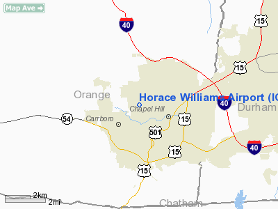
| Horace Williams Airport |
 |
| IATA: none – ICAO: KIGX – FAA LID: IGX |
| Summary |
| Airport type |
Public |
| Owner/Operator |
University of North Carolina at Chapel Hill |
| Location |
Chapel Hill |
| Elevation AMSL |
512 ft / 156 m |
| Coordinates |
35°56′06″N 079°03′57″W / 35.935°N 79.06583°W / 35.935; -79.06583 |
| Website |
www.airport.unc.edu |
| Runways |
| Direction |
Length |
Surface |
| ft |
m |
| 9/27 |
4,005 |
1,221 |
Asphalt |
| Statistics (2007) |
| Aircraft operations |
10,800 |
| Based aircraft |
47 |
| Source: Federal Aviation Administration |
Horace Williams Airport (ICAO: KIGX, FAA LID: IGX) is a public use airport located one nautical mile (1.85 km) north of the central business district of Chapel Hill, a city in Orange County, North Carolina, United States. It is owned by the University of North Carolina at Chapel Hill. Although most U.S. airports use the same three-letter location identifier for the FAA and IATA, this airport is assigned IGX by the FAA but has no designation from the IATA.
Horace Williams Airport is home to North Carolina's Area Health Education Center (AHEC) program, which flies doctors and medical specialists participating in instructional and outreach programs, serving outlying communities in under-served areas of the state. In addition, some private flights also help bring distant patients to the UNC Hospitals, as well as occasionally serving as rapid air link with hospital helicopter service for time-critical organ transplants. History
Originally known as Martindale Field, the airport was renamed for Prof. Horace Williams, Chair of Mental and Moral Science (Philosophy) at the University during the first half the twentieth century.
The airport was part of a large gift of land to the university by professor Horace Williams in the 1930s, and while the professor did not restrict the use of the property to airport use, it has been an airport since 1933. Presidents Ford and George H. Bush received Navy primary flight training at the airport. President Kennedy visited UNC in October, 1961 and arrived and departed via Horace Williams Airport.
Facilities and aircraft
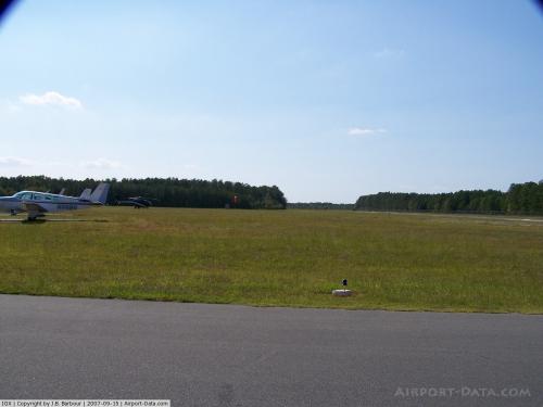
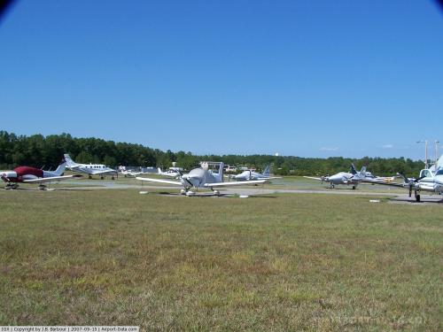
Horace Williams Airport covers an area of 420 acres (170 ha) at an elevation of 512 feet (156 m) above mean sea level. It has one runway designated 9/27 with an asphalt surface measuring 4,005 by 75 feet (1,221 x 23 m).
For the 12-month period ending July 31, 2007, the airport had 10,800 aircraft operations, an average of 29 per day: 94% general aviation, 5% air taxi and 1% military. At that time there were 47 aircraft based at this airport: 77% single-engine and 23% multi-engine.
Safety Incidents
On July 12, 2010, a Cirrus SR 20 carrying Kyle Henn, the brother of a victim of the July 2010 World Cup Finals bombing in Uganda, crashed upon landing at the airport. One person was killed during this crash; Henn survived with non-life threatening injuries, and acted to try to save the crash victim after impact.
Closure plans
The University plans to close the airport to make room for construction of Carolina North, a planned major long-term expansion of its campus.
Opposition to closure plans began immediately after the announcement of the planned closure, in 2000 when pilots claimed that closing this air field would be a loss of infrastructure that would never be replaced. They pointed out that one of the unique features of Chapel Hill is the airfield. In their view, North Carolina advertises "First In Flight" on every automobile license plate, hence, the move to close Horace Williams Airport represents short sighted planning in terms of the future of aviation and Chapel Hill. They note that upgrades to the airport approved by the FAA have kept pace with current technology and it is staffed with meticulous attention detail and careful people. Their position is that there is something very special about airplanes, and to lose them in Chapel Hill for the sake of more buildings, traffic and population density must be carefully considered. According to stated views of pilots and plane owners on this issue, the overall pride and flavor of the area ought to be taken into account before such a drastic measure begins.
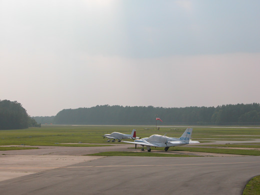 | |
Horace Williams Airport in June, 2005. |
Conflict between the town and airport advocates has had a history dating back to the 1980s, revolving around issues such as the location of the airport in a residential area that includes 4 schools, a church, and a YMCA, as well as several crashes in the area that eventually resulted in the University's ejection of a flying club flight school from the airport. Critics of the airport noticed that the University's first plans for the Carolina North project included keeping the airport in close proximity to occupied buildings and reminded the University that liability in the event of another crash could be substantial, given the existence of known guidelines recommending against building so close to a working runway. In addition, interested private-industry interests indicated concern about the costs and liabilities of building on the site if the airport remained. The plans for Carolina North were revised, and the UNC Board of Trustees commissioned a study on the basis of which they ordered the airport closed.
The University's plans for airport closure have been blocked in the state legislature on at least three occasions since the 2000 announcement. Although some planes using the airport do so on University business, opposition to closure has historically been offered primarily by private plane owners and general aviation lobbyists desiring to preserve their access to the airport. Most recently, opposition efforts have focused on the University's planned move of six AHEC planes to new facilities at Raleigh-Durham International Airport, to make way for construction of the first phase of the new Carolina North campus project, planned to include teaching, research, and cooperative public-private projects affiliated with the University.
The above content comes from Wikipedia and is published under free licenses – click here to read more.
 |
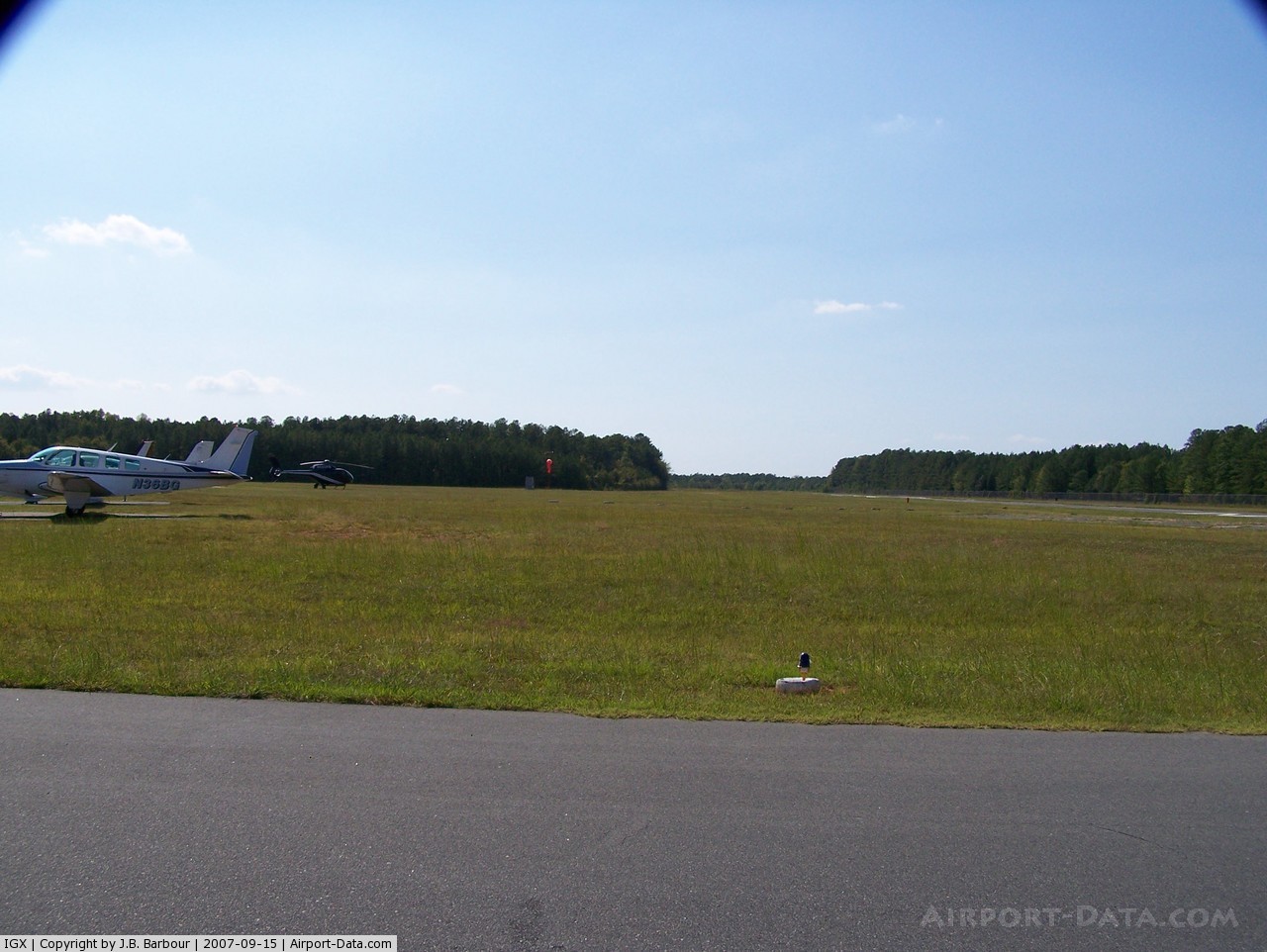
(Click on the photo to enlarge) |
 |
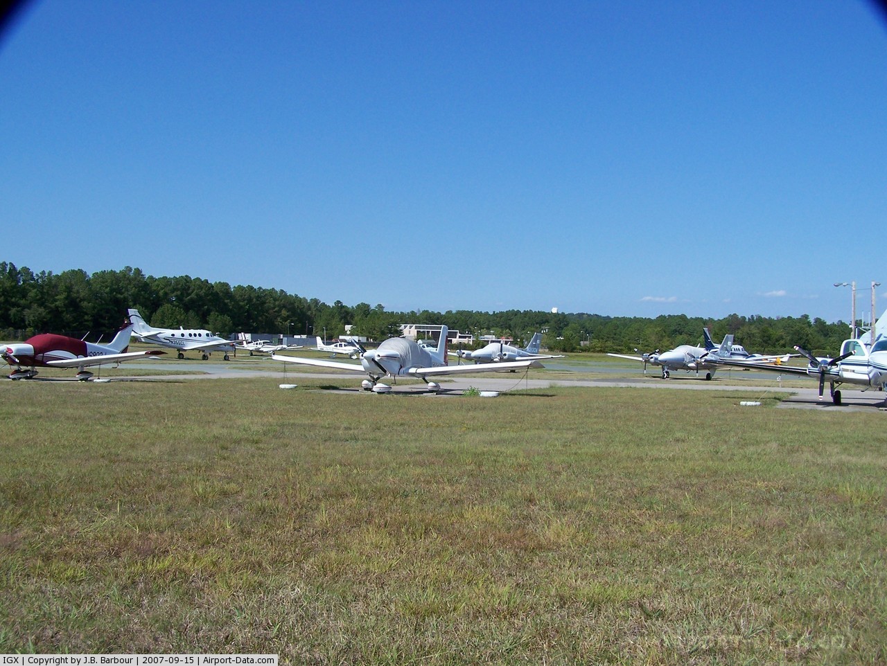
(Click on the photo to enlarge) |
 |
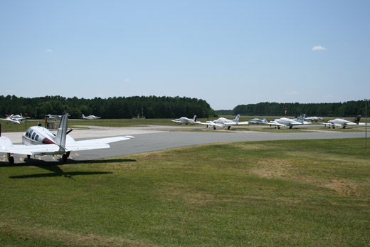
(Click on the photo to enlarge) |
Location & QuickFacts
| FAA Information Effective: | 2008-09-25 |
| Airport Identifier: | IGX |
| Airport Status: | Operational |
| Longitude/Latitude: | 079-03-57.2700W/35-56-06.0000N
-79.065908/35.935000 (Estimated) |
| Elevation: | 512 ft / 156.06 m (Surveyed) |
| Land: | 420 acres |
| From nearest city: | 1 nautical miles N of Chapel Hill, NC |
| Location: | Orange County, NC |
| Magnetic Variation: | 08W (2000) |
Owner & Manager
| Ownership: | Publicly owned |
| Owner: | University Of N Carolina |
| Address: | Cb 1510, Unc-ch
Chapel Hill, NC 27599-1510 |
| Manager: | Paul Burke |
| Address: | Cb 1510, Unc-ch
Chapel Hill, NC 27599-1510 |
| Phone number: | 919-962-1337
OR 919-962-1337 |
Airport Operations and Facilities
| Airport Use: | Open to public |
| Wind indicator: | Yes |
| Segmented Circle: | Yes |
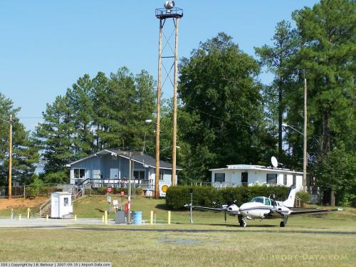
| Control Tower: | No |
| Lighting Schedule: | DUSK-DAWN
ACTVT MIRL RY 09/27 AND REIL RYS 09 & 27 - CTAF. |
| Beacon Color: | Clear-Green (lighted land airport) |
| Landing fee charge: | No |
| Sectional chart: | Charlotte |
| Region: | ASO - Southern |
| Boundary ARTCC: | ZDC - Washington |
| Tie-in FSS: | RDU - Raleigh |
| FSS on Airport: | No |
| FSS Toll Free: | 1-800-WX-BRIEF |
| NOTAMs Facility: | IGX (NOTAM-d service avaliable) |
Airport Communications
| CTAF: | 123.000 |
| Unicom: | 123.000 |
Airport Services
| Fuel available: | 100LLA |
| Bottled Oxygen: | NONE |
| Bulk Oxygen: | NONE |
Runway Information
Runway 09/27
| Dimension: | 4005 x 75 ft / 1220.7 x 22.9 m |
| Surface: | ASPH, Good Condition |
| Weight Limit: | Single wheel: 12500 lbs. |
| Edge Lights: | Medium |
| |
Runway 09 |
Runway 27 |
| Longitude: | 079-04-21.3700W | 079-03-33.1600W |
| Latitude: | 35-56-03.2000N | 35-56-08.8000N |
| Elevation: | 512.00 ft | 488.00 ft |
| Alignment: | 82 | 127 |
| Traffic Pattern: | Left | Right |
| Markings: | Non-precision instrument, Fair Condition | Non-precision instrument, Fair Condition |
| Crossing Height: | 21.00 ft | 23.00 ft |
| Displaced threshold: | 0.00 ft | 730.00 ft |
| VASI: | 4-light PAPI on left side | 4-light PAPI on left side |
| Visual Glide Angle: | 4.00° | 4.00° |
| Runway End Identifier: | Yes | Yes |
| Obstruction: | 70 ft trees, 1320.0 ft from runway, 116 ft right of centerline, 16:1 slope to clear
+45 FT TREES 0-200 FT FROM THR 240 L&R. | 27 ft trees, 231.0 ft from runway, 230 ft left of centerline, 1:1 slope to clear
APCH RATIO 38:1 TO DSPLCD THLD.
+70 FT TREES 0-200 FT FROM THR 235L. |
|
Radio Navigation Aids
| ID |
Type |
Name |
Ch |
Freq |
Var |
Dist |
| OQA | FAN MARKER | Rockingham County | | | | 47.4 nm |
| LE | NDB | Leevy | | 350.00 | 07W | 16.7 nm |
| HUR | NDB | Person | | 220.00 | 08W | 17.9 nm |
| TOX | NDB | Siler City | | 371.00 | 07W | 21.9 nm |
| HB | NDB | Himun | | 361.00 | 08W | 25.4 nm |
| TT | NDB | Leeco | | 406.00 | 08W | 26.6 nm |
| HXO | NDB | Huntsboro | | 271.00 | 07W | 30.9 nm |
| EEJ | NDB | Lee County/dcmsnd | | 428.00 | 07W | 34.6 nm |
| HQT | NDB | Harnett | | 417.00 | 08W | 35.7 nm |
| EUU | NDB | Jnall | | 251.00 | 07W | 39.9 nm |
| CQJ | NDB | City Lake | | 266.00 | 08W | 41.1 nm |
| JN | NDB | Jurly | | 263.00 | 09W | 41.7 nm |
| POB | NDB | Pope | | 338.00 | 07W | 42.9 nm |
| SIF | NDB | Slammer | | 423.00 | 07W | 43.2 nm |
| FGP | NDB | Fort Bragg | | 393.00 | 07W | 49.4 nm |
| POB | TACAN | Pope | 085X | | 07W | 46.6 nm |
| DAN | VOR | Danville | | 113.10 | 06W | 40.3 nm |
| RDU | VORTAC | Raleigh/durham | 119X | 117.20 | 04W | 14.3 nm |
| LIB | VORTAC | Liberty | 077X | 113.00 | 03W | 27.6 nm |
| SBV | VORTAC | South Boston | 041X | 110.40 | 05W | 44.6 nm |
| GSO | VORTAC | Greensboro | 109X | 116.20 | 03W | 44.8 nm |
Remarks
- ARPT CLSD TO ACFT 12500 LBS OR GREATER; GLIDERS; BALLOONS; MINIATURE ACFT; ULTRALIGHTS & PAJA ACTIVITY.
- NO PRACTICE APPROACHES/LNDGS WITHOUT PRIOR PERMISSION CALL 919-962-1337.
- DEER ON & INVOF ARPT.
- NO RECREATIONAL OR TRAINING FLIGHTS; 2100-0600; CLSD TO TRANSIENT ACFT OPNS 2100-0600 EXCEPT ACFT ON UNIVERSITY OR HOSPITAL BUSINESS; ALL OTHER TRANSIENT ACFT OPERATING 2100-0600 MUST HAVE 24 HR PPR CALL AMGR 919-962-1337.
- BE ALERT FOR ROUGH TURF AREAS MKD WITH TIRES PAINTED WHITE.
- ARPT CLSD TO PURE JET POWERED ACFT; EXCEPT FOR UNIVERSITY USERS TRANSPORTING PERSONS ON OFFICIAL UNIVERSITY BUSINESS.
- RY 09 HAS A 60 FT DROPOFF 200 FT FROM THLD L & R OF CNTRLN IN RY SAFETY AREA.
- RY 27 HAS 200 FT OVRN.
- EXISTED PRIOR TO 1959.
Images and information placed above are from
http://www.airport-data.com/airport/IGX/
We thank them for the data!
| General Info
|
| Country |
United States
|
| State |
NORTH CAROLINA
|
| FAA ID |
IGX
|
| Latitude |
35-56-06.015N
|
| Longitude |
079-03-57.241W
|
| Elevation |
512 feet
|
| Near City |
CHAPEL HILL
|
We don't guarantee the information is fresh and accurate. The data may
be wrong or outdated.
For more up-to-date information please refer to other sources.
|
|