 |
|
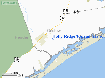
Holly Ridge/topsail Island Airport |
Location & QuickFacts
| FAA Information Effective: | 2008-09-25 |
| Airport Identifier: | N21 |
| Airport Status: | Operational |
| Longitude/Latitude: | 077-31-51.8860W/34-29-27.6010N
-77.531079/34.491000 (Estimated) |
| Elevation: | 40 ft / 12.19 m (Estimated) |
| Land: | 23 acres |
| From nearest city: | 1 nautical miles SE of Holly Ridge, NC |
| Location: | Onslow County, NC |
| Magnetic Variation: | 08W (1985) |
Owner & Manager
| Ownership: | Privately owned |
| Owner: | Grover D Ellis & John M Whitley |
| Address: | Po Box 221
Holly Ridge, NC 28445 |
| Phone number: | 910-329-4751 |
| Manager: | John Whitley |
| Address: | 142 Stump Sound Church Road
Holly Ridge, NC 28445 |
| Phone number: | 910-329-4751 |
Airport Operations and Facilities
| Airport Use: | Open to public |
| Wind indicator: | Yes |
| Segmented Circle: | No |
| Control Tower: | No |
| Lighting Schedule: | DUSK-DAWN |
| Landing fee charge: | No |
| Sectional chart: | Charlotte |
| Region: | ASO - Southern |
| Boundary ARTCC: | ZDC - Washington |
| Tie-in FSS: | RDU - Raleigh |
| FSS on Airport: | No |
| FSS Toll Free: | 1-800-WX-BRIEF |
| NOTAMs Facility: | RDU (NOTAM-d service avaliable) |
Airport Communications
Airport Services
Runway Information
Runway 14/32
| Dimension: | 3600 x 88 ft / 1097.3 x 26.8 m |
| Surface: | TURF, Good Condition |
| Edge Lights: | Non-standard lighting system
LGTD THR RY 14 RELCTD 925 FT; RY 32 LGTD THR RELCTD 675 FT; 2000 FT OF RY 14/32 USBL FOR NGT OPNS. |
| |
Runway 14 |
Runway 32 |
| Traffic Pattern: | Left | Left |
| Displaced threshold: | 925.00 ft | 600.00 ft |
| Obstruction: | 60 ft plines, 50.0 ft from runway
APCH RATIO 16:1 TO DSPLCD THR; RY 32 14:1 TO DSPLCD THR; RY 14/32 0:1 TO DSPLCD THR DUE TO +30 FT TREES; 120 FT L & R PARALLEL TO RY. | 50 ft plines, 65.0 ft from runway
RY 32 APCH SLOPE 14:1 TO DSPLCD THLD. RY 32 HAS A ROAD 145 FT FROM END OF RY. |
|
Radio Navigation Aids
| ID |
Type |
Name |
Ch |
Freq |
Var |
Dist |
| NCA | NDB | New River | | 356.00 | 08W | 14.7 nm |
| ACZ | NDB | Pendy | | 379.00 | 09W | 27.0 nm |
| CLB | NDB | Carolina Beach | | 216.00 | 04W | 31.5 nm |
| DKA | NDB | Kenan | | 332.00 | 07W | 39.8 nm |
| SUT | NDB | Yaupon | | 233.00 | 08W | 43.3 nm |
| MRH | NDB | Morehead | | 269.00 | 08W | 45.3 nm |
| TGQ | NDB | Elizabethtown | | 398.00 | 08W | 48.8 nm |
| DIW | NDB/DME | Dixon | 107X | 198.00 | 08W | 6.1 nm |
| NCA | TACAN | New River | 101X | | 08W | 13.7 nm |
| NJM | TACAN | Bogue Mcalf | 067X | | 08W | 27.6 nm |
| NKT | TACAN | Cherry Point | 075X | | 09W | 40.8 nm |
| EWN | VOR/DME | New Bern | 083X | 113.60 | 08W | 42.4 nm |
| ILM | VORTAC | Wilmington | 117X | 117.00 | 07W | 19.0 nm |
Remarks
- DEER ON AND INVOF ARPT.
- PRVDD VFR
Images and information placed above are from
http://www.airport-data.com/airport/N21/
We thank them for the data!
| General Info
|
| Country |
United States
|
| State |
NORTH CAROLINA
|
| FAA ID |
N21
|
| Latitude |
34-29-27.601N
|
| Longitude |
077-31-51.886W
|
| Elevation |
40 feet
|
| Near City |
HOLLY RIDGE
|
We don't guarantee the information is fresh and accurate. The data may
be wrong or outdated.
For more up-to-date information please refer to other sources.
|
|


