 |
|
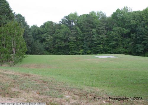 |
(Click on the photo to enlarge) |
Location & QuickFacts
| FAA Information Effective: | 2008-09-25 |
| Airport Identifier: | 83NC |
| Airport Status: | Operational |
| Longitude/Latitude: | 078-59-17.0000W/35-55-20.4000N
-78.988056/35.922333 (Estimated) |
| Elevation: | 300 ft / 91.44 m (Estimated) |
| Land: | 6 acres |
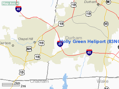
| From nearest city: | 6 nautical miles SW of Durham, NC |
| Location: | Durham County, NC |
| Magnetic Variation: | 08W (2000) |
Owner & Manager
| Ownership: | Privately owned |
| Owner: | Nancy Schneider |
| Address: | 5307 Farrington Rd
Chapel Hill, NC 27517 |
| Phone number: | 919-489-4992 |
| Manager: | Dale Schneider |
| Address: | 5850 Fayetteville Road, Suite 204
Durham, NC 27713-6692 |
| Phone number: | 919-730-5000
CELL |
Airport Operations and Facilities
| Airport Use: | Private
MEDICAL USE. |
| Wind indicator: | Yes |
| Segmented Circle: | No |
| Control Tower: | No |
| Lighting Schedule: | RDO-CTL
ACTVT PERIMETER LGTS - 123.025. |
| Sectional chart: | Charlotte |
| Region: | ASO - Southern |
| Boundary ARTCC: | ZDC - Washington |
| Tie-in FSS: | RDU - Raleigh |
| FSS Toll Free: | 1-800-WX-BRIEF |
Runway Information
Helipad H1
| Dimension: | 110 x 100 ft / 33.5 x 30.5 m |
| Surface: | TURF, |
| |
Runway H1 |
Runway |
| Traffic Pattern: | Left | Left |
|
Radio Navigation Aids
| ID |
Type |
Name |
Ch |
Freq |
Var |
Dist |
| LE | NDB | Leevy | | 350.00 | 07W | 13.0 nm |
| HUR | NDB | Person | | 220.00 | 08W | 19.1 nm |
| TOX | NDB | Siler City | | 371.00 | 07W | 25.0 nm |
| TT | NDB | Leeco | | 406.00 | 08W | 26.6 nm |
| HXO | NDB | Huntsboro | | 271.00 | 07W | 29.0 nm |
| HB | NDB | Himun | | 361.00 | 08W | 29.2 nm |
| HQT | NDB | Harnett | | 417.00 | 08W | 33.1 nm |
| EEJ | NDB | Lee County/dcmsnd | | 428.00 | 07W | 34.9 nm |
| EUU | NDB | Jnall | | 251.00 | 07W | 36.3 nm |
| JN | NDB | Jurly | | 263.00 | 09W | 38.4 nm |
| POB | NDB | Pope | | 338.00 | 07W | 41.8 nm |
| CQJ | NDB | City Lake | | 266.00 | 08W | 44.5 nm |
| SIF | NDB | Slammer | | 423.00 | 07W | 46.7 nm |
| FGP | NDB | Fort Bragg | | 393.00 | 07W | 47.9 nm |
| POB | TACAN | Pope | 085X | | 07W | 45.9 nm |
| DAN | VOR | Danville | | 113.10 | 06W | 42.4 nm |
| RDU | VORTAC | Raleigh/durham | 119X | 117.20 | 04W | 10.4 nm |
| LIB | VORTAC | Liberty | 077X | 113.00 | 03W | 31.1 nm |
| SBV | VORTAC | South Boston | 041X | 110.40 | 05W | 45.3 nm |
| GSO | VORTAC | Greensboro | 109X | 116.20 | 03W | 48.6 nm |
Remarks
- OWNER REQUESTS CHARTING.
- PRVDD VFR/PVT, AREA APPROPRIATELY MARKED, NON-OBSTRUCTING WIND INDICATOR IS MAINTAINED.
Images and information placed above are from
http://www.airport-data.com/airport/83NC/
We thank them for the data!
| General Info
|
| Country |
United States
|
| State |
NORTH CAROLINA
|
| FAA ID |
83NC
|
| Latitude |
35-55-20.400N
|
| Longitude |
078-59-17.000W
|
| Elevation |
300 feet
|
| Near City |
DURHAM
|
We don't guarantee the information is fresh and accurate. The data may
be wrong or outdated.
For more up-to-date information please refer to other sources.
|
|


