 |
|
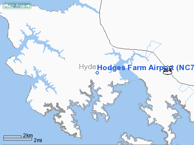
Location & QuickFacts
| FAA Information Effective: | 2008-09-25 |
| Airport Identifier: | NC73 |
| Airport Status: | Operational |
| Longitude/Latitude: | 076-26-57.7280W/35-26-19.5990N
-76.449369/35.438778 (Estimated) |
| Elevation: | 6 ft / 1.83 m (Surveyed) |
| Land: | 0 acres |
| From nearest city: | 3 nautical miles SE of Sladesville, NC |
| Location: | Hyde County, NC |
| Magnetic Variation: | 09W (1985) |
Owner & Manager
| Ownership: | Privately owned |
| Owner: | J. Al Hodges, Jr. |
| Address: | P.o. Box 29
Hatteras, NC 27943 |
| Phone number: | 252-986-2230
FAX 252-986-1433. |
| Manager: | J. Al Hodges, Jr. |
| Address: | P.o. Box 29
Hatteras, NC 27943 |
| Phone number: | 252-986-2230
FAX 252-986-1433. |
Airport Operations and Facilities
| Airport Use: | Private |
| Wind indicator: | Yes |
| Segmented Circle: | No |
| Control Tower: | No |
| Lighting Schedule: | PHONE REQ
FOR LIRL RY 01/19 AND ARPT BCN CALL 919-926-6651. |
| Beacon Color: | Clear-Green (lighted land airport) |
| Landing fee charge: | No |
| Sectional chart: | Washington |
| Region: | ASO - Southern |
| Boundary ARTCC: | ZDC - Washington |
| Tie-in FSS: | RDU - Raleigh |
| FSS on Airport: | No |
| FSS Toll Free: | 1-800-WX-BRIEF |
Runway Information
Runway 01/19
| Dimension: | 2750 x 75 ft / 838.2 x 22.9 m |
| Surface: | TURF, |
| Edge Lights: | Low |
| |
Runway 01 |
Runway 19 |
| Traffic Pattern: | Left | Left |
|
Radio Navigation Aids
| ID |
Type |
Name |
Ch |
Freq |
Var |
Dist |
| PGV | FAN MARKER | Belvoir | | | 06W | 47.2 nm |
| HI | MARINE NDB | Hatteras Inlet Station/dcm | | 1.00 | 09W | 39.1 nm |
| PMZ | NDB | Plymouth | | 221.00 | 10W | 27.1 nm |
| RNW | NDB | Chocowinity | | 388.00 | 07W | 32.5 nm |
| EDE | NDB | Edenton | | 265.00 | 10W | 35.7 nm |
| MCZ | NDB | Williamston | | 336.00 | 09W | 43.6 nm |
| MRH | NDB | Morehead | | 269.00 | 08W | 43.8 nm |
| MQI | NDB | Manteo | | 370.00 | 09W | 46.7 nm |
| AQE | NDB | Alwood | | 230.00 | 09W | 47.9 nm |
| OUC | NDB/DME | Pamlico/dcmsnd | 034X | 404.00 | 09W | 29.8 nm |
| NKT | TACAN | Cherry Point | 075X | | 09W | 38.4 nm |
| EWN | VOR/DME | New Bern | 083X | 113.60 | 08W | 36.6 nm |
| RBX | VOR/DME | Wright Brothers | 053X | 111.60 | 08W | 46.8 nm |
Remarks
Images and information placed above are from
http://www.airport-data.com/airport/NC73/
We thank them for the data!
| General Info
|
| Country |
United States
|
| State |
NORTH CAROLINA
|
| FAA ID |
NC73
|
| Latitude |
35-26-19.599N
|
| Longitude |
076-26-57.728W
|
| Elevation |
6 feet
|
| Near City |
SLADESVILLE
|
We don't guarantee the information is fresh and accurate. The data may
be wrong or outdated.
For more up-to-date information please refer to other sources.
|
|


