|
 |
|
||||
|
Coordinates: 35°44′28″N 081°23′22″W / 35.74111°N 81.38944°W
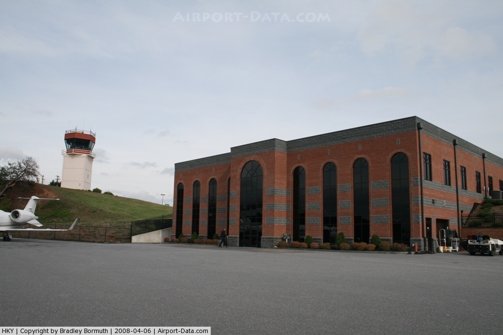
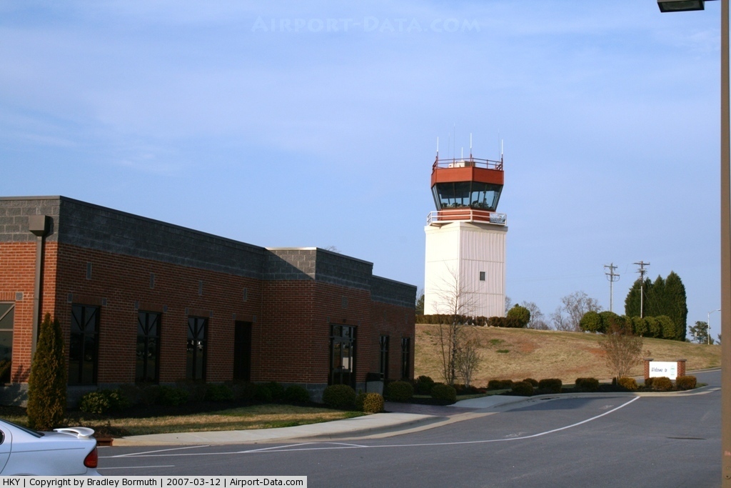
Hickory Regional Airport (IATA: HKY, ICAO: KHKY, FAA LID: HKY) is a public airport located three miles (5 km) west of the central business district of Hickory, a city in Catawba County, North Carolina, United States. It is owned by the City of Hickory. Facilities and Aircraft
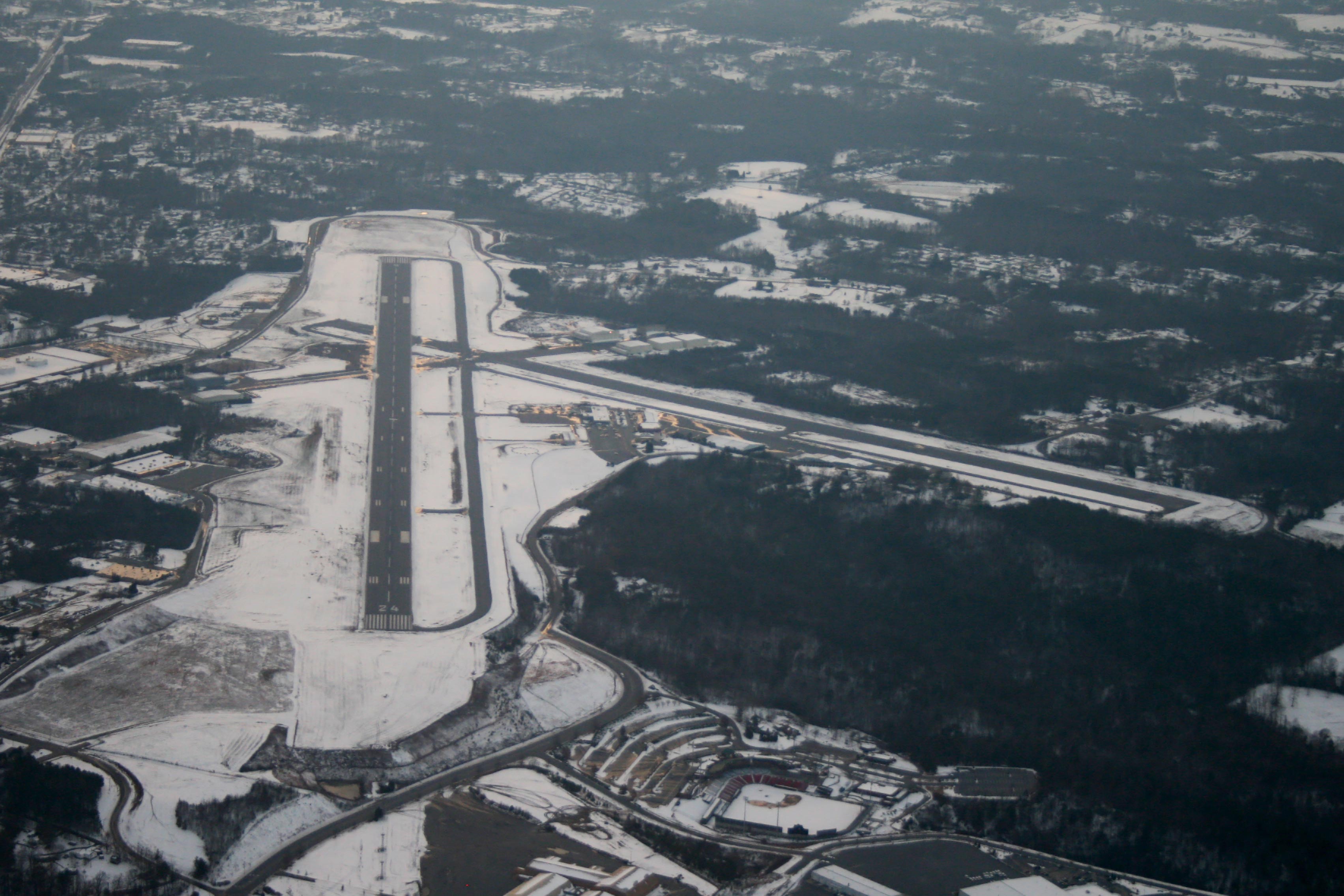
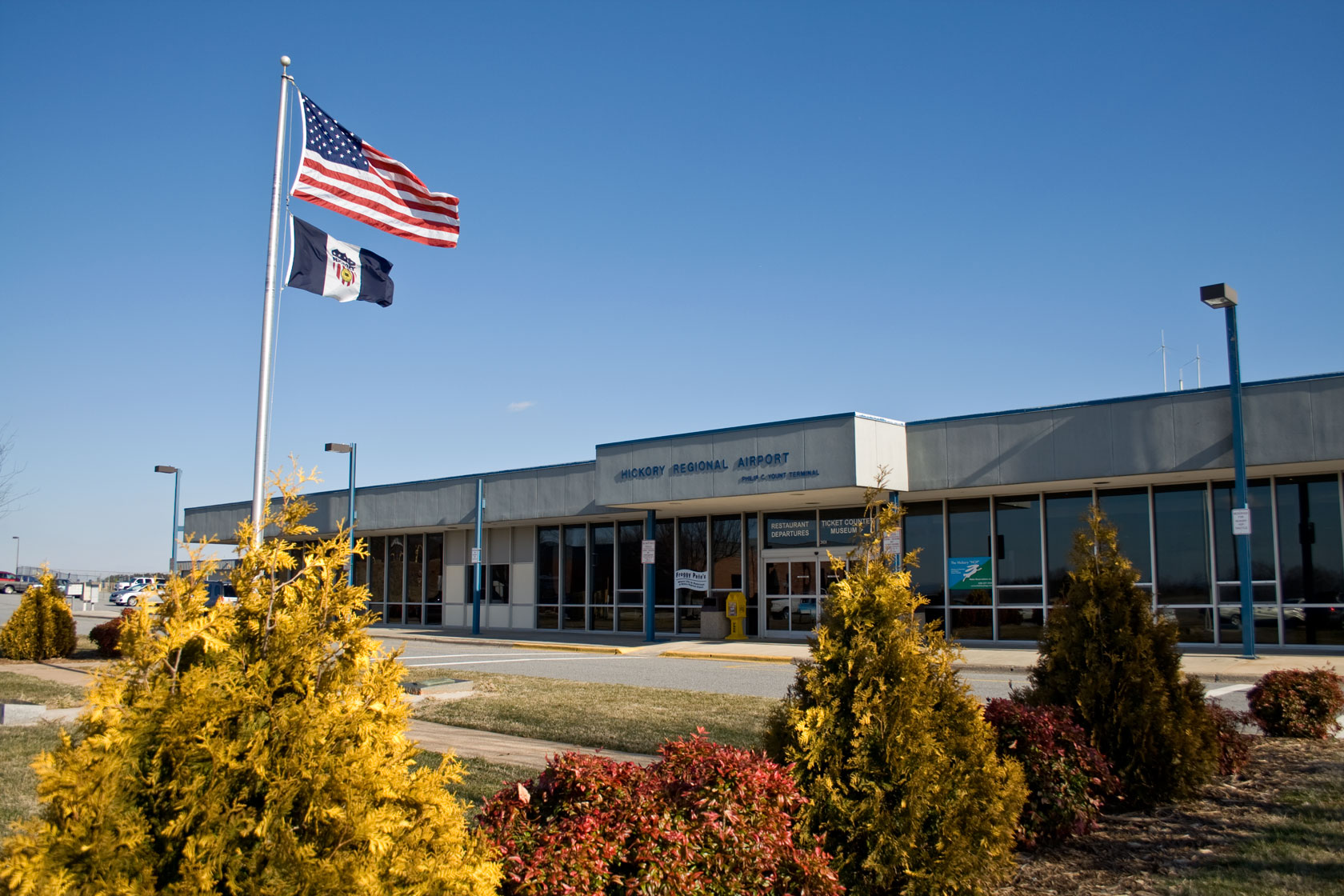
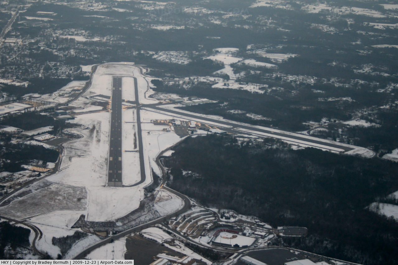
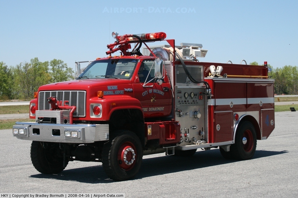
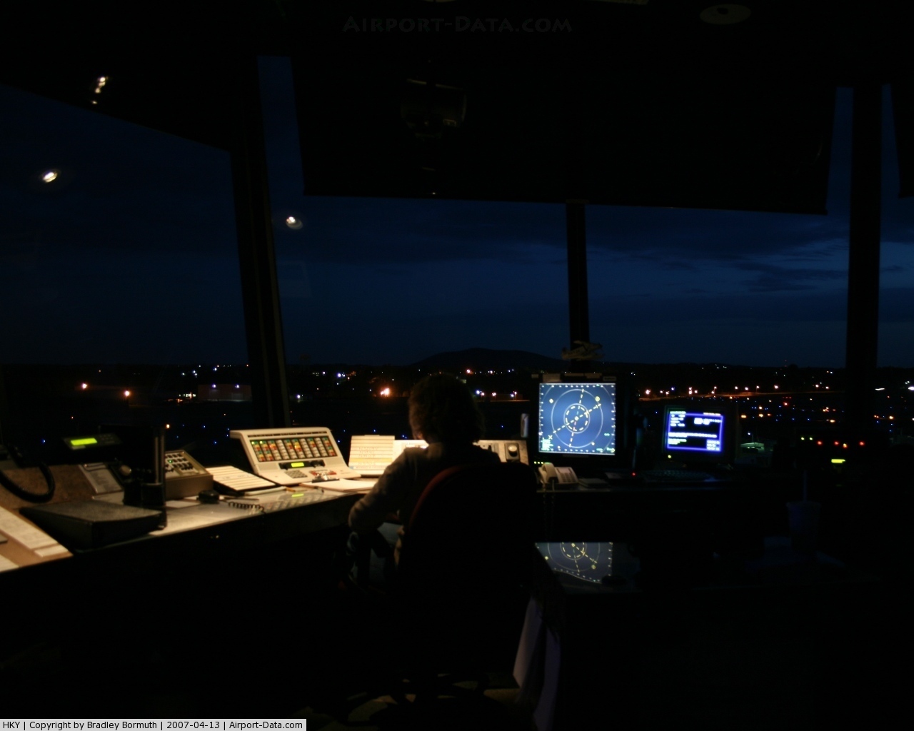
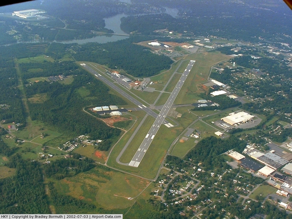
Hickory Regional Airport covers an area of 739 acres (299 ha) which contains two asphalt paved runways: 6/24 measuring 6,400 x 150 ft. (1,951 x 46 m) and 1/19: 4,400 x 150 ft. (1,341 x 46 m). For the 12-month period ending July 31, 2009, the airport had 40,504 aircraft operations, an average of 111 per day: 99% general aviation and 1% military. There are also a total of 70 aircraft based on the airport. The airport has an operating control tower from 7:00am to 11:00pm daily for safety and sequencing of aircraft landing and departing. Also on the field is a Aircraft Rescue and Firefighting (ARFF) station manned 24/7. For weather information, the airport uses an automated airport weather station (ASOS). The airport terminal building, which was built in 1960, has served as a hub for commerce and transportation for more than 40 years. However, it no longer supports airline travel as the most recent airline, Delta Connection, ceased operation from Hickory in 2005 . The building remains an active part of the airport housing airport administration and maintenance, a café, rental cars, a bus service, as well as the Hickory Aviation Museum. In 2003, a new building was constructed to serve the general aviation community. There are several flight instructors who instruct at the Hickory Regional Airport and airplane rental is provided through the fixed base operator (FBO), Riverhawk Aviation. Instruction is provided both on an individual basis where the prospective pilot is taught both the knowledge and flight training required by the instructor, and through the flight school at Caldwell Community College & Technical Institute, where the knowledge component is taught in a classroom setting. Additional pilot instruction including sport pilot training is given through an independent company on the airport that operates a Remos GX and a Cub Crafters Sport Cub aircraft. Riverhawk Aviation, which is the airport's only FBO, has about 172,000 square feet (16,000 m) of hangar space, maintenance and office facilities. They have a FAR part 145 repair station with highly trained Aircraft Maintenance Technicians that can maintain and repair small piston aircraft to medium-sized business jets. History
The Hickory Municipal Airport was first opened to aircraft traffic on May 17, 1940. At that time, there were two unpaved runways which were 2,700 and 3,100 feet in length. Shortly thereafter, the runway which came to be designated 6/24 was lengthened and both of the existing runways were paved. On August 2, 1941, Pennsylvania Central Airline which later became Capital Airlines, brought the first scheduled air-carrier service to Hickory. This service was interrupted by World War II, and was suspended in May, 1942. During the war years the Hickory Municipal Airport served as a Pilot Training center for the Military. In 1947, the Civil Aeronautics Administration opened the Hickory Interstate Airways Communications Station, which was housed in a wooden structure on the south side of the field, at the former FBO site. As the Flight Service Station, this operation is now housed, along with a portion of the Systems Maintenance Sector, in the modern Terminal Building. The main offices for the Systems Maintenance Sector are now located in the present FBO office building. In May, 1950, the City of Hickory contracted for the construction of a North-South Runway (runway 1/19), which is a total of 4,400 feet in length. Capital Airlines resumed scheduled service in August 1951, and continued until August 1952, at which time Piedmont Airlines began to serve Hickory. Since initial construction, runway 6/24 has been extended in length twice, to its present length of 6,402 feet. A full Instrument Landing System (ILS) was installed on runway 24, and commissioned in 1977. A MALSR Approach Lighting System was also installed on this runway. In 1960, the base of operations for the airport was moved from the south side of the field when the new terminal building was constructed. In the mid-1960's, the Fixed Base Operator, Cannon Aviation, Inc., also moved from the south side of the field, into new quarters adjacent to the Terminal Building. The Fixed Base Operation was later bought by a locally formed corporation, Carolina Airways, Inc., and since that time, the FBO has changed owners several times and two substantial expansion projects have been completed. In the early part of 1969, a new High Intensity Lighting system (HIRL) was installed on runway 6/24 as well as lighting on the parallel taxiway. A new taxiway, complete with lighting, was constructed parallel to runway 1/19. In the same improvements project, runway 6/24 was overlayed for the purpose of increasing the pavement strength and a new 36-inch Airport Beacon was installed. In the Fall of 1973, the Federal Aviation Administration, following much planning and work, commissioned an Air Traffic Control Tower at the Hickory Airport. Commercial Airline ServicesWhile not currently served by any commercial airline, the Hickory Regional Airport has had such service for much of its history. On August 2, 1941, Pennsylvania Central Airlines which later became Capital Airlines, brought the first scheduled air-carrier service to Hickory. This service was interrupted by World War II, and was suspended in May, 1942. Capital Airlines resumed scheduled service in August 1951, and continued until August 1952, at which time Piedmont Airlines (1948–1989) began to serve Hickory. From 1952-1980, Piedmont Airlines provided direct and non-stop service to various destinations such as Asheville (NC), Baltimore (MD), Charlotte (NC), Winston-Salem (NC), Tri-Cities Area (TN), Atlanta (GA), and Washington (VA/DC). Aircraft varied from the Douglas DC-3, Martin 404, Fokker F27, Fairchild Hiller FH-227, and the NAMC YS-11. After the airline deregulation of the late 1970s, the nature of commercial service would change for Hickory. Now smaller, commuter airline service would be offered to feed large hubs of aviation activity. Atlantis Airlines (1979-1985) was one small airline of this type, offering up to 6 daily direct flights to Charlotte and Atlanta. The period of 1978-2002 would also see Sunbird Airlines (later CCAir) operate up to 10 daily flights using Cessna 402 and Cessna 404(s), Beechcraft Model 99 Airliners, Shorts 330 and Shorts 360 Skyvans, DeHavilland Canada Dash 8, and BAE Jetstream 32 Turboprops. These aircraft would operate under the marketing names of Sunbird Airlines, Piedmont Commuter, and finally US Airways Express. CCAir would be later acquired by Mesa Airlines who would, in the wake of the September 11th 2001 attacks, decide to suspend its daily US Airways Express commuter flights to Charlotte-Douglas International Airport in April 2002. Most recently, in 2005, Delta Connection carrier Atlantic Southeast Airlines operated Bombardier CRJ200 Regional Jets on their direct service to Atlanta Hartsfield-Jackson International Airport, before ceasing this service in the fall of the year. Local officials hope to attract and continue to aggressively pursue future commercial airline service, despite challenges caused by the relatively close proximity of the large Charlotte-Douglas International Airport. Nonetheless, the airport has maintained a relatively high traffic volume due to its corporate, air charter, air cargo, and local and itinerant general aviation activity. The above content comes from Wikipedia and is published under free licenses – click here to read more.
Location & QuickFacts
Owner & Manager
Airport Operations and Facilities
Airport Communications
Airport Services
Runway InformationRunway 01/19
Runway 06/24
Radio Navigation Aids
Remarks
Images and information placed above are from We thank them for the data!
We don't guarantee the information is fresh and accurate. The data may
be wrong or outdated.
|
|||||||||||||||||||||||||||||||||||||||||||||||||||||||||||||||||||||||||||||||||||||||||||||||||||||||||||||||||||||||||||||||||||||||||||||||||||||||||||||||||||||||||||||||||||||||||||||||||||||||||||||||||||||||||||||||||||||||||||||||||||||||||||||||||||||||||||||||||||||||||||||||||||||||||||||||||||||||||||||||||||||||||||||||||||||||||||||||||||||||||||||||||||||||||||||||||||||||||||||||||||||||||||||||||||||||||||||||||||||||||||||||||||||||

 |
|
Copyright 2004-2026 © by Airports-Worldwide.com, Vyshenskoho st. 36, Lviv 79010, Ukraine Legal Disclaimer |