 |
|
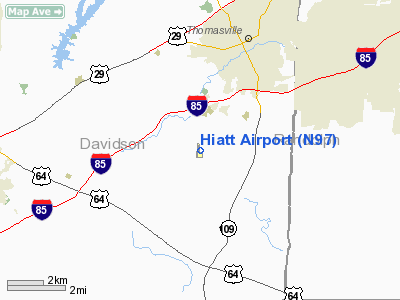
Location & QuickFacts
| FAA Information Effective: | 2008-09-25 |
| Airport Identifier: | N97 |
| Airport Status: | Operational |
| Longitude/Latitude: | 080-06-27.1610W/35-49-48.4920N
-80.107545/35.830137 (Estimated) |
| Elevation: | 855 ft / 260.60 m (Estimated) |
| Land: | 30 acres |
| From nearest city: | 3 nautical miles SW of Thomasville, NC |
| Location: | Davidson County, NC |
| Magnetic Variation: | 10W (2000) |
Owner & Manager
| Ownership: | Privately owned |
| Owner: | Paul Douglas Tharp |
| Address: | 788 Wright Road
Lexington, NC 27292 |
| Phone number: | 336-472-2314 |
| Manager: | Paul Douglas Tharp |
| Address: | 788 Wright Road
Lexington, NC 27292 |
| Phone number: | 336-881-0248 |
Airport Operations and Facilities
| Airport Use: | Open to public |
| Wind indicator: | Yes |
| Segmented Circle: | No |
| Control Tower: | No |
| Lighting Schedule: | DUSK-DAWN
ACTVT LIRL RYS 01/19 & TRIL RY 19 - CTAF. |
| Beacon Color: | Clear-Green (lighted land airport) |
| Landing fee charge: | No |
| Sectional chart: | Charlotte |
| Region: | ASO - Southern |
| Boundary ARTCC: | ZTL - Atlanta |
| Tie-in FSS: | RDU - Raleigh |
| FSS on Airport: | No |
| FSS Toll Free: | 1-800-WX-BRIEF |
| NOTAMs Facility: | RDU (NOTAM-d service avaliable) |
Airport Communications
Airport Services
| Fuel available: | 100LL
FOR FUEL CALL 336-881-0248. |
| Airframe Repair: | MAJOR |
| Power Plant Repair: | MAJOR |
| Bottled Oxygen: | NONE |
| Bulk Oxygen: | NONE |
Runway Information
Runway 01/19
| Dimension: | 2500 x 75 ft / 762.0 x 22.9 m |
| Surface: | TURF, Fair Condition |
| Edge Lights: | Low |
| |
Runway 01 |
Runway 19 |
| Traffic Pattern: | Left | Left |
| Crossing Height: | 0.00 ft | 25.00 ft |
| VASI: | | tri-color on left side |
| Visual Glide Angle: | 0.00° | 3.20° |
| Obstruction: | 50 ft trees, 8.0 ft from runway, 85 ft left of centerline | 60 ft trees, 0.0 ft from runway, 110 ft right of centerline |
|
Runway 09/27
| Dimension: | 1160 x 50 ft / 353.6 x 15.2 m |
| Surface: | TURF, Fair Condition |
| |
Runway 09 |
Runway 27 |
| Traffic Pattern: | Left | Left |
| Obstruction: | 40 ft trees, 3.0 ft from runway, 109 ft right of centerline | 45 ft trees, 0.0 ft from runway, 70 ft left of centerline |
|
Radio Navigation Aids
| ID |
Type |
Name |
Ch |
Freq |
Var |
Dist |
| OQA | FAN MARKER | Rockingham County | | | | 38.3 nm |
| SEN | NDB | Swearing/dcmsnd | | 260.00 | 06W | 9.8 nm |
| CQJ | NDB | City Lake | | 266.00 | 08W | 13.7 nm |
| DVZ | NDB | Davie | | 354.00 | 06W | 17.7 nm |
| RU | NDB | Rovdy | | 275.00 | 06W | 19.5 nm |
| VU | NDB | Aller | | 346.00 | 06W | 20.6 nm |
| HB | NDB | Himun | | 361.00 | 08W | 27.0 nm |
| TOX | NDB | Siler City | | 371.00 | 07W | 31.7 nm |
| SIF | NDB | Slammer | | 423.00 | 07W | 37.2 nm |
| AZW | NDB | Mount Airy | | 223.00 | 07W | 39.2 nm |
| ZEF | NDB | Zephyr | | 326.00 | 05W | 41.7 nm |
| UV | NDB | Bales | | 396.00 | 07W | 46.6 nm |
| VW | NDB | Temky | | 280.00 | 05W | 46.8 nm |
| AFP | NDB | Anson County | | 283.00 | 07W | 48.5 nm |
| GSO | VORTAC | Greensboro | 109X | 116.20 | 03W | 14.4 nm |
| LIB | VORTAC | Liberty | 077X | 113.00 | 03W | 24.1 nm |
| SDZ | VORTAC | Sandhills | 055X | 111.80 | 03W | 44.8 nm |
Remarks
- RY 19 PREFERRED FOR LDNG UPHILL; RWY AND THLDS MARKED WITH YELLOW CONES.
- RYS 01/19 & 09/27 VFR USE ONLY.
- RY 27 HAS +4 FT FENCE 30 FT FROM THLD & 12 FT BLDG 70 FT FROM THLD ON EXTDD CNTRLN.
- BE ALERT FOR NUMEROUS TREES IN THE APPROACHES.
- ARPT PHONE NR 336-476-4171.
- AIRCRAFT MONITOR 122.9.
Images and information placed above are from
http://www.airport-data.com/airport/N97/
We thank them for the data!
| General Info
|
| Country |
United States
|
| State |
NORTH CAROLINA
|
| FAA ID |
N97
|
| Latitude |
35-49-48.492N
|
| Longitude |
080-06-27.161W
|
| Elevation |
855 feet
|
| Near City |
THOMASVILLE
|
We don't guarantee the information is fresh and accurate. The data may
be wrong or outdated.
For more up-to-date information please refer to other sources.
|
|


