 |
|
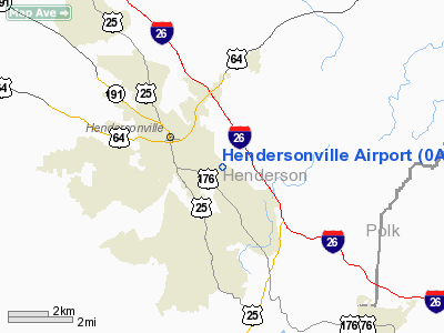
Location & QuickFacts
| FAA Information Effective: | 2008-09-25 |
| Airport Identifier: | 0A7 |
| Airport Status: | Operational |
| Longitude/Latitude: | 082-25-59.4270W/35-18-27.4200N
-82.433174/35.307617 (Estimated) |
| Elevation: | 2084 ft / 635.20 m (Estimated) |
| Land: | 33 acres |
| From nearest city: | 2 nautical miles E of Hendersonville, NC |
| Location: | Henderson County, NC |
| Magnetic Variation: | 04W (1985) |
Owner & Manager
| Ownership: | Privately owned |
| Owner: | John Fadok |
| Address: | 1232 Shepherd St
Hendersonville, NC 28792 |
| Phone number: | 828-693-1897 |
| Manager: | John Fadok |
| Address: | 1232 Shepherd St
Hendersonville, NC 28792 |
| Phone number: | 828-693-1897
FBO; AMGR PHONE 828-693-1897. |
Airport Operations and Facilities
| Airport Use: | Open to public |
| Wind indicator: | Yes |
| Segmented Circle: | No |
| Control Tower: | No |
| Lighting Schedule: | RDO-CTL
ACTVT LIRL RY 14/32 - CTAF. |
| Landing fee charge: | Yes
$10.00 FEE ACFT OVER 6000 POUNDS OR TURBINE. |
| Sectional chart: | Atlanta |
| Region: | ASO - Southern |
| Boundary ARTCC: | ZTL - Atlanta |
| Tie-in FSS: | RDU - Raleigh |
| FSS on Airport: | No |
| FSS Toll Free: | 1-800-WX-BRIEF |
| NOTAMs Facility: | RDU (NOTAM-d service avaliable) |
Airport Communications
| CTAF: | 123.000 |
| Unicom: | 123.000 |
Airport Services
| Fuel available: | 100LL |
| Airframe Repair: | MAJOR |
| Power Plant Repair: | MAJOR |
| Bottled Oxygen: | NONE |
| Bulk Oxygen: | NONE |
Runway Information
Runway 15/33
| Dimension: | 3075 x 40 ft / 937.3 x 12.2 m |
| Surface: | ASPH, Good Condition |
| Weight Limit: | Single wheel: 10000 lbs. |
| Edge Lights: | Non-standard lighting system |
| |
Runway 15 |
Runway 33 |
| Traffic Pattern: | Left | Left |
| Markings: | Nonstandard, Good Condition
PAINT FADED. | Nonstandard, Good Condition
PAINT FADED. |
| Displaced threshold: | 270.00 ft | 325.00 ft |
| Runway End Identifier: | No | No |
| Centerline Lights: | No | No |
| Touchdown Lights: | No | No |
| Obstruction: | 50 ft tree, 275.0 ft from runway, 99 ft left of centerline, 1:1 slope to clear
RY 15 APCH SLOPE 7:1 TO DSPLACD THR (ROAD).
ROAD 30 FT FROM END OF RUNWAY IN PRIMARY SURFACE. | 21 ft road, 200.0 ft from runway
RY 33 APCH SLOPE 19:1 TO DSPLCD THR (ROAD).
3 FT FENCE 40 FT FM THLD; ROAD 110 FT FROM THR ON CENTERLINE. |
|
Radio Navigation Aids
| ID |
Type |
Name |
Ch |
Freq |
Var |
Dist |
| MRN | FAN MARKER | Lenoir | | | 03W | 49.2 nm |
| BRA | NDB | Broad River | | 379.00 | 04W | 2.8 nm |
| RFE | NDB | Rutherford | | 344.00 | 05W | 23.7 nm |
| LQK | NDB | Lake Keowee | | 408.00 | 04W | 32.7 nm |
| FRT | NDB | Fairmont | | 248.00 | 05W | 32.9 nm |
| GY | NDB | Dyana | | 338.00 | 03W | 37.1 nm |
| SLP | NDB | First River | | 417.00 | 06W | 41.1 nm |
| CEU | NDB | Clemson | | 257.00 | 05W | 44.2 nm |
| FIQ | NDB | Fiddlers | | 391.00 | 07W | 44.4 nm |
| SUG | VORTAC | Sugarloaf Mountain | 059X | 112.20 | 02W | 10.0 nm |
| SPA | VORTAC | Spartanburg | 104X | 115.70 | 02W | 29.8 nm |
| SOT | VORTAC | Snowbird | 025X | 108.80 | 04W | 41.9 nm |
Remarks
- NORTH SIDE OF RY HAS 60 FT TREES 80 FT FROM CENTERLINE.
- NUMEROUS OBSTNS IN APCH AND PRIM SFCS. HANGER AND PARKED AIRCRAFT 90 FT LEFT OF RY 32.
- ACFT PARKED 40 FT FM EDGE OF RY 15/33 SOUTH END.
- FOR SVC AFT HRS CALL 828-693-1897.
- EXISTED IN 1952.
Images and information placed above are from
http://www.airport-data.com/airport/0A7/
We thank them for the data!
| General Info
|
| Country |
United States
|
| State |
NORTH CAROLINA
|
| FAA ID |
0A7
|
| Latitude |
35-18-27.420N
|
| Longitude |
082-25-59.427W
|
| Elevation |
2084 feet
|
| Near City |
HENDERSONVILLE
|
We don't guarantee the information is fresh and accurate. The data may
be wrong or outdated.
For more up-to-date information please refer to other sources.
|
|


