 |
|
| Henderson Field |
| IATA: none – ICAO: KACZ – FAA LID: ACZ |
| Summary |
| Airport type |
Public |
| Operator |
Town of Wallace |
| Location |
Wallace, North Carolina |
| Elevation AMSL |
39 ft / 11.9 m |
| Coordinates |
34°43′04″N 78°00′13″W / 34.71778°N 78.00361°W / 34.71778; -78.00361Coordinates: 34°43′04″N 78°00′13″W / 34.71778°N 78.00361°W / 34.71778; -78.00361 |
| Runways |
| Direction |
Length |
Surface |
| ft |
m |
| 9/27 |
3,998 |
1,219 |
Asphalt |
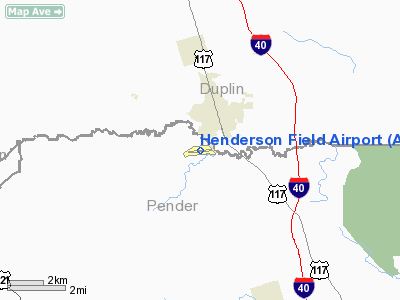
Henderson Field (ICAO: KACZ, FAA LID: ACZ) is a public airport located one mile (2 km) southwest of the central business district (CBD) of Wallace, a town in Duplin County, North Carolina, USA. This general aviation airport covers 145 acres (59 ha) and has one runway.
Although most U.S. airports use the same three-letter location identifier for the FAA and IATA, Henderson Field is assigned ACZ by the FAA but has no designation from the IATA (which assigned ACZ to Zabol, Iran). The airport's ICAO identifier is KACZ.
The above content comes from Wikipedia and is published under free licenses – click here to read more.
Location & QuickFacts
| FAA Information Effective: | 2008-09-25 |
| Airport Identifier: | ACZ |
| Airport Status: | Operational |
| Longitude/Latitude: | 078-00-13.0480W/34-43-04.4050N
-78.003624/34.717890 (Estimated) |
| Elevation: | 39 ft / 11.89 m (Surveyed) |
| Land: | 145 acres |
| From nearest city: | 1 nautical miles SW of Wallace, NC |
| Location: | Pender County, NC |
| Magnetic Variation: | 09W (2000) |
Owner & Manager
| Ownership: | Publicly owned |
| Owner: | Town Of Wallace |
| Address: | Town Hall
Wallace, NC 28466 |
| Phone number: | 910-285-4136 |
| Manager: | Bill Cook |
| Address: | 250 Henderson Field Road
Wallace, NC 28466 |
| Phone number: | 910-285-6642
NIGHT PHONE 910-285-2126 (POLICE DEPT). ALTERNATE: 910-284-1186 |
Airport Operations and Facilities
| Airport Use: | Open to public |
| Wind indicator: | Yes |
| Segmented Circle: | Yes |
| Control Tower: | No |
| Lighting Schedule: | DUSK-DAWN |
| Beacon Color: | Clear-Green (lighted land airport) |
| Landing fee charge: | No |
| Sectional chart: | Charlotte |
| Region: | ASO - Southern |
| Boundary ARTCC: | ZDC - Washington |
| Tie-in FSS: | RDU - Raleigh |
| FSS on Airport: | No |
| FSS Toll Free: | 1-800-WX-BRIEF |
| NOTAMs Facility: | RDU (NOTAM-d service avaliable) |
| Federal Agreements: | NGY |
Airport Communications
| CTAF: | 122.800 |
| Unicom: | 122.800 |
Airport Services
| Fuel available: | 100LLA A1+ |
| Airframe Repair: | NONE |
| Power Plant Repair: | NONE |
| Bottled Oxygen: | NONE |
| Bulk Oxygen: | NONE |
Runway Information
Runway 09/27
| Dimension: | 3998 x 75 ft / 1218.6 x 22.9 m |
| Surface: | ASPH, |
| Weight Limit: | Single wheel: 12500 lbs. |
| Edge Lights: | Medium |
| |
Runway 09 |
Runway 27 |
| Longitude: | 078-00-36.9420W | 077-59-49.2260W |
| Latitude: | 34-43-02.6840N | 34-43-06.0990N |
| Elevation: | 39.00 ft | 31.00 ft |
| Alignment: | 85 | 127 |
| Traffic Pattern: | Left | Left |
| Markings: | Non-precision instrument, Good Condition | Non-precision instrument, Good Condition |
| Crossing Height: | 0.00 ft | 25.00 ft |
| Displaced threshold: | 149.00 ft | 151.00 ft |
| VASI: | 2-box on left side
VASI OTS INDEFLY. | 2-box on left side
VASI OTS INDEFLY. |
| Visual Glide Angle: | 0.00° | 3.80° |
| Obstruction: | 52 ft trees, 968.0 ft from runway, 243 ft right of centerline, 14:1 slope to clear
APCH SLOPE 20:1 TO DSPLCD THLD.
SUMMER MONTHS +8' CORN 100' EITHER SIDE OF CNTRLN ADJACENT TO APPH THRS. | 82 ft trees, 1742.0 ft from runway, 270 ft right of centerline, 18:1 slope to clear
APCH SLOPE 23:1 TO DSPLCD THLD. |
|
Radio Navigation Aids
| ID |
Type |
Name |
Ch |
Freq |
Var |
Dist |
| DKA | NDB | Kenan | | 332.00 | 07W | 21.7 nm |
| CTZ | NDB | Clinton | | 412.00 | 08W | 23.5 nm |
| TGQ | NDB | Elizabethtown | | 398.00 | 08W | 27.8 nm |
| NCA | NDB | New River | | 356.00 | 08W | 28.4 nm |
| CLB | NDB | Carolina Beach | | 216.00 | 04W | 36.8 nm |
| CPC | NDB | Camp | | 227.00 | 07W | 44.2 nm |
| FGP | NDB | Fort Bragg | | 393.00 | 07W | 47.2 nm |
| SUT | NDB | Yaupon | | 233.00 | 08W | 47.6 nm |
| JYN | NDB | Wayne | | 208.00 | 08W | 48.8 nm |
| DIW | NDB/DME | Dixon | 107X | 198.00 | 08W | 28.7 nm |
| NCA | TACAN | New River | 101X | | 08W | 27.8 nm |
| GSB | TACAN | Seymour Johnson | 112X | | 08W | 37.1 nm |
| NJM | TACAN | Bogue Mcalf | 067X | | 08W | 48.3 nm |
| FAY | VOR/DME | Fayetteville | 025X | 108.80 | 04W | 45.9 nm |
| ILM | VORTAC | Wilmington | 117X | 117.00 | 07W | 22.9 nm |
| ISO | VORTAC | Kinston | 033X | 109.60 | 05W | 45.0 nm |
Remarks
- 5' DITCH 135' RIGHT OF CNTRLN RWY 09.
- 7' DITCH 140' LEFT OF CNTRLN RWY 27.
- RWY 27 SAFETY AREA HAS 20' DEPRESSIONS/CREEK 160'FR THR BOTH SIDES C/L.
Images and information placed above are from
http://www.airport-data.com/airport/ACZ/
We thank them for the data!
| General Info
|
| Country |
United States
|
| State |
NORTH CAROLINA
|
| FAA ID |
ACZ
|
| Latitude |
34-43-04.405N
|
| Longitude |
078-00-13.048W
|
| Elevation |
39 feet
|
| Near City |
WALLACE
|
We don't guarantee the information is fresh and accurate. The data may
be wrong or outdated.
For more up-to-date information please refer to other sources.
|
|


