 |
|
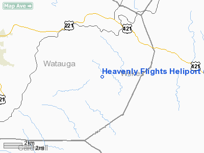
Heavenly Flights Heliport |
Location & QuickFacts
| FAA Information Effective: | 2008-09-25 |
| Airport Identifier: | 40NC |
| Airport Status: | Operational |
| Longitude/Latitude: | 081-31-26.0000W/36-10-49.0000N
-81.523889/36.180278 (Estimated) |
| Elevation: | 2474 ft / 754.08 m (Estimated) |
| Land: | 1 acres |
| From nearest city: | 7 nautical miles S of Boone, NC |
| Location: | Watauga County, NC |
| Magnetic Variation: | 06W (1995) |
Owner & Manager
| Ownership: | Privately owned |
| Owner: | David Kaplan |
| Address: | 725 Sunrise Valley
Boone, NC 28607 |
| Phone number: | 828-264-1322 |
| Manager: | Debbie Triplett |
| Address: | 1896 Heavenly Mtn Drive
Vilas, NC 28607 |
| Phone number: | 828-264-6040
EXT 106. |
Airport Operations and Facilities
| Airport Use: | Private |
| Wind indicator: | Yes |
| Segmented Circle: | No |
| Control Tower: | No |
| Lighting Schedule: | RDO-CTL
ACTVT PERIMETER LGTS - 123.0. |
| Sectional chart: | Cincinnati |
| Region: | ASO - Southern |
| Boundary ARTCC: | ZTL - Atlanta |
| Tie-in FSS: | RDU - Raleigh |
| FSS on Airport: | No |
| FSS Toll Free: | 1-800-WX-BRIEF |
Runway Information
Helipad H1
| Dimension: | 25 x 25 ft / 7.6 x 7.6 m |
| Surface: | TURF, |
| |
Runway H1 |
Runway |
| Traffic Pattern: | Left | Left |
|
Radio Navigation Aids
| ID |
Type |
Name |
Ch |
Freq |
Var |
Dist |
| MRN | FAN MARKER | Lenoir | | | 03W | 23.6 nm |
| BAR | NDB | Hemlock | | 320.00 | 02W | 17.3 nm |
| JU | NDB | Ashee | | 410.00 | 07W | 18.1 nm |
| JJO | NDB | Mountain City | | 396.00 | 04W | 20.3 nm |
| UKF | NDB | Wilki | | 209.00 | 06W | 21.1 nm |
| HK | NDB | Tawba | | 332.00 | 06W | 25.9 nm |
| FIQ | NDB | Fiddlers | | 391.00 | 07W | 29.2 nm |
| VW | NDB | Temky | | 280.00 | 05W | 33.1 nm |
| EZT | NDB | Elizabethton | | 275.00 | 02W | 37.1 nm |
| VJ | NDB | Whine | | 236.00 | 05W | 39.1 nm |
| ZEF | NDB | Zephyr | | 326.00 | 05W | 39.6 nm |
| IZN | NDB | Lincolnton | | 432.00 | 06W | 44.1 nm |
| MK | NDB | Suzze | | 335.00 | 06W | 46.5 nm |
| HLX | NDB | Hillsville | | 269.00 | 06W | 48.7 nm |
| BO | NDB | Booie | | 221.00 | 04W | 48.9 nm |
| AZW | NDB | Mount Airy | | 223.00 | 07W | 49.2 nm |
| BZM | VOR/DME | Barretts Mountain | 045X | 110.80 | 06W | 23.2 nm |
| GZG | VOR/DME | Glade Spring | 039X | 110.20 | 02W | 47.1 nm |
| HMV | VORTAC | Holston Mountain | 093X | 114.60 | 04W | 33.1 nm |
| HKY | VOT | Hickory Regional | | 110.00 | | 27.2 nm |
Remarks
- PRVDD VFR/PVT USE ONLY; AREA IS MARKED; WIND INDICATOR IS MAINTAINED.
Images and information placed above are from
http://www.airport-data.com/airport/40NC/
We thank them for the data!
| General Info
|
| Country |
United States
|
| State |
NORTH CAROLINA
|
| FAA ID |
40NC
|
| Latitude |
36-10-49.000N
|
| Longitude |
081-31-26.000W
|
| Elevation |
2474 feet
|
| Near City |
BOONE
|
We don't guarantee the information is fresh and accurate. The data may
be wrong or outdated.
For more up-to-date information please refer to other sources.
|
|


