 |
|
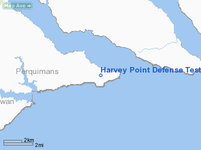
Harvey Point Defense Testing Activity Airport |
Location & QuickFacts
| FAA Information Effective: | 2008-09-25 |
| Airport Identifier: | NC01 |
| Airport Status: | Operational |
| Longitude/Latitude: | 076-19-37.4000W/36-05-46.4000N
-76.327056/36.096222 (Estimated) |
| Elevation: | 10 ft / 3.05 m (Surveyed) |
| Land: | 100 acres |
| From nearest city: | 10 nautical miles SE of Hertford, NC |
| Location: | Perquimans County, NC |
| Magnetic Variation: | () |
Owner & Manager
| Ownership: | Privately owned |
| Owner: | Harvey Point Defense Testing Activi |
| Address: | 2835 Harvey Point Road
Hertford, NC 27944 |
| Phone number: | 252-426-5221 |
| Manager: | Mr. Tony Bass |
| Address: | 2835 Harvey Point Road
Hertford, NC 27944 |
| Phone number: | 252-426-5221 |
Airport Operations and Facilities
| Airport Use: | Private |
| Wind indicator: | Yes |
| Control Tower: | No |
| Sectional chart: | Charlotte |
| Region: | ASO - Southern |
| Boundary ARTCC: | ZDC - Washington |
| Tie-in FSS: | RDU - Raleigh |
| FSS Toll Free: | 1-800-WX-BRIEF |
Runway Information
Runway 03/21
| Dimension: | 5291 x 100 ft / 1612.7 x 30.5 m |
| Surface: | ASPH, Good Condition |
| Edge Lights: | High |
| |
Runway 03 |
Runway 21 |
| Longitude: | 076-19-47.6074W | 076-19-27.1162W |
| Latitude: | 36-05-21.6324N | 36-06-11.2424N |
| Elevation: | 8.00 ft | 7.00 ft |
| Traffic Pattern: | Left | Right |
| Markings: | Precision instrument, | Precision instrument, |
| Crossing Height: | 40.00 ft | 40.00 ft |
| Displaced threshold: | 0.00 ft | 198.00 ft |
| VASI: | 4-light PAPI on left side | 4-light PAPI on left side |
| Visual Glide Angle: | 3.00° | 3.00° |
| Runway End Identifier: | Yes | Yes |
| Obstruction: | 80 ft trees, 200L/ ft right of centerline | |
|
Radio Navigation Aids
| ID |
Type |
Name |
Ch |
Freq |
Var |
Dist |
| LLW | NDB | Woodville | | 254.00 | 10W | 10.1 nm |
| EDE | NDB | Edenton | | 265.00 | 10W | 12.4 nm |
| PMZ | NDB | Plymouth | | 221.00 | 10W | 27.3 nm |
| EY | NDB | Chesi | | 233.00 | 09W | 30.4 nm |
| MQI | NDB | Manteo | | 370.00 | 09W | 32.6 nm |
| RK | NDB | Waley | | 249.00 | 10W | 34.0 nm |
| PVG | NDB | Portsmouth | | 241.00 | 10W | 41.5 nm |
| ASJ | NDB | Ahoskie | | 415.00 | 10W | 42.9 nm |
| MCZ | NDB | Williamston | | 336.00 | 09W | 43.8 nm |
| NTU | TACAN | Oceana | 113X | | 10W | 45.9 nm |
| ECG | VOR/DME | Elizabeth City | 072X | 112.50 | 07W | 12.2 nm |
| RBX | VOR/DME | Wright Brothers | 053X | 111.60 | 08W | 32.4 nm |
| CVI | VORTAC | Cofield | 093X | 114.60 | 09W | 31.2 nm |
| ORF | VORTAC | Norfolk | 116X | 116.90 | 07W | 48.2 nm |
| FKN | VORTAC | Franklin | 043X | 110.60 | 09W | 49.8 nm |
Remarks
- TREES TO 80 FEET ABOVE RUNWAY ELEVATION LINE BOTH SIDES OF RUNWAY, FULL LENGTH, APPROXIMATELY 150 FT FROM EDGE OF PAVEMENT.
- RUNWAY 3 HAS A NON-STANDARD MALS THRESHOLD LIGHT BAR.
- PILOT CONTROL LIGHTING IS AVAILABLE BY REQUEST ONLY.
- AIRFIELD IS FOR OFFICIAL BUSINESS ONLY AND PRIOR PERMISSION IS REQUIRED.
- REMAIN NORTHWEST OF RUNWAY FOR CIRCLING APPROACHES AND TRAFFIC PATTERNS.
- DO NOT ENTER R-5301 WITHOUT PERMISSION AND APPROVAL OF ATC.
Images and information placed above are from
http://www.airport-data.com/airport/NC01/
We thank them for the data!
| General Info
|
| Country |
United States
|
| State |
NORTH CAROLINA
|
| FAA ID |
NC01
|
| Latitude |
35-05-25.589N
|
| Longitude |
078-52-29.090W
|
| Elevation |
190 feet
|
| Near City |
FAYETTEVILLE
|
We don't guarantee the information is fresh and accurate. The data may
be wrong or outdated.
For more up-to-date information please refer to other sources.
|
|


