|
|
Harnett Rgnl Jetport Airport |
| Harnett Regional Jetport |
| IATA: none – ICAO: KHRJ – FAA LID: HRJ |
| Summary |
| Airport type |
Public |
| Owner |
Harnett County |
| Serves |
Erwin, North Carolina |
| Elevation AMSL |
202 ft / 62 m |
| Coordinates |
35°22′49″N 078°43′56″W / 35.38028°N 78.73222°W / 35.38028; -78.73222 |
| Runways |
| Direction |
Length |
Surface |
| ft |
m |
| 5/23 |
5,000 |
1,524 |
Asphalt |
| Statistics (2009) |
| Aircraft operations |
51,300 |
| Based aircraft |
53 |
| Source: Federal Aviation Administration |
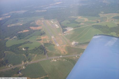
Harnett Regional Jetport (ICAO: KHRJ, FAA LID: HRJ) is a county-owned public-use airport in Harnett County, North Carolina, United States. The airport is located four nautical miles (7 km) northwest of the central business district of Erwin. It was formerly known as Harnett County Airport.
Although many U.S. airports use the same three-letter location identifier for the FAA and IATA, this facility is assigned HRJ by the FAA but has no designation from the IATA (which assigned HRJ to Chaurjhari, Nepal). The airport's ICAO identifier is KHRJ.
Facilities and aircraft
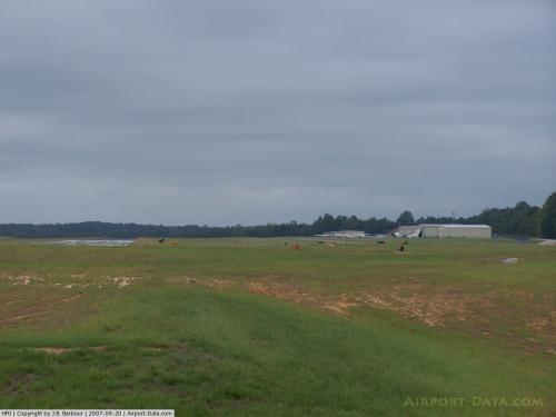
Harnett Regional Jetport covers an area of 152 acres (62 ha) at an elevation of 202 feet (62 m) above mean sea level. It has one runway designated 5/23 with an asphalt surface measuring 5,000 by 75 feet (1,524 x 23 m).
For the 12-month period ending September 7, 2009, the airport had 51,300 aircraft operations, an average of 140 per day: 86% general aviation, 14% military, and <1% air taxi. At that time there were 53 aircraft based at this airport: 60% single-engine, 9% multi-engine, 4% jet and 26% glider.
The above content comes from Wikipedia and is published under free licenses – click here to read more.

 |
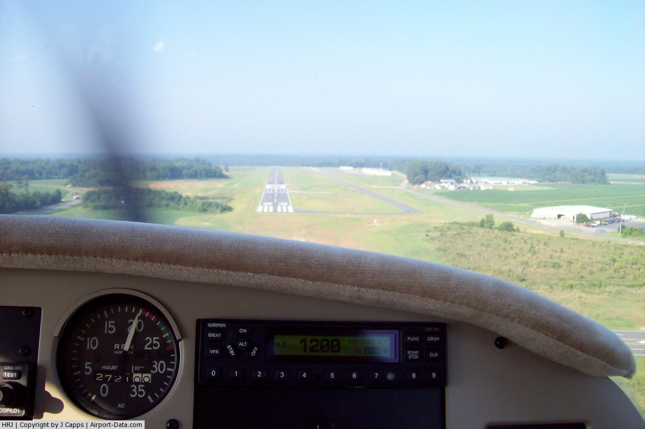
(Click on the photo to enlarge) |
 |
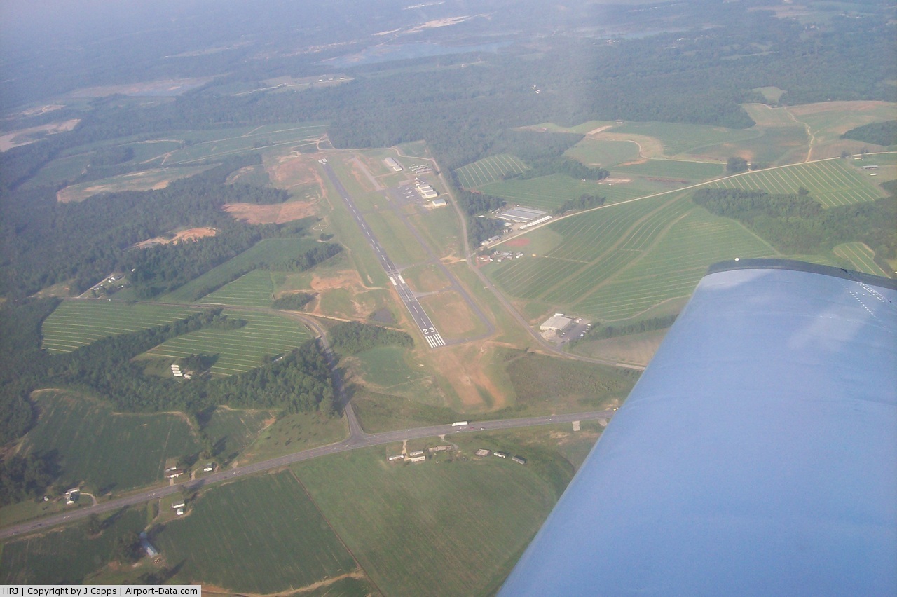
(Click on the photo to enlarge) |
 |
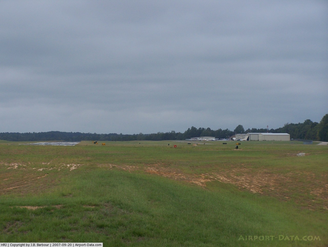
(Click on the photo to enlarge) |
 |
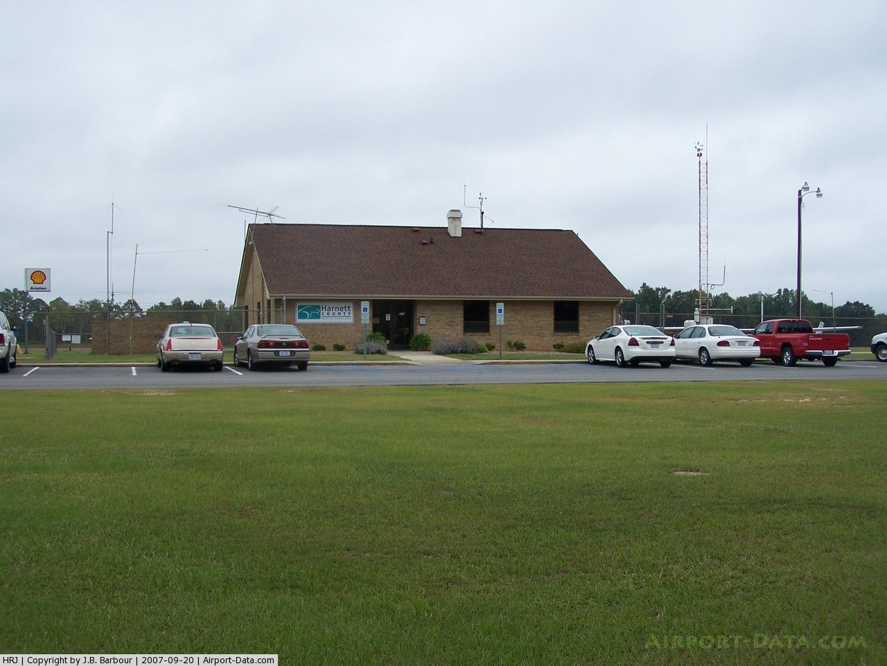
(Click on the photo to enlarge) |
Location & QuickFacts
| FAA Information Effective: | 2008-09-25 |
| Airport Identifier: | HRJ |
| Airport Status: | Operational |
| Longitude/Latitude: | 078-43-56.0490W/35-22-48.5629N
-78.732236/35.380156 (Estimated) |
| Elevation: | 202 ft / 61.57 m (Surveyed) |
| Land: | 152 acres |
| From nearest city: | 4 nautical miles NW of Erwin, NC |
| Location: | Harnett County, NC |
| Magnetic Variation: | 08W (2000) |
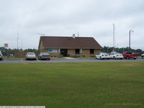
Owner & Manager
| Ownership: | Publicly owned |
| Owner: | Harnett Regional Jetport |
| Address: | Po Box 759
Lillington, NC 27546 |
| Phone number: | 910-893-7555 |
| Manager: | Stanley Bass |
| Address: | 615 Airport Rd
Erwin, NC 28339 |
| Phone number: | 910-814-2740 |
Airport Operations and Facilities
| Airport Use: | Open to public |
| Wind indicator: | Yes |
| Segmented Circle: | Yes |
| Control Tower: | No |
| Lighting Schedule: | DUSK-DAWN
AFTER 2200 ACTVT MIRL RY 05/23, PAPI RYS 05 & RY 23 AND REIL RY 05 & RY 23 - CTAF. |
| Beacon Color: | Clear-Green (lighted land airport) |
| Landing fee charge: | No |
| Sectional chart: | Charlotte |
| Region: | ASO - Southern |
| Boundary ARTCC: | ZDC - Washington |
| Tie-in FSS: | RDU - Raleigh |
| FSS on Airport: | No |
| FSS Toll Free: | 1-800-WX-BRIEF |
| NOTAMs Facility: | HRJ (NOTAM-d service avaliable) |
| Federal Agreements: | NGY |
Airport Communications
| CTAF: | 122.700 |
| Unicom: | 122.700 |
Airport Services
| Fuel available: | 100LLA A1+ |
| Airframe Repair: | MAJOR |
| Power Plant Repair: | MAJOR |
| Bottled Oxygen: | NONE |
| Bulk Oxygen: | NONE |
Runway Information
Runway 05/23
| Dimension: | 4999 x 75 ft / 1523.7 x 22.9 m |
| Surface: | ASPH, Fair Condition |
| Weight Limit: | Single wheel: 13000 lbs. |
| Edge Lights: | Medium |
| |
Runway 05 |
Runway 23 |
| Longitude: | 078-44-15.4339W | 078-43-36.6641W |
| Latitude: | 35-22-29.6109N | 35-23-07.5148N |
| Elevation: | 188.00 ft | 202.00 ft |
| Alignment: | 40 | 127 |
| Traffic Pattern: | Left | Left |
| Markings: | Nonstandard, Poor Condition
RY 5 HAS NO THLD OR AIMING POINT MARKING. | Non-precision instrument, Good Condition |
| Crossing Height: | 35.00 ft | 35.00 ft |
| VASI: | 2-light PAPI on left side | 2-light PAPI on left side |
| Visual Glide Angle: | 3.00° | 3.00° |
| Runway End Identifier: | Yes
RWY 05 REIL OTS INDEFLY. | Yes
RWY 23 REIL OTS INDEFLY. |
|
Radio Navigation Aids
| ID |
Type |
Name |
Ch |
Freq |
Var |
Dist |
| HQT | NDB | Harnett | | 417.00 | 08W | 4.2 nm |
| POB | NDB | Pope | | 338.00 | 07W | 14.3 nm |
| FGP | NDB | Fort Bragg | | 393.00 | 07W | 15.0 nm |
| JN | NDB | Jurly | | 263.00 | 09W | 16.1 nm |
| TT | NDB | Leeco | | 406.00 | 08W | 21.2 nm |
| EUU | NDB | Jnall | | 251.00 | 07W | 23.0 nm |
| EEJ | NDB | Lee County/dcmsnd | | 428.00 | 07W | 24.1 nm |
| CTZ | NDB | Clinton | | 412.00 | 08W | 30.3 nm |
| LE | NDB | Leevy | | 350.00 | 07W | 32.9 nm |
| JYN | NDB | Wayne | | 208.00 | 08W | 41.7 nm |
| TOX | NDB | Siler City | | 371.00 | 07W | 42.4 nm |
| HFF | NDB | Mackall | | 278.00 | 06W | 42.6 nm |
| DKA | NDB | Kenan | | 332.00 | 07W | 44.0 nm |
| RW | NDB | Jambe | | 235.00 | 09W | 44.2 nm |
| RSY | NDB | Robeson | | 359.00 | 08W | 48.8 nm |
| POB | TACAN | Pope | 085X | | 07W | 19.4 nm |
| GSB | TACAN | Seymour Johnson | 112X | | 08W | 37.4 nm |
| LBT | VOR | Lumberton | | 110.00 | 08W | 48.9 nm |
| FAY | VOR/DME | Fayetteville | 025X | 108.80 | 04W | 24.7 nm |
| RDU | VORTAC | Raleigh/durham | 119X | 117.20 | 04W | 29.7 nm |
| SDZ | VORTAC | Sandhills | 055X | 111.80 | 03W | 43.1 nm |
Remarks
- 60 FT DROPOFF 285 FT FM RY 05 THLD. 15 FT DROPOFF 30 FT LEFT OF RY 23.
- GCO AVBL ON FREQ 135.075 THRU FAY CD & FLT SVCS.
- BIRDS ON & INVOF ARPT.
- ARPT LOCATED 18 NM NE OF POPE AFB; HEAVY AMTS MILITARY TFC AS LOW AS 500 FT AGL OVERHEAD HARNETT RGNL JETPORT.
- CTN: ULTRALIGHT AIRPARK 2NM SE. HVY AMTS ULTRALIGHT ACTVY TO 1000'MSL MAINLY WEEKENDS EXTENDING INTO HARNETT RGNL JETPORT TFC PATTERN.
- GLIDER ACTVTY DALGT HRS MAY BE USING RIGHT HAND TRAFFIC.
- ROTG BCN OBSCURED BY TREES NORTH & WEST OF ARPT.
- ARPT PHONE NUMBER 910-814-2740.
- GLIDERS USE GRASS AREA ADJACENT RY 05/23 FOR LDG.
Images and information placed above are from
http://www.airport-data.com/airport/HRJ/
We thank them for the data!
| General Info
|
| Country |
United States
|
| State |
NORTH CAROLINA
|
| FAA ID |
HRJ
|
| Latitude |
35-22-43.681N
|
| Longitude |
078-44-01.065W
|
| Elevation |
198 feet
|
| Near City |
ERWIN
|
We don't guarantee the information is fresh and accurate. The data may
be wrong or outdated.
For more up-to-date information please refer to other sources.
|
|