 |
|
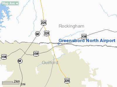
Location & QuickFacts
| FAA Information Effective: | 2008-09-25 |
| Airport Identifier: | 36NC |
| Airport Status: | Operational |
| Longitude/Latitude: | 079-54-29.0000W/36-15-13.0000N
-79.908056/36.253611 (Estimated) |
| Elevation: | 900 ft / 274.32 m (Estimated) |
| Land: | 0 acres |
| From nearest city: | 10 nautical miles N of Greensboro, NC |
| Location: | Guilford County, NC |
| Magnetic Variation: | 07W (1995) |
Owner & Manager
| Ownership: | Privately owned |
| Owner: | Alexander C. Hunt |
| Address: | P.o. Box 430
Summerfield, NC 27358 |
| Phone number: | 336-643-0124 |
| Manager: | Alexander C. Hunt |
| Address: | P.o. Box 430
Summerfield, NC 27358 |
| Phone number: | 336-643-0124 |
Airport Operations and Facilities
| Airport Use: | Private |
| Wind indicator: | Yes |
| Segmented Circle: | No |
| Control Tower: | No |
| Sectional chart: | Cincinnati |
| Region: | ASO - Southern |
| Boundary ARTCC: | ZDC - Washington |
| Tie-in FSS: | RDU - Raleigh |
| FSS on Airport: | No |
| FSS Toll Free: | 1-800-WX-BRIEF |
Runway Information
Runway 05/23
| Dimension: | 3200 x 32 ft / 975.4 x 9.8 m |
| Surface: | ASPH-TURF,
FIRST 800 FT OF RY 5 APCH IS TURF; FIRST 950 FT OF RY 23 APCH IS TURF; MIDDLE 1450 FT PORTION OF RY IS ASPH. |
| |
Runway 05 |
Runway 23 |
| Traffic Pattern: | Left | Left |
| Displaced threshold: | 700.00 ft
RY 05 DSPLCD THLD MKD WITH ORANGE CONES. | 0.00 ft |
| Obstruction: | 15 ft road, 250.0 ft from runway | |
|
Radio Navigation Aids
| ID |
Type |
Name |
Ch |
Freq |
Var |
Dist |
| OQA | FAN MARKER | Rockingham County | | | | 11.1 nm |
| SIF | NDB | Slammer | | 423.00 | 07W | 10.4 nm |
| UV | NDB | Bales | | 396.00 | 07W | 20.2 nm |
| HB | NDB | Himun | | 361.00 | 08W | 22.8 nm |
| AZW | NDB | Mount Airy | | 223.00 | 07W | 31.6 nm |
| CQJ | NDB | City Lake | | 266.00 | 08W | 32.4 nm |
| DVZ | NDB | Davie | | 354.00 | 06W | 33.6 nm |
| SEN | NDB | Swearing/dcmsnd | | 260.00 | 06W | 34.2 nm |
| TOX | NDB | Siler City | | 371.00 | 07W | 36.7 nm |
| ZEF | NDB | Zephyr | | 326.00 | 05W | 39.7 nm |
| HUR | NDB | Person | | 220.00 | 08W | 40.8 nm |
| RU | NDB | Rovdy | | 275.00 | 06W | 42.2 nm |
| VU | NDB | Aller | | 346.00 | 06W | 46.7 nm |
| DAN | VOR | Danville | | 113.10 | 06W | 33.5 nm |
| GSO | VORTAC | Greensboro | 109X | 116.20 | 03W | 12.9 nm |
| LIB | VORTAC | Liberty | 077X | 113.00 | 03W | 30.2 nm |
Remarks
- 1120 FT RADIO TOWER 1.5 NM NW OF ARPT; 571 FT TV TOWER 1.8 NM S OF ARPT.
- PRVDD VFR; PVT USE.
Images and information placed above are from
http://www.airport-data.com/airport/36NC/
We thank them for the data!
| General Info
|
| Country |
United States
|
| State |
NORTH CAROLINA
|
| FAA ID |
36NC
|
| Latitude |
36-15-13.000N
|
| Longitude |
079-54-29.000W
|
| Elevation |
900 feet
|
| Near City |
GREENSBORO
|
We don't guarantee the information is fresh and accurate. The data may
be wrong or outdated.
For more up-to-date information please refer to other sources.
|
|


