|
|
 |
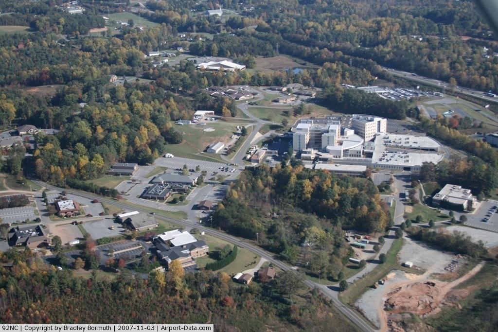
(Click on the photo to enlarge) |
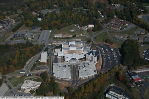 |
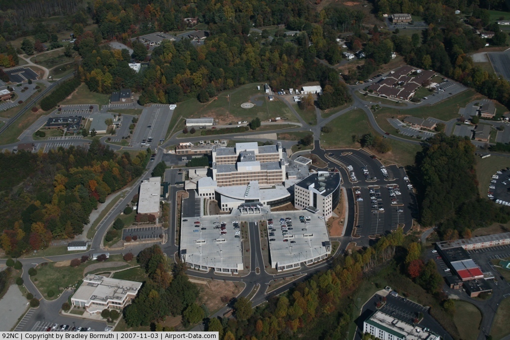
(Click on the photo to enlarge) |
Location & QuickFacts
| FAA Information Effective: | 2008-09-25 |
| Airport Identifier: | 92NC |
| Airport Status: | Operational |
| Longitude/Latitude: | 081-39-13.3440W/35-43-38.4660N
-81.653707/35.727352 (Estimated) |
| Elevation: | 1178 ft / 359.05 m (Estimated) |
| Land: | 1 acres |
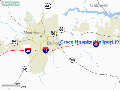
| From nearest city: | 2 nautical miles E of Morganton, NC |
| Location: | Burke County, NC |
| Magnetic Variation: | 05W (1985) |
Owner & Manager
| Ownership: | Privately owned |
| Owner: | Grace Healthcare System |
| Address: | 2201 South Sterling St.
Morganton, NC 28655 |
| Phone number: | 828-580-5000 |
| Manager: | Earl Morann |
| Address: | 2201 South Sterling St.
Morganton, NC 28655 |
| Phone number: | 828-580-5560 |
Airport Operations and Facilities
| Airport Use: | Private |
| Wind indicator: | Yes |
| Segmented Circle: | No |
| Control Tower: | No |
| Landing fee charge: | No |
| Sectional chart: | Charlotte |
| Region: | ASO - Southern |
| Boundary ARTCC: | ZTL - Atlanta |
| Tie-in FSS: | RDU - Raleigh |
| FSS Toll Free: | 1-800-WX-BRIEF |
| NOTAMs Facility: | RDU (NOTAM-d service avaliable) |
Runway Information
Helipad H1
| Dimension: | 50 x 50 ft / 15.2 x 15.2 m |
| Surface: | CONC, |
| |
Runway H1 |
Runway |
| Traffic Pattern: | Left | Left |
| Approach lights: | LDIN | |
|
Radio Navigation Aids
| ID |
Type |
Name |
Ch |
Freq |
Var |
Dist |
| MRN | FAN MARKER | Lenoir | | | 03W | 4.4 nm |
| FIQ | NDB | Fiddlers | | 391.00 | 07W | 1.3 nm |
| HK | NDB | Tawba | | 332.00 | 06W | 17.3 nm |
| RFE | NDB | Rutherford | | 344.00 | 05W | 27.0 nm |
| BAR | NDB | Hemlock | | 320.00 | 02W | 27.9 nm |
| SLP | NDB | First River | | 417.00 | 06W | 28.7 nm |
| VW | NDB | Temky | | 280.00 | 05W | 28.9 nm |
| IZN | NDB | Lincolnton | | 432.00 | 06W | 30.0 nm |
| UKF | NDB | Wilki | | 209.00 | 06W | 35.6 nm |
| GHJ | NDB | Stonia | | 260.00 | 06W | 40.4 nm |
| JJO | NDB | Mountain City | | 396.00 | 04W | 42.2 nm |
| JU | NDB | Ashee | | 410.00 | 07W | 45.4 nm |
| EZT | NDB | Elizabethton | | 275.00 | 02W | 46.4 nm |
| BRA | NDB | Broad River | | 379.00 | 04W | 48.4 nm |
| BZM | VOR/DME | Barretts Mountain | 045X | 110.80 | 06W | 21.9 nm |
| CLT | VOR/DME | Charlotte | 097X | 115.00 | 05W | 47.2 nm |
| SUG | VORTAC | Sugarloaf Mountain | 059X | 112.20 | 02W | 35.7 nm |
| SPA | VORTAC | Spartanburg | 104X | 115.70 | 02W | 43.8 nm |
| HMV | VORTAC | Holston Mountain | 093X | 114.60 | 04W | 48.5 nm |
| HKY | VOT | Hickory Regional | | 110.00 | | 12.8 nm |
| CLT | VOT | Charlotte | | 112.00 | | 46.6 nm |
Remarks
- +4 FT PERIMETER FENCE 60 FT FM PAD.
- VFR PRIVATE USE; APCH/DEP OPNS 130 DEG TO 315 DEG; TKOF/LANDING AREA APPROPRIATELY MARKED; NON-OBSTRUCTING WIND INDICATOR MAINTAINED.
Images and information placed above are from
http://www.airport-data.com/airport/92NC/
We thank them for the data!
|
|