 |
|
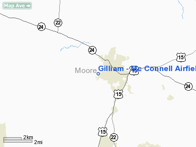
Gilliam - Mc Connell Airfield Airport |
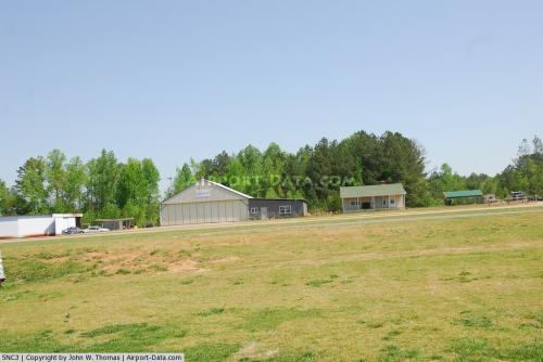 |
(Click on the photo to enlarge) |
Location & QuickFacts
| FAA Information Effective: | 2008-09-25 |
| Airport Identifier: | 5NC3 |
| Airport Status: | Operational |
| Longitude/Latitude: | 079-26-13.0000W/35-20-30.0000N
-79.436944/35.341667 (Estimated) |
| Elevation: | 445 ft / 135.64 m (Estimated) |
| Land: | 30 acres |
| From nearest city: | 1 nautical miles SW of Carthage, NC |
| Location: | Moore County, NC |
| Magnetic Variation: | 07W () |
Owner & Manager
| Ownership: | Privately owned |
| Owner: | S. Roland Gilliam |
| Address: | P.o. Box 339
Carthage, NC 28327 |
| Phone number: | 910-947-3636
DAY PHONE 910-695-5216. |
| Manager: | S. Roland Gilliam |
| Address: | 194 Gilliam-mc Connell Road
Carthage, NC 28327 |
| Phone number: | 910-947-3599 |
Airport Operations and Facilities
| Airport Use: | Private |
| Wind indicator: | Yes |
| Segmented Circle: | No |
| Control Tower: | No |
| Sectional chart: | Charlotte |
| Region: | ASO - Southern |
| Boundary ARTCC: | ZDC - Washington |
| Tie-in FSS: | RDU - Raleigh |
| FSS Toll Free: | 1-800-WX-BRIEF |
Airport Services
Runway Information
Runway 13/31
| Dimension: | 2538 x 36 ft / 773.6 x 11.0 m |
| Surface: | ASPH, Good Condition |
| |
Runway 13 |
Runway 31 |
| Traffic Pattern: | Right | Left |
| Markings: | Numbers only, Good Condition | Numbers only, Good Condition |
| Displaced threshold: | 0.00 ft | 300.00 ft
RY 31 DSPLCD THLD MKD WITH 4 FT WIDE WHITE STRIPE. |
| Obstruction: | | 13 ft pline, 40.0 ft from runway |
|
Radio Navigation Aids
| ID |
Type |
Name |
Ch |
Freq |
Var |
Dist |
| EEJ | NDB | Lee County/dcmsnd | | 428.00 | 07W | 10.7 nm |
| TT | NDB | Leeco | | 406.00 | 08W | 17.3 nm |
| HFF | NDB | Mackall | | 278.00 | 06W | 19.0 nm |
| POB | NDB | Pope | | 338.00 | 07W | 24.7 nm |
| TOX | NDB | Siler City | | 371.00 | 07W | 25.3 nm |
| CQJ | NDB | City Lake | | 266.00 | 08W | 30.8 nm |
| RCZ | NDB | Roscoe | | 375.00 | 07W | 32.0 nm |
| VU | NDB | Aller | | 346.00 | 06W | 32.7 nm |
| FGP | NDB | Fort Bragg | | 393.00 | 07W | 33.0 nm |
| ME | NDB | Maxtn | | 257.00 | 08W | 36.5 nm |
| AFP | NDB | Anson County | | 283.00 | 07W | 37.0 nm |
| HQT | NDB | Harnett | | 417.00 | 08W | 37.7 nm |
| HB | NDB | Himun | | 361.00 | 08W | 38.9 nm |
| CQW | NDB | Cheraw | | 409.00 | 05W | 41.8 nm |
| BES | NDB | Bennettsville | | 230.00 | 07W | 45.8 nm |
| RSY | NDB | Robeson | | 359.00 | 08W | 47.5 nm |
| LE | NDB | Leevy | | 350.00 | 07W | 49.6 nm |
| SEN | NDB | Swearing/dcmsnd | | 260.00 | 06W | 49.7 nm |
| POB | TACAN | Pope | 085X | | 07W | 23.1 nm |
| LBT | VOR | Lumberton | | 110.00 | 08W | 47.8 nm |
| FAY | VOR/DME | Fayetteville | 025X | 108.80 | 04W | 34.9 nm |
| SDZ | VORTAC | Sandhills | 055X | 111.80 | 03W | 10.6 nm |
| LIB | VORTAC | Liberty | 077X | 113.00 | 03W | 29.5 nm |
| RDU | VORTAC | Raleigh/durham | 119X | 117.20 | 04W | 45.1 nm |
| GSO | VORTAC | Greensboro | 109X | 116.20 | 03W | 49.8 nm |
Remarks
- 75 FT TREES NORTH, SOUTH, EAST & WEST OF ARPT.
- ARPT MONITORS FREQ 122.9.
- PRVDD VFR, PVT USE.
Images and information placed above are from
http://www.airport-data.com/airport/5NC3/
We thank them for the data!
| General Info
|
| Country |
United States
|
| State |
NORTH CAROLINA
|
| FAA ID |
5NC3
|
| Latitude |
35-20-30.000N
|
| Longitude |
079-26-13.000W
|
| Elevation |
445 feet
|
| Near City |
CARTHAGE
|
We don't guarantee the information is fresh and accurate. The data may
be wrong or outdated.
For more up-to-date information please refer to other sources.
|
|


