 |
|
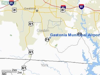
| Gastonia Municipal Airport |
| IATA: none – ICAO: KAKH – FAA LID: AKH |
| Summary |
| Airport type |
Public |
| Operator |
City of Gastonia |
| Location |
Gastonia, North Carolina |
| Elevation AMSL |
798 ft / 243.2 m |
| Coordinates |
35°12′10″N 81°9′0″W / 35.20278°N 81.15°W / 35.20278; -81.15Coordinates: 35°12′10″N 81°9′0″W / 35.20278°N 81.15°W / 35.20278; -81.15 |
| Runways |
| Direction |
Length |
Surface |
| ft |
m |
| 3/21 |
3,770 |
1,149 |
Asphalt |
Gastonia Municipal Airport (ICAO: KAKH, FAA LID: AKH) is a public airport located four miles (6 km) south of the central business district (CBD) of Gastonia, a city in Gaston County, North Carolina, USA. This general aviation airport covers 280 acres (113 ha) and has one runway.
The above content comes from Wikipedia and is published under free licenses – click here to read more.
Location & QuickFacts
| FAA Information Effective: | 2008-09-25 |
| Airport Identifier: | AKH |
| Airport Status: | Operational |
| Longitude/Latitude: | 081-08-59.6000W/35-12-09.5000N
-81.149889/35.202639 (Estimated) |
| Elevation: | 798 ft / 243.23 m (Surveyed) |
| Land: | 280 acres |
| From nearest city: | 4 nautical miles S of Gastonia, NC |
| Location: | Gaston County, NC |
| Magnetic Variation: | 06W (2000) |
Owner & Manager
| Ownership: | Publicly owned |
| Owner: | City Of Gastonia |
| Address: | Po Box 1748
Gastonia, NC 28053 |
| Phone number: | 704-866-6992 |
| Manager: | Richard Duffie |
| Address: | 1126 Gaston Day School Road
Gastonia, NC 28056 |
| Phone number: | 704-864-4363 |
Airport Operations and Facilities
| Airport Use: | Open to public |
| Wind indicator: | Yes |
| Segmented Circle: | Yes |
| Control Tower: | No |
| Lighting Schedule: | DUSK-DAWN
ACTVT MIRL RY 03/21 AND ODALS RY 03, PAPI RYS 03 AND 21 . - CTAF. |
| Beacon Color: | Clear-Green (lighted land airport) |
| Landing fee charge: | No |
| Sectional chart: | Charlotte |
| Region: | ASO - Southern |
| Boundary ARTCC: | ZTL - Atlanta |
| Tie-in FSS: | RDU - Raleigh |
| FSS on Airport: | No |
| FSS Toll Free: | 1-800-WX-BRIEF |
| NOTAMs Facility: | AKH (NOTAM-d service avaliable) |
| Federal Agreements: | NY1 |
Airport Communications
| CTAF: | 123.000 |
| Unicom: | 123.000 |
Airport Services
| Fuel available: | 100LLA1+ |
| Airframe Repair: | MINOR |
| Power Plant Repair: | MINOR |
| Bottled Oxygen: | NONE |
| Bulk Oxygen: | NONE |
Runway Information
Runway 03/21
| Dimension: | 3770 x 100 ft / 1149.1 x 30.5 m |
| Surface: | ASPH, Good Condition |
| Weight Limit: | Single wheel: 24000 lbs. |
| Edge Lights: | Medium |
| |
Runway 03 |
Runway 21 |
| Longitude: | 081-09-10.3310W | 081-08-48.7720W |
| Latitude: | 35-11-53.0382N | 35-12-25.8539N |
| Elevation: | 796.00 ft | 780.00 ft |
| Alignment: | 28 | 127 |
| Traffic Pattern: | Left | Left |
| Markings: | Non-precision instrument, Good Condition | Non-precision instrument, Good Condition |
| Crossing Height: | 26.00 ft | 31.00 ft |
| Displaced threshold: | 0.00 ft | 90.00 ft |
| VASI: | 2-light PAPI on right side | 2-light PAPI on left side |
| Visual Glide Angle: | 3.00° | 3.00° |
| Approach lights: | ODALS | |
| Centerline Lights: | No | No |
| Touchdown Lights: | No | No |
| Obstruction: | 67 ft trees, 662.0 ft from runway, 305 ft right of centerline, 6:1 slope to clear | 11 ft trees, 333.0 ft from runway, 51 ft left of centerline, 13:1 slope to clear
RWY 21 APCH SLOPE 46:1 TO DSPLCD THLD. |
|
Radio Navigation Aids
| ID |
Type |
Name |
Ch |
Freq |
Var |
Dist |
| MRN | FAN MARKER | Lenoir | | | 03W | 42.6 nm |
| GHJ | NDB | Stonia | | 260.00 | 06W | 0.8 nm |
| UZ | NDB | Rally | | 227.00 | 05W | 19.1 nm |
| IZN | NDB | Lincolnton | | 432.00 | 06W | 20.4 nm |
| SLP | NDB | First River | | 417.00 | 06W | 22.2 nm |
| DCM | NDB | Chester | | 220.00 | 06W | 25.1 nm |
| TWL | NDB | Wesley | | 204.00 | 06W | 26.5 nm |
| LKR | NDB | Lancaster | | 400.00 | 07W | 32.2 nm |
| VW | NDB | Temky | | 280.00 | 05W | 34.6 nm |
| HK | NDB | Tawba | | 332.00 | 06W | 35.9 nm |
| UOT | NDB | Union County | | 326.00 | 04W | 39.5 nm |
| FIQ | NDB | Fiddlers | | 391.00 | 07W | 39.8 nm |
| RFE | NDB | Rutherford | | 344.00 | 05W | 40.4 nm |
| FRT | NDB | Fairmont | | 248.00 | 05W | 44.9 nm |
| RU | NDB | Rovdy | | 275.00 | 06W | 45.4 nm |
| PYG | NDB | Pageland | | 270.00 | 06W | 48.5 nm |
| CLT | VOR/DME | Charlotte | 097X | 115.00 | 05W | 9.8 nm |
| BZM | VOR/DME | Barretts Mountain | 045X | 110.80 | 06W | 40.3 nm |
| FML | VORTAC | Fort Mill | 071X | 112.40 | 02W | 16.0 nm |
| SPA | VORTAC | Spartanburg | 104X | 115.70 | 02W | 39.5 nm |
| CLT | VOT | Charlotte | | 112.00 | | 10.4 nm |
| HKY | VOT | Hickory Regional | | 110.00 | | 34.4 nm |
Remarks
- PARALLEL TWY UNLGTD.
- RY 03 HAS 25 FT PLINE 400 FT FROM THR L & R OF CNTRLN.
- RY 21 HAS 50 FT DROP-OFF 100 FT FROM THR L&R OF CNTRLN.
- NOISE ABATEMENT: FROM 2200-0600 PILOTS ARE REQUESTED TO USE RY 21 AS CALM WIND RY & DO RUNUPS ON RAMP; NOT RY END. TO AVOID LOW ALT TURNS TO THE WEST REQ CLNC THRU CLASS B ASP FROM CHARLOTTE APCH.
- DEER ON & INVOF ARPT.
Images and information placed above are from
http://www.airport-data.com/airport/AKH/
We thank them for the data!
| General Info
|
| Country |
United States
|
| State |
NORTH CAROLINA
|
| FAA ID |
AKH
|
| Latitude |
35-12-09.574N
|
| Longitude |
081-08-59.523W
|
| Elevation |
797 feet
|
| Near City |
GASTONIA
|
We don't guarantee the information is fresh and accurate. The data may
be wrong or outdated.
For more up-to-date information please refer to other sources.
|
|


