|
|
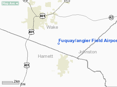
Fuquay/angier Field Airport |
 |
(Click on the photo to enlarge) |
Location & QuickFacts
| FAA Information Effective: | 2008-09-25 |
| Airport Identifier: | 78NC |
| Airport Status: | Operational |
| Longitude/Latitude: | 078-44-51.0480W/35-32-39.5720N
-78.747513/35.544326 (Estimated) |
| Elevation: | 349 ft / 106.38 m (Surveyed) |
| Land: | 25 acres |
| From nearest city: | 3 nautical miles SE of Fuquay/varina, NC |
| Location: | Wake County, NC |
| Magnetic Variation: | 07W (1985) |
Owner & Manager
| Ownership: | Privately owned |
| Owner: | Kennebec Flying Club |
| Address: | 8312 Maude Stewart Road
Fuquay Varina, NC 27526-7856 |
| Phone number: | 919-639-0806 |
| Manager: | L. Wayne Poole
PRES, KENNEBEC FLYING CLUB. |
| Address: | 910 N. West St
Raleigh, NC 27603-1139 |
| Phone number: | 919-828-1485 |
Airport Operations and Facilities
| Airport Use: | Private |
| Wind indicator: | Yes |
| Segmented Circle: | No |
| Control Tower: | No |
| Lighting Schedule: | RDO-CTL
ACTVT LIRL RY 14/32 & ROTG BCN - 122.800. |
| Beacon Color: | Clear-Green (lighted land airport) |
| Landing fee charge: | No |
| Sectional chart: | Charlotte |
| Region: | ASO - Southern |
| Boundary ARTCC: | ZDC - Washington |
| Tie-in FSS: | RDU - Raleigh |
| FSS on Airport: | No |
| FSS Toll Free: | 1-800-WX-BRIEF |
Airport Communications
| Unicom: | 122.800
UNICOM OPERS ONLY DURG HOURS OF ATTENDANCE. |
Airport Services
| Fuel available: | 100LL |
| Airframe Repair: | NONE |
| Power Plant Repair: | NONE |
| Bottled Oxygen: | NONE |
| Bulk Oxygen: | NONE |
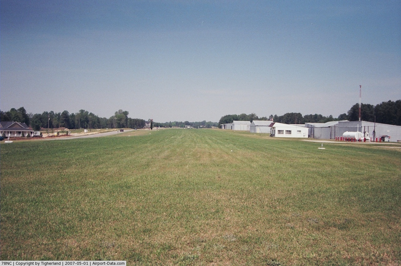
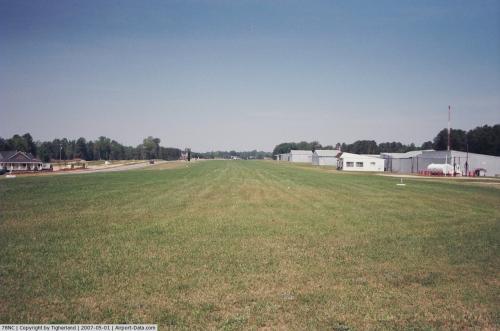
Runway Information
Runway 14/32
| Dimension: | 2780 x 90 ft / 847.3 x 27.4 m |
| Surface: | TURF, Good Condition |
| Edge Lights: | Low
NON-STD RWY LGTS; NO LGTS SE 800' RIGHT SIDE; THRS MARKED BY PAIR RED LGTS. |
| |
Runway 14 |
Runway 32 |
| Traffic Pattern: | Left | Left |
| Markings: | None, | None, |
| Obstruction: | 15 ft road, 100 ft right of centerline
SECONDARY OBSTRUCTION ARE TREES; APCH RATIO FROM TREES IS 8:1. | 15 ft road, 0.0 ft from runway
SECONDARY OBSTRUCTION ARE TREES; APCH RATIO FROM TREES IS 6:1. |
|
Radio Navigation Aids
| ID |
Type |
Name |
Ch |
Freq |
Var |
Dist |
| HQT | NDB | Harnett | | 417.00 | 08W | 7.6 nm |
| JN | NDB | Jurly | | 263.00 | 09W | 16.3 nm |
| TT | NDB | Leeco | | 406.00 | 08W | 19.4 nm |
| EUU | NDB | Jnall | | 251.00 | 07W | 19.6 nm |
| POB | NDB | Pope | | 338.00 | 07W | 21.6 nm |
| LE | NDB | Leevy | | 350.00 | 07W | 23.0 nm |
| FGP | NDB | Fort Bragg | | 393.00 | 07W | 24.6 nm |
| EEJ | NDB | Lee County/dcmsnd | | 428.00 | 07W | 25.5 nm |
| TOX | NDB | Siler City | | 371.00 | 07W | 37.3 nm |
| CTZ | NDB | Clinton | | 412.00 | 08W | 39.1 nm |
| RW | NDB | Jambe | | 235.00 | 09W | 40.5 nm |
| JYN | NDB | Wayne | | 208.00 | 08W | 41.5 nm |
| HUR | NDB | Person | | 220.00 | 08W | 44.2 nm |
| HXO | NDB | Huntsboro | | 271.00 | 07W | 45.9 nm |
| HFF | NDB | Mackall | | 278.00 | 06W | 47.7 nm |
| HB | NDB | Himun | | 361.00 | 08W | 48.5 nm |
| DKA | NDB | Kenan | | 332.00 | 07W | 49.6 nm |
| POB | TACAN | Pope | 085X | | 07W | 26.7 nm |
| GSB | TACAN | Seymour Johnson | 112X | | 08W | 40.0 nm |
| FAY | VOR/DME | Fayetteville | 025X | 108.80 | 04W | 34.2 nm |
| RDU | VORTAC | Raleigh/durham | 119X | 117.20 | 04W | 19.8 nm |
| LIB | VORTAC | Liberty | 077X | 113.00 | 03W | 45.2 nm |
| SDZ | VORTAC | Sandhills | 055X | 111.80 | 03W | 45.7 nm |
Remarks
- SLIGHT DOGLEG TO LEFT WHEN LNDG RWY 14-900' PAST THR.
- FLIGHT TRAINING AND COMMERICAL OPERATIONS WITH PRIOR APPROVAL ONLY.
Images and information placed above are from
http://www.airport-data.com/airport/78NC/
We thank them for the data!
| General Info
|
| Country |
United States
|
| State |
NORTH CAROLINA
|
| FAA ID |
78NC
|
| Latitude |
35-32-39.572N
|
| Longitude |
078-44-51.048W
|
| Elevation |
349 feet
|
| Near City |
FUQUAY/VARINA
|
We don't guarantee the information is fresh and accurate. The data may
be wrong or outdated.
For more up-to-date information please refer to other sources.
|
|