|
|
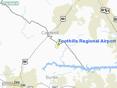
| Foothills Regional Airport |
 |
| IATA: MRN – ICAO: KMRN – FAA LID: MRN |
| Summary |
| Airport type |
Public |
| Owner |
Foothills Regional Airport Authority |
| Serves |
Morganton, North Carolina |
| Elevation AMSL |
1,270 ft / 387 m |
| Coordinates |
35°49′13″N 081°36′41″W / 35.82028°N 81.61139°W / 35.82028; -81.61139 (Foothills Regional Airport) |
| Runways |
| Direction |
Length |
Surface |
| ft |
m |
| 3/21 |
5,500 |
1,676 |
Asphalt |
| Statistics (2005) |
| Aircraft operations |
17,000 |
| Source: Federal Aviation Administration |
Foothills Regional Airport (formerly Morganton-Lenior Airport) (IATA: MRN, ICAO: KMRN, FAA LID: MRN) is a public airport located six miles northeast of the City of Morganton, NC. It is owned by the Foothills Regional Airport Authority.
Facilities and Aircraft
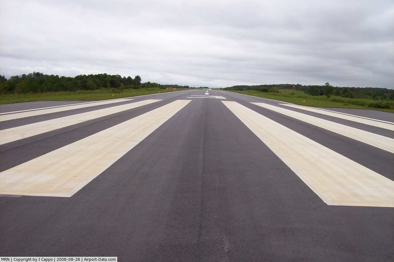
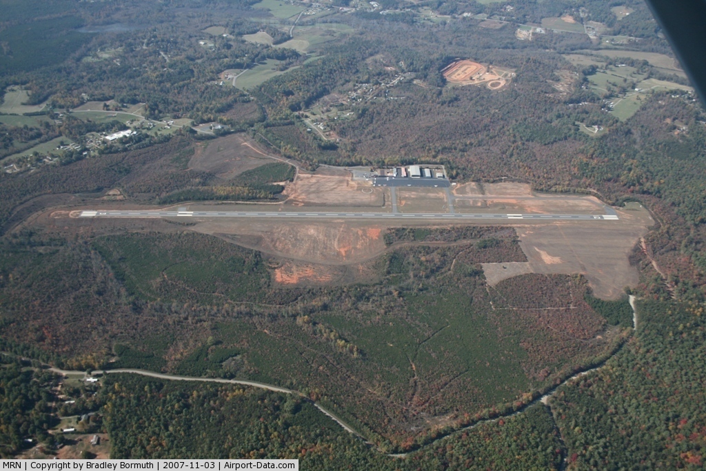
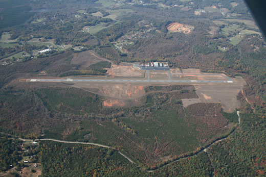
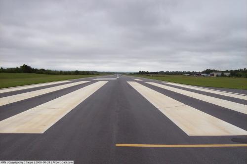
The Foothills Regional Airport covers an area of 1,170 acres (473 ha) which contains one grooved asphalt paved runway: 3/21 measuring 5,500 ft × 75 ft (1,676 m × 23 m). For the 12-month period ending August 31, 2005, the airport had 17,000 aircraft operations, an average of 46 per day: 97% general aviation and 3% military. There are 73 aircraft based on the field.
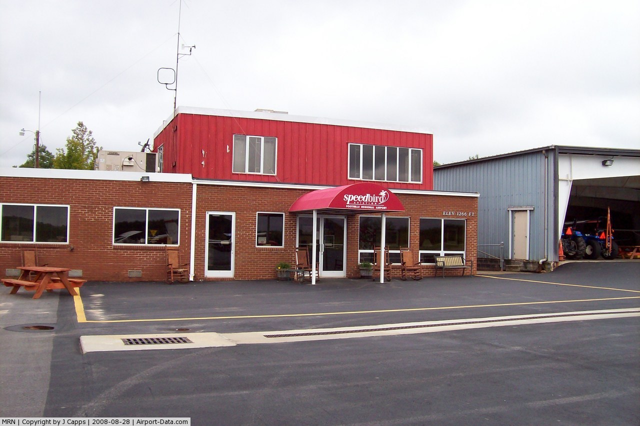
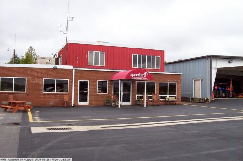
FBO Operations
Speedbird Aviation Services was the airports full service FBO until it closed on September 30, 2008 due to strained relations with the Foothills Regional Airport Authority. The Foothills Regional Airport Authority now runs the FBO directly but flight training is no longer available. Since the closure of Speedbird, traffic at the airport has significantly decreased.
The above content comes from Wikipedia and is published under free licenses – click here to read more.
 |
(Click on the photo to enlarge) |
 |
(Click on the photo to enlarge) |
 |
(Click on the photo to enlarge) |
 |
(Click on the photo to enlarge) |
Location & QuickFacts
| FAA Information Effective: | 2008-09-25 |
| Airport Identifier: | MRN |
| Airport Status: | Operational |
| Longitude/Latitude: | 081-36-41.0830W/35-49-12.8410N
-81.611412/35.820234 (Estimated) |
| Elevation: | 1270 ft / 387.10 m (Surveyed) |
| Land: | 1170 acres |
| From nearest city: | 6 nautical miles NE of Morganton, NC |
| Location: | Caldwell County, NC |
| Magnetic Variation: | 07W (2005) |
Owner & Manager
| Ownership: | Publicly owned |
| Owner: | Foothills Regional Airport Authorit |
| Address: | Po Box 3448
Morganton, NC 28680 |
| Phone number: | 828-437-2766 |
| Manager: | Truby Proctor |
| Address: | 3566 Morganton Lenoir Arpt
Morganton, NC 28656 |
| Phone number: | 828-757-0099 |
Airport Operations and Facilities
| Airport Use: | Open to public |
| Wind indicator: | Yes |
| Segmented Circle: | Yes |
| Control Tower: | No |
| Lighting Schedule: | DUSK-DAWN
ACTVT MIRL RY 03/21, REIL RY 03 & PAPI RYS 03 & 21 - CTAF. |
| Beacon Color: | Clear-Green (lighted land airport) |
| Landing fee charge: | No |
| Sectional chart: | Atlanta |
| Region: | ASO - Southern |
| Boundary ARTCC: | ZTL - Atlanta |
| Tie-in FSS: | RDU - Raleigh |
| FSS on Airport: | No |
| FSS Toll Free: | 1-800-WX-BRIEF |
| NOTAMs Facility: | MRN (NOTAM-d service avaliable) |
| Federal Agreements: | NGY |
Airport Communications
| CTAF: | 122.700 |
| Unicom: | 122.700 |
Airport Services
| Fuel available: | 100LLA1+
AFTER HOURS FUEL OR SERVICE CALL 828-757-0099 |
| Airframe Repair: | MAJOR |
| Power Plant Repair: | MAJOR |
| Bottled Oxygen: | LOW |
| Bulk Oxygen: | HIGH |
Runway Information
Runway 03/21
| Dimension: | 5500 x 75 ft / 1676.4 x 22.9 m |
| Surface: | ASPH, Good Condition |
| Weight Limit: | Dual wheel: 60000 lbs. |
| Edge Lights: | Medium |
| |
Runway 03 |
Runway 21 |
| Longitude: | 081-36-54.4580W | 081-36-27.7080W |
| Latitude: | 35-48-47.9220N | 35-49-37.7600N |
| Elevation: | 1248.00 ft | 1268.00 ft |
| Alignment: | 24 | 127 |
| ILS Type: | LOCALIZER
| |
| Traffic Pattern: | Left | Left |
| Markings: | Non-precision instrument, Good Condition | Non-precision instrument, Good Condition |
| Crossing Height: | 66.00 ft | 50.00 ft |
| VASI: | 4-light PAPI on left side | 4-light PAPI on right side |
| Visual Glide Angle: | 3.00° | 3.50° |
| Runway End Identifier: | Yes | No |
| Centerline Lights: | No | No |
| Touchdown Lights: | No | No |
| Obstruction: | , 50:1 slope to clear | 92 ft trees, 1376.0 ft from runway, 270 ft left of centerline, 12:1 slope to clear |
|
Radio Navigation Aids
| ID |
Type |
Name |
Ch |
Freq |
Var |
Dist |
| MRN | FAN MARKER | Lenoir | | | 03W | 1.6 nm |
| FIQ | NDB | Fiddlers | | 391.00 | 07W | 7.2 nm |
| HK | NDB | Tawba | | 332.00 | 06W | 15.0 nm |
| BAR | NDB | Hemlock | | 320.00 | 02W | 23.9 nm |
| VW | NDB | Temky | | 280.00 | 05W | 26.8 nm |
| UKF | NDB | Wilki | | 209.00 | 06W | 30.5 nm |
| IZN | NDB | Lincolnton | | 432.00 | 06W | 30.7 nm |
| RFE | NDB | Rutherford | | 344.00 | 05W | 32.9 nm |
| SLP | NDB | First River | | 417.00 | 06W | 34.1 nm |
| JJO | NDB | Mountain City | | 396.00 | 04W | 37.3 nm |
| JU | NDB | Ashee | | 410.00 | 07W | 39.5 nm |
| EZT | NDB | Elizabethton | | 275.00 | 02W | 43.7 nm |
| GHJ | NDB | Stonia | | 260.00 | 06W | 43.9 nm |
| BZM | VOR/DME | Barretts Mountain | 045X | 110.80 | 06W | 18.3 nm |
| CLT | VOR/DME | Charlotte | 097X | 115.00 | 05W | 49.8 nm |
| SUG | VORTAC | Sugarloaf Mountain | 059X | 112.20 | 02W | 40.6 nm |
| HMV | VORTAC | Holston Mountain | 093X | 114.60 | 04W | 44.8 nm |
| SPA | VORTAC | Spartanburg | 104X | 115.70 | 02W | 49.7 nm |
| HKY | VOT | Hickory Regional | | 110.00 | | 11.8 nm |
| CLT | VOT | Charlotte | | 112.00 | | 49.1 nm |
Remarks
- MILITARY CONTRACT FUEL AVBL.
Images and information placed above are from
http://www.airport-data.com/airport/MRN/
We thank them for the data!
| General Info
|
| Country |
United States
|
| State |
NORTH CAROLINA
|
| FAA ID |
MRN
|
| Latitude |
35-49-17.372N
|
| Longitude |
081-36-38.651W
|
| Elevation |
1270 feet
|
| Near City |
MORGANTON
|
We don't guarantee the information is fresh and accurate. The data may
be wrong or outdated.
For more up-to-date information please refer to other sources.
|
|