|
|
 |
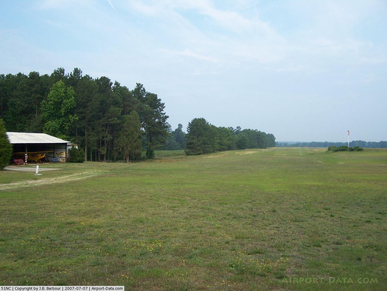
(Click on the photo to enlarge) |
Location & QuickFacts
| FAA Information Effective: | 2008-09-25 |
| Airport Identifier: | 51NC |
| Airport Status: | Operational |
| Longitude/Latitude: | 078-20-55.0000W/35-51-43.0000N
-78.348611/35.861944 (Estimated) |
| Elevation: | 355 ft / 108.20 m (Estimated) |
| Land: | 0 acres |
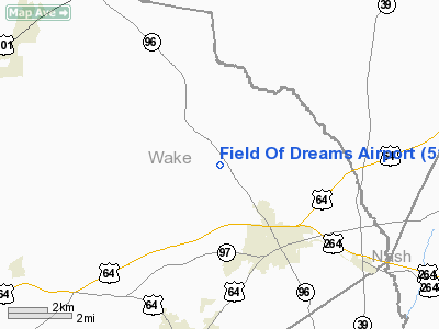
| From nearest city: | 2 nautical miles NW of Zebulon, NC |
| Location: | Wake County, NC |
| Magnetic Variation: | 08W (1995) |
Owner & Manager
| Ownership: | Privately owned |
| Owner: | Ramona Bunn |
| Address: | 2701 Old Zebulon Road
Zebulon, NC 27597 |
| Phone number: | 919-269-7349 |
| Manager: | Charles M. Barnes |
| Address: | 724 West Gannon Avenue
Zebulon, NC 27597 |
| Phone number: | 919-365-0349
AMGR ADDL PHONE 919-269-5506 OR PAGER 919-269-1311. |
Airport Operations and Facilities
| Airport Use: | Private |
| Segmented Circle: | No |
| Control Tower: | No |
| Sectional chart: | Charlotte |
| Region: | ASO - Southern |
| Boundary ARTCC: | ZDC - Washington |
| Tie-in FSS: | RDU - Raleigh |
| FSS Toll Free: | 1-800-WX-BRIEF |
Runway Information
Runway 10/28
| Dimension: | 2300 x 100 ft / 701.0 x 30.5 m |
| Surface: | TURF, |
| |
Runway 10 |
Runway 28 |
| Traffic Pattern: | Left | Left |
| Obstruction: | | 50 ft trees, 300.0 ft from runway |
|
Radio Navigation Aids
| ID |
Type |
Name |
Ch |
Freq |
Var |
Dist |
| PGV | FAN MARKER | Belvoir | | | 06W | 49.0 nm |
| EUU | NDB | Jnall | | 251.00 | 07W | 15.3 nm |
| LE | NDB | Leevy | | 350.00 | 07W | 18.6 nm |
| RW | NDB | Jambe | | 235.00 | 09W | 19.6 nm |
| JN | NDB | Jurly | | 263.00 | 09W | 23.6 nm |
| HXO | NDB | Huntsboro | | 271.00 | 07W | 29.4 nm |
| JYN | NDB | Wayne | | 208.00 | 08W | 29.8 nm |
| HQT | NDB | Harnett | | 417.00 | 08W | 30.3 nm |
| ETC | NDB | Tarboro | | 257.00 | 08W | 39.3 nm |
| HUR | NDB | Person | | 220.00 | 08W | 41.4 nm |
| TT | NDB | Leeco | | 406.00 | 08W | 44.4 nm |
| RZZ | NDB | Rapids | | 407.00 | 08W | 46.7 nm |
| AEA | NDB | Jones | | 373.00 | 09W | 47.4 nm |
| POB | NDB | Pope | | 338.00 | 07W | 48.3 nm |
| AQE | NDB | Alwood | | 230.00 | 09W | 48.5 nm |
| FGP | NDB | Fort Bragg | | 393.00 | 07W | 49.0 nm |
| GSB | TACAN | Seymour Johnson | 112X | | 08W | 36.6 nm |
| RDU | VORTAC | Raleigh/durham | 119X | 117.20 | 04W | 21.2 nm |
| TYI | VORTAC | Tar River | 125X | 117.80 | 05W | 32.1 nm |
| ISO | VORTAC | Kinston | 033X | 109.60 | 05W | 48.6 nm |
Remarks
Images and information placed above are from
http://www.airport-data.com/airport/51NC/
We thank them for the data!
| General Info
|
| Country |
United States
|
| State |
NORTH CAROLINA
|
| FAA ID |
51NC
|
| Latitude |
35-51-43.000N
|
| Longitude |
078-20-55.000W
|
| Elevation |
355 feet
|
| Near City |
ZEBULON
|
We don't guarantee the information is fresh and accurate. The data may
be wrong or outdated.
For more up-to-date information please refer to other sources.
|
|