 |
|
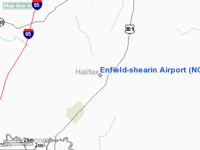
Location & QuickFacts
| FAA Information Effective: | 2008-09-25 |
| Airport Identifier: | NC45 |
| Airport Status: | Operational |
| Longitude/Latitude: | 077-38-15.0000W/36-13-02.0000N
-77.637500/36.217222 (Estimated) |
| Elevation: | 125 ft / 38.10 m (Estimated) |
| Land: | 375 acres |
| From nearest city: | 3 nautical miles NE of Enfield, NC |
| Location: | Halifax County, NC |
| Magnetic Variation: | 09W (1995) |
Owner & Manager
| Ownership: | Privately owned |
| Owner: | Marvin Shearin Ii |
| Address: | 105 Whitfield St
Enfield, NC 27823-1339 |
| Phone number: | 252-445-2406 |
| Manager: | Marvin Shearin Ii |
| Address: | 105 Whitfield St
Enfield, NC 27823-1339 |
| Phone number: | 252-445-2406 |
Airport Operations and Facilities
| Airport Use: | Private |
| Wind indicator: | Yes |
| Segmented Circle: | No |
| Control Tower: | No |
| Lighting Schedule: | RDO-CTL
ACTVT LIRL RY 03/21 - 122.8. |
| Sectional chart: | Washington |
| Region: | ASO - Southern |
| Boundary ARTCC: | ZDC - Washington |
| Tie-in FSS: | RDU - Raleigh |
| FSS on Airport: | No |
| FSS Toll Free: | 1-800-WX-BRIEF |
Airport Services
Runway Information
Runway 03/21
| Dimension: | 3200 x 75 ft / 975.4 x 22.9 m |
| Surface: | TURF, |
| Edge Lights: | Low |
| |
Runway 03 |
Runway 21 |
| Traffic Pattern: | Left | Left |
|
Radio Navigation Aids
| ID |
Type |
Name |
Ch |
Freq |
Var |
Dist |
| PGV | FAN MARKER | Belvoir | | | 06W | 36.8 nm |
| RZZ | NDB | Rapids | | 407.00 | 08W | 13.9 nm |
| ETC | NDB | Tarboro | | 257.00 | 08W | 17.5 nm |
| ASJ | NDB | Ahoskie | | 415.00 | 10W | 22.9 nm |
| ELQ | NDB | Emporia | | 261.00 | 10W | 26.2 nm |
| MCZ | NDB | Williamston | | 336.00 | 09W | 31.0 nm |
| AEA | NDB | Jones | | 373.00 | 09W | 31.2 nm |
| RW | NDB | Jambe | | 235.00 | 09W | 31.4 nm |
| AQE | NDB | Alwood | | 230.00 | 09W | 33.3 nm |
| MBV | NDB | Mecklenburg/dcmsnd | | 356.00 | 08W | 35.0 nm |
| JYN | NDB | Wayne | | 208.00 | 08W | 43.5 nm |
| HXO | NDB | Huntsboro | | 271.00 | 07W | 47.8 nm |
| PMZ | NDB | Plymouth | | 221.00 | 10W | 49.1 nm |
| RNW | NDB | Chocowinity | | 388.00 | 07W | 49.8 nm |
| TYI | VORTAC | Tar River | 125X | 117.80 | 05W | 14.8 nm |
| CVI | VORTAC | Cofield | 093X | 114.60 | 09W | 38.3 nm |
| LVL | VORTAC | Lawrenceville | 076X | 112.90 | 08W | 38.3 nm |
| FKN | VORTAC | Franklin | 043X | 110.60 | 09W | 42.5 nm |
Remarks
Images and information placed above are from
http://www.airport-data.com/airport/NC45/
We thank them for the data!
| General Info
|
| Country |
United States
|
| State |
NORTH CAROLINA
|
| FAA ID |
NC45
|
| Latitude |
36-13-02.000N
|
| Longitude |
077-38-15.000W
|
| Elevation |
125 feet
|
| Near City |
ENFIELD
|
We don't guarantee the information is fresh and accurate. The data may
be wrong or outdated.
For more up-to-date information please refer to other sources.
|
|


