 |
|
Location & QuickFacts
| FAA Information Effective: | 2008-09-25 |
| Airport Identifier: | NC06 |
| Airport Status: | Operational |
| Longitude/Latitude: | 081-53-48.4090W/36-09-37.4520N
-81.896780/36.160403 (Estimated) |
| Elevation: | 3468 ft / 1057.05 m (Estimated) |
| Land: | 10 acres |
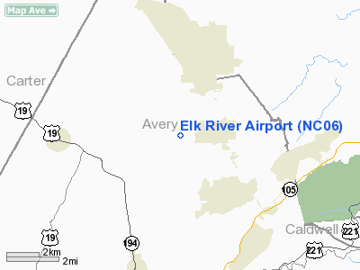
| From nearest city: | 2 nautical miles W of Banner Elk, NC |
| Location: | Avery County, NC |
| Magnetic Variation: | 05W (1985) |
Owner & Manager
| Ownership: | Privately owned |
| Owner: | Elk River Prop Owners Assoc. |
| Address: | Po Box 2200
Banner Elk, NC 28604-2200 |
| Phone number: | 828-898-9791 |
| Manager: | Scott Heath |
| Address: | 643 Banner Elk Hwy
Banner Elk, NC 28604 |
| Phone number: | 828-898-9791 |
Airport Operations and Facilities
| Airport Use: | Private |
| Wind indicator: | Yes |
| Segmented Circle: | No |
| Control Tower: | No |
| Landing fee charge: | No |
| Sectional chart: | Cincinnati |
| Region: | ASO - Southern |
| Boundary ARTCC: | ZTL - Atlanta |
| Tie-in FSS: | RDU - Raleigh |
| FSS on Airport: | No |
| FSS Toll Free: | 1-800-WX-BRIEF |
Airport Communications
Airport Services
| Airframe Repair: | NONE |
| Power Plant Repair: | NONE |
| Bottled Oxygen: | NONE |
| Bulk Oxygen: | NONE |
Runway Information
Runway 12/30
| Dimension: | 4600 x 75 ft / 1402.1 x 22.9 m |
| Surface: | ASPH, |
| |
Runway 12 |
Runway 30 |
| Traffic Pattern: | Left | Left |
| Markings: | Basic, Poor Condition | Basic, Poor Condition |
| Runway End Identifier: | No | No |
| Centerline Lights: | No | No |
| Touchdown Lights: | No | No |
| Obstruction: | 375 ft mtn, 3000.0 ft from runway, 8:1 slope to clear | 700 ft trees mtn, 3500.0 ft from runway, 5:1 slope to clear |
|
Radio Navigation Aids
| ID |
Type |
Name |
Ch |
Freq |
Var |
Dist |
| MRN | FAN MARKER | Lenoir | | | 03W | 25.6 nm |
| BAR | NDB | Hemlock | | 320.00 | 02W | 0.9 nm |
| JJO | NDB | Mountain City | | 396.00 | 04W | 15.8 nm |
| EZT | NDB | Elizabethton | | 275.00 | 02W | 20.4 nm |
| FIQ | NDB | Fiddlers | | 391.00 | 07W | 29.2 nm |
| JU | NDB | Ashee | | 410.00 | 07W | 32.3 nm |
| BO | NDB | Booie | | 221.00 | 04W | 32.4 nm |
| VJ | NDB | Whine | | 236.00 | 05W | 34.6 nm |
| HK | NDB | Tawba | | 332.00 | 06W | 36.5 nm |
| UKF | NDB | Wilki | | 209.00 | 06W | 38.9 nm |
| VW | NDB | Temky | | 280.00 | 05W | 46.6 nm |
| DYQ | NDB | Dulaney | | 263.00 | 04W | 48.2 nm |
| RFE | NDB | Rutherford | | 344.00 | 05W | 48.8 nm |
| BZM | VOR/DME | Barretts Mountain | 045X | 110.80 | 06W | 36.4 nm |
| GZG | VOR/DME | Glade Spring | 039X | 110.20 | 02W | 40.9 nm |
| HMV | VORTAC | Holston Mountain | 093X | 114.60 | 04W | 20.1 nm |
| SUG | VORTAC | Sugarloaf Mountain | 059X | 112.20 | 02W | 48.8 nm |
| HKY | VOT | Hickory Regional | | 110.00 | | 35.2 nm |
Remarks
- PVMNT COND: GOOD.
- APCHS NON STD. 1ST 500' RWY 30 ON 5% GRADE; USE RWY 12 WIND COND PERMITTING.
- ARPT IS EXTENDED PORTION OF PRIVATE RECREATIONAL DEVELOPMENT COMPLEX.
- TUNNEL UNDERPASS EXTENDS FROM EXISTING ACFT PKG APRON ON N SIDE UNDERNEATH RWY 12/30 TO S SIDE GIVING ACESS TO GOLF COURSE.
- 23,000 SQ FT HGR AREA.
- VFR ONLY.
Images and information placed above are from
http://www.airport-data.com/airport/NC06/
We thank them for the data!
| General Info
|
| Country |
United States
|
| State |
NORTH CAROLINA
|
| FAA ID |
NC06
|
| Latitude |
36-09-37.452N
|
| Longitude |
081-53-48.409W
|
| Elevation |
3468 feet
|
| Near City |
BANNER ELK
|
We don't guarantee the information is fresh and accurate. The data may
be wrong or outdated.
For more up-to-date information please refer to other sources.
|
|


