 |
|
Coordinates: 39°56′03.4″N 074°48′26.1″W / 39.934278°N 74.80725°W / 39.934278; -74.80725
| Flying W Airport |
| IATA: none – ICAO: none – FAA LID: N14 |
| Summary |
| Airport type |
Public use |
| Owner |
Cave Holdings - Flying W, LLC |
| Operator |
Mindy Redner |
| Serves |
Lumberton Township, New Jersey |
| Location |
Burlington County, New Jersey |
| Elevation AMSL |
49 ft / 15 m |
| Runways |
| Direction |
Length |
Surface |
| ft |
m |
| 1/19 |
3,496 |
1,066 |
Asphalt |
| Statistics (2008) |
| Aircraft operations |
34.989 |
| Based aircraft |
122 |
| Source: Federal Aviation Administration |
Flying W Airport (FAA LID: N14) is a public-use airport located one nautical miles (1.852 km) southwest of the central business district of Lumberton Township in Burlington County, New Jersey, United States. The airport is privately owned.. The street address is 66 Fostertown Road, Medford, NJ 08055.
The above content comes from Wikipedia and is published under free licenses – click here to read more.
Location & QuickFacts
| FAA Information Effective: | 2008-09-25 |
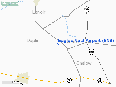
| Airport Identifier: | 6N9 |
| Airport Status: | Operational |
| Longitude/Latitude: | 077-41-54.0000W/34-58-55.5890N
-77.698333/34.982108 (Estimated) |
| Elevation: | 115 ft / 35.05 m (Estimated) |
| Land: | 8 acres |
| From nearest city: | 0 nautical miles SW of Potters Hill, NC |
| Location: | Duplin County, NC |
| Magnetic Variation: | 08W (1984) |
Owner & Manager
| Ownership: | Privately owned |
| Owner: | Elton Williams |
| Address: | 1553 Nc 41 North
Pink Hill, NC 28572 |
| Phone number: | 910-298-3567 |
| Manager: | Elton Williams |
| Address: | 1553 Nc 41 North
Pink Hill, NC 28572 |
| Phone number: | 910-298-3567 |
Airport Operations and Facilities
| Airport Use: | Open to public |
| Wind indicator: | Yes |
| Segmented Circle: | No |
| Control Tower: | No |
| Landing fee charge: | No |
| Sectional chart: | Charlotte |
| Region: | ASO - Southern |
| Boundary ARTCC: | ZDC - Washington |
| Tie-in FSS: | RDU - Raleigh |
| FSS on Airport: | No |
| FSS Toll Free: | 1-800-WX-BRIEF |
| NOTAMs Facility: | RDU (NOTAM-d service avaliable) |
Airport Communications
Airport Services
| Airframe Repair: | NONE |
| Power Plant Repair: | NONE |
Runway Information
Runway 13/31
| Dimension: | 1850 x 75 ft / 563.9 x 22.9 m |
| Surface: | TURF, Good Condition |
| |
Runway 13 |
Runway 31 |
| Traffic Pattern: | Left | Left |
| Obstruction: | 75 ft trees, 650.0 ft from runway, 120 ft left of centerline, 8:1 slope to clear | 15 ft road, 89.0 ft from runway, 5:1 slope to clear |
|
Radio Navigation Aids
| ID |
Type |
Name |
Ch |
Freq |
Var |
Dist |
| PGV | FAN MARKER | Belvoir | | | 06W | 42.5 nm |
| DKA | NDB | Kenan | | 332.00 | 07W | 12.1 nm |
| NCA | NDB | New River | | 356.00 | 08W | 20.5 nm |
| ACZ | NDB | Pendy | | 379.00 | 09W | 22.0 nm |
| CTZ | NDB | Clinton | | 412.00 | 08W | 32.7 nm |
| JYN | NDB | Wayne | | 208.00 | 08W | 34.2 nm |
| RNW | NDB | Chocowinity | | 388.00 | 07W | 43.0 nm |
| JN | NDB | Jurly | | 263.00 | 09W | 46.4 nm |
| AQE | NDB | Alwood | | 230.00 | 09W | 46.4 nm |
| TGQ | NDB | Elizabethtown | | 398.00 | 08W | 48.7 nm |
| RW | NDB | Jambe | | 235.00 | 09W | 49.0 nm |
| EUU | NDB | Jnall | | 251.00 | 07W | 49.5 nm |
| DIW | NDB/DME | Dixon | 107X | 198.00 | 08W | 27.7 nm |
| NCA | TACAN | New River | 101X | | 08W | 20.9 nm |
| GSB | TACAN | Seymour Johnson | 112X | | 08W | 25.1 nm |
| NJM | TACAN | Bogue Mcalf | 067X | | 08W | 37.5 nm |
| NKT | TACAN | Cherry Point | 075X | | 09W | 40.9 nm |
| EWN | VOR/DME | New Bern | 083X | 113.60 | 08W | 32.6 nm |
| ISO | VORTAC | Kinston | 033X | 109.60 | 05W | 24.4 nm |
| ILM | VORTAC | Wilmington | 117X | 117.00 | 07W | 38.9 nm |
Remarks
- +4' FENCE 35' FM CNTRLN NORTH SIDE OF RY.
- RY 13/31 HAS SURFACE VARIATIONS.
- VFR OPERATIONS ONLY.
Images and information placed above are from
http://www.airport-data.com/airport/6N9/
We thank them for the data!
| General Info
|
| Country |
United States
|
| State |
NORTH CAROLINA
|
| FAA ID |
6N9
|
| Latitude |
34-58-55.589N
|
| Longitude |
077-41-54.000W
|
| Elevation |
115 feet
|
| Near City |
POTTERS HILL
|
We don't guarantee the information is fresh and accurate. The data may
be wrong or outdated.
For more up-to-date information please refer to other sources.
|
|


