 |
|
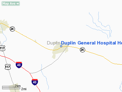
Duplin General Hospital Heliport |
Location & QuickFacts
| FAA Information Effective: | 2008-09-25 |
| Airport Identifier: | 23NC |
| Airport Status: | Operational |
| Longitude/Latitude: | 077-57-42.0000W/34-57-53.0000N
-77.961667/34.964722 (Estimated) |
| Elevation: | 126 ft / 38.40 m (Estimated) |
| Land: | 0 acres |
| From nearest city: | 0 nautical miles N of Kenansville, NC |
| Location: | Duplin County, NC |
| Magnetic Variation: | 08W (1990) |
Owner & Manager
| Ownership: | Publicly owned |
| Owner: | Duplin General Hospital |
| Address: | 401 N Main Street
Kenansville, NC 28349 |
| Phone number: | 910-296-0941 |
| Manager: | Richard E Harrell |
| Address: | 401 N Main Street
Kenansville, NC 28349 |
| Phone number: | 910-296-0267 |
Airport Operations and Facilities
| Airport Use: | Private
MEDICAL. |
| Wind indicator: | Yes |
| Segmented Circle: | No |
| Control Tower: | No |
| Lighting Schedule: | PHONE REQ
FOR ROTG BCN & PERIMETER LGTS CALL 910-296-0267. |
| Beacon Color: | Clear-Green-Yellow (heliport) |
| Sectional chart: | Charlotte |
| Region: | ASO - Southern |
| Boundary ARTCC: | ZDC - Washington |
| Tie-in FSS: | RDU - Raleigh |
| FSS on Airport: | No |
| FSS Toll Free: | 1-800-WX-BRIEF |
Runway Information
Helipad H1
| Dimension: | 40 x 40 ft / 12.2 x 12.2 m |
| Surface: | CONC, |
| |
Runway H1 |
Runway |
| Traffic Pattern: | Left | Left |
|
Radio Navigation Aids
| ID |
Type |
Name |
Ch |
Freq |
Var |
Dist |
| PGV | FAN MARKER | Belvoir | | | 06W | 49.5 nm |
| DKA | NDB | Kenan | | 332.00 | 07W | 6.8 nm |
| ACZ | NDB | Pendy | | 379.00 | 09W | 15.1 nm |
| CTZ | NDB | Clinton | | 412.00 | 08W | 19.8 nm |
| NCA | NDB | New River | | 356.00 | 08W | 30.0 nm |
| JYN | NDB | Wayne | | 208.00 | 08W | 33.9 nm |
| TGQ | NDB | Elizabethtown | | 398.00 | 08W | 37.9 nm |
| JN | NDB | Jurly | | 263.00 | 09W | 38.2 nm |
| EUU | NDB | Jnall | | 251.00 | 07W | 43.1 nm |
| FGP | NDB | Fort Bragg | | 393.00 | 07W | 43.2 nm |
| HQT | NDB | Harnett | | 417.00 | 08W | 44.9 nm |
| RW | NDB | Jambe | | 235.00 | 09W | 48.3 nm |
| DIW | NDB/DME | Dixon | 107X | 198.00 | 08W | 34.6 nm |
| GSB | TACAN | Seymour Johnson | 112X | | 08W | 22.3 nm |
| NCA | TACAN | New River | 101X | | 08W | 30.0 nm |
| NJM | TACAN | Bogue Mcalf | 067X | | 08W | 49.0 nm |
| FAY | VOR/DME | Fayetteville | 025X | 108.80 | 04W | 45.0 nm |
| EWN | VOR/DME | New Bern | 083X | 113.60 | 08W | 45.6 nm |
| ISO | VORTAC | Kinston | 033X | 109.60 | 05W | 31.4 nm |
| ILM | VORTAC | Wilmington | 117X | 117.00 | 07W | 37.1 nm |
Remarks
- PRVDD PVT USE; ALL APCH/DEP ARE FM 253 DEGS TO 265 DEGS & FM 345 DEGS TO 358 DEGS; AREA APPROPRIATELY MARKED; AND A WIND INDICATOR MAINTAINED.
Images and information placed above are from
http://www.airport-data.com/airport/23NC/
We thank them for the data!
| General Info
|
| Country |
United States
|
| State |
NORTH CAROLINA
|
| FAA ID |
23NC
|
| Latitude |
34-57-53.000N
|
| Longitude |
077-57-42.000W
|
| Elevation |
126 feet
|
| Near City |
KENANSVILLE
|
We don't guarantee the information is fresh and accurate. The data may
be wrong or outdated.
For more up-to-date information please refer to other sources.
|
|


