 |
|
 |
(Click on the photo to enlarge) |
Location & QuickFacts
| FAA Information Effective: | 2008-09-25 |
| Airport Identifier: | 76NC |
| Airport Status: | Operational |
| Longitude/Latitude: | 077-37-28.9070W/36-09-35.5530N
-77.624696/36.159876 (Estimated) |
| Elevation: | 100 ft / 30.48 m (Estimated) |
| Land: | 7 acres |
| From nearest city: | 3 nautical miles SE of Enfield, NC |
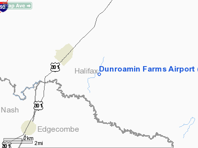
| Location: | Halifax County, NC |
| Magnetic Variation: | 08W (1985) |
Owner & Manager
| Ownership: | Privately owned |
| Owner: | Walter F. Clement |
| Address: | Po Box 421
Enfield, NC 27823-0421 |
| Phone number: | 252-445-5602 |
| Manager: | Walter F. Clement |
| Address: | 3201 Thirteen Bridges Road
Enfield, NC 27823-9010 |
| Phone number: | 252-308-7696 |
Airport Operations and Facilities
| Airport Use: | Private |
| Wind indicator: | Yes |
| Segmented Circle: | No |
| Control Tower: | No |
| Landing fee charge: | No |
| Sectional chart: | Washington |
| Region: | ASO - Southern |
| Boundary ARTCC: | ZDC - Washington |
| Tie-in FSS: | RDU - Raleigh |
| FSS on Airport: | No |
| FSS Toll Free: | 1-800-WX-BRIEF |
Airport Services
| Airframe Repair: | NONE |
| Power Plant Repair: | NONE |
Runway Information
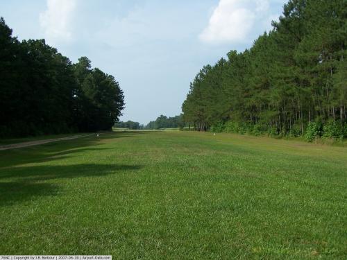
Runway 03/21
| Dimension: | 3000 x 70 ft / 914.4 x 21.3 m |
| Surface: | TURF, |
| |
Runway 03 |
Runway 21 |
| Traffic Pattern: | Left | Left |
| Obstruction: | 50 ft trees, 100.0 ft from runway | 45 ft trees, 100.0 ft from runway |
|
Radio Navigation Aids
| ID |
Type |
Name |
Ch |
Freq |
Var |
Dist |
| PGV | FAN MARKER | Belvoir | | | 06W | 33.4 nm |
| ETC | NDB | Tarboro | | 257.00 | 08W | 14.0 nm |
| RZZ | NDB | Rapids | | 407.00 | 08W | 17.4 nm |
| ASJ | NDB | Ahoskie | | 415.00 | 10W | 23.3 nm |
| MCZ | NDB | Williamston | | 336.00 | 09W | 28.3 nm |
| RW | NDB | Jambe | | 235.00 | 09W | 28.8 nm |
| ELQ | NDB | Emporia | | 261.00 | 10W | 29.2 nm |
| AQE | NDB | Alwood | | 230.00 | 09W | 29.9 nm |
| AEA | NDB | Jones | | 373.00 | 09W | 34.3 nm |
| MBV | NDB | Mecklenburg/dcmsnd | | 356.00 | 08W | 38.2 nm |
| JYN | NDB | Wayne | | 208.00 | 08W | 40.4 nm |
| RNW | NDB | Chocowinity | | 388.00 | 07W | 46.5 nm |
| PMZ | NDB | Plymouth | | 221.00 | 10W | 46.9 nm |
| EUU | NDB | Jnall | | 251.00 | 07W | 48.7 nm |
| HXO | NDB | Huntsboro | | 271.00 | 07W | 48.9 nm |
| TYI | VORTAC | Tar River | 125X | 117.80 | 05W | 11.7 nm |
| CVI | VORTAC | Cofield | 093X | 114.60 | 09W | 38.7 nm |
| LVL | VORTAC | Lawrenceville | 076X | 112.90 | 08W | 41.8 nm |
| FKN | VORTAC | Franklin | 043X | 110.60 | 09W | 44.6 nm |
| ISO | VORTAC | Kinston | 033X | 109.60 | 05W | 47.5 nm |
Remarks
- FOUR STORAGE BINS WEST SIDE OF RWY. BLDGS ADJACENT TO RWY (SHOP ROOF ORANGE CHECK PAINTED). RWY LCTD BETWEEN PAVED ROADS.
- VFR USE ONLY.
Images and information placed above are from
http://www.airport-data.com/airport/76NC/
We thank them for the data!
| General Info
|
| Country |
United States
|
| State |
NORTH CAROLINA
|
| FAA ID |
76NC
|
| Latitude |
36-09-35.553N
|
| Longitude |
077-37-28.907W
|
| Elevation |
100 feet
|
| Near City |
ENFIELD
|
We don't guarantee the information is fresh and accurate. The data may
be wrong or outdated.
For more up-to-date information please refer to other sources.
|
|


