|
|
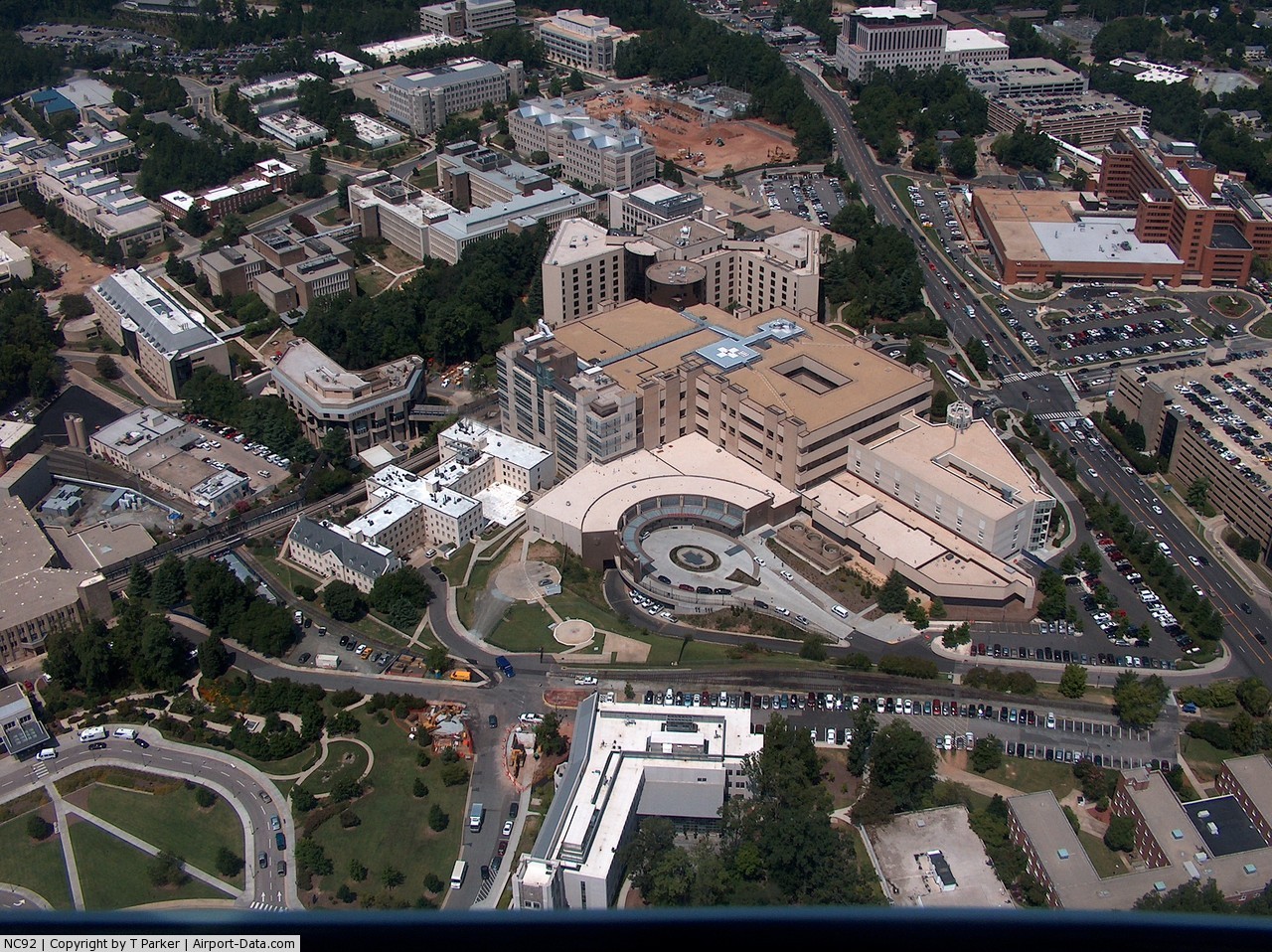
Duke University North Heliport |

 |
(Click on the photo to enlarge) |
Location & QuickFacts
| FAA Information Effective: | 2008-09-25 |
| Airport Identifier: | NC92 |
| Airport Status: | Operational |
| Longitude/Latitude: | 078-56-19.0310W/36-00-23.5150N
-78.938620/36.006532 (Estimated) |
| Elevation: | 395 ft / 120.40 m (Estimated) |
| Land: | 0 acres |
| From nearest city: | 2 nautical miles NW of Durham, NC |
| Location: | Durham County, NC |
| Magnetic Variation: | 07W (1985) |
Owner & Manager
| Ownership: | Privately owned |
| Owner: | Duke Univ Medical Center |
| Address: | Po Box 3520
Durham, NC 27710 |
| Phone number: | 919-681-5433 |
| Manager: | Jeff Doucette |
| Address: | Po Box 3520
Durham, NC 27710 |
| Phone number: | 919-681-4506 |
Airport Operations and Facilities
| Airport Use: | Private
MEDICAL |
| Wind indicator: | Yes |
| Segmented Circle: | No |
| Control Tower: | No |
| Lighting Schedule: | DUSK-DAWN |
| Beacon Color: | Clear-Green-Yellow (heliport) |
| Sectional chart: | Charlotte |
| Region: | ASO - Southern |
| Boundary ARTCC: | ZDC - Washington |
| Tie-in FSS: | RDU - Raleigh |
| FSS Toll Free: | 1-800-WX-BRIEF |
Airport Communications
Runway Information
Helipad H1
| Dimension: | 60 x 60 ft / 18.3 x 18.3 m |
| Surface: | CONC, |
| |
Runway H1 |
Runway |
| Traffic Pattern: | Left | Left |
|
Radio Navigation Aids
| ID |
Type |
Name |
Ch |
Freq |
Var |
Dist |
| LE | NDB | Leevy | | 350.00 | 07W | 11.6 nm |
| HUR | NDB | Person | | 220.00 | 08W | 15.0 nm |
| HXO | NDB | Huntsboro | | 271.00 | 07W | 23.5 nm |
| TOX | NDB | Siler City | | 371.00 | 07W | 29.4 nm |
| HB | NDB | Himun | | 361.00 | 08W | 31.5 nm |
| TT | NDB | Leeco | | 406.00 | 08W | 32.1 nm |
| HQT | NDB | Harnett | | 417.00 | 08W | 36.8 nm |
| EUU | NDB | Jnall | | 251.00 | 07W | 37.3 nm |
| EEJ | NDB | Lee County/dcmsnd | | 428.00 | 07W | 40.5 nm |
| JN | NDB | Jurly | | 263.00 | 09W | 40.6 nm |
| SIF | NDB | Slammer | | 423.00 | 07W | 45.9 nm |
| POB | NDB | Pope | | 338.00 | 07W | 46.9 nm |
| CQJ | NDB | City Lake | | 266.00 | 08W | 48.4 nm |
| RW | NDB | Jambe | | 235.00 | 09W | 49.6 nm |
| DAN | VOR | Danville | | 113.10 | 06W | 38.9 nm |
| RDU | VORTAC | Raleigh/durham | 119X | 117.20 | 04W | 11.0 nm |
| LIB | VORTAC | Liberty | 077X | 113.00 | 03W | 34.8 nm |
| SBV | VORTAC | South Boston | 041X | 110.40 | 05W | 40.3 nm |
Remarks
- PRVDD VFR/PVT USE; AND USE OF HELIPORT COORDINATED WITH RALEIGH GADO.
Images and information placed above are from
http://www.airport-data.com/airport/NC92/
We thank them for the data!
| General Info
|
| Country |
United States
|
| State |
NORTH CAROLINA
|
| FAA ID |
NC92
|
| Latitude |
36-00-23.515N
|
| Longitude |
078-56-19.031W
|
| Elevation |
395 feet
|
| Near City |
DURHAM
|
We don't guarantee the information is fresh and accurate. The data may
be wrong or outdated.
For more up-to-date information please refer to other sources.
|
|