 |
|
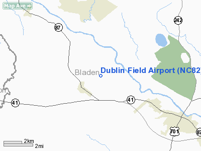
Location & QuickFacts
| FAA Information Effective: | 2008-09-25 |
| Airport Identifier: | NC82 |
| Airport Status: | Operational |
| Longitude/Latitude: | 078-42-09.0600W/34-40-10.6100N
-78.702517/34.669614 (Estimated) |
| Elevation: | 126 ft / 38.40 m (Estimated) |
| Land: | 0 acres |
| From nearest city: | 1 nautical miles NE of Dublin, NC |
| Location: | Bladen County, NC |
| Magnetic Variation: | 07W (1985) |
Owner & Manager
| Ownership: | Privately owned |
| Owner: | Taylor Wilkes Helo Service Inc |
| Address: | 1065 Rice Pond Road
Elizabethtown, NC 28337 |
| Phone number: | 910-862-4165 |
| Manager: | Oren M. Taylor |
| Address: | 1065 Rice Pond Road
Elizabethtown, NC 28337 |
| Phone number: | 910-862-4165 |
Airport Operations and Facilities
| Airport Use: | Private |
| Wind indicator: | Yes |
| Segmented Circle: | No |
| Control Tower: | No |
| Landing fee charge: | No |
| Sectional chart: | Charlotte |
| Region: | ASO - Southern |
| Boundary ARTCC: | ZDC - Washington |
| Tie-in FSS: | RDU - Raleigh |
| FSS on Airport: | No |
| FSS Toll Free: | 1-800-WX-BRIEF |
Runway Information
Runway 03/21
| Dimension: | 2186 x 66 ft / 666.3 x 20.1 m |
| Surface: | TURF, |
| |
Runway 03 |
Runway 21 |
| Traffic Pattern: | Left | Left |
|
Radio Navigation Aids
| ID |
Type |
Name |
Ch |
Freq |
Var |
Dist |
| TGQ | NDB | Elizabethtown | | 398.00 | 08W | 12.5 nm |
| RSY | NDB | Robeson | | 359.00 | 08W | 18.0 nm |
| JB | NDB | Jigel | | 384.00 | 08W | 22.8 nm |
| CPC | NDB | Camp | | 227.00 | 07W | 23.9 nm |
| CTZ | NDB | Clinton | | 412.00 | 08W | 24.9 nm |
| FGP | NDB | Fort Bragg | | 393.00 | 07W | 28.7 nm |
| ACZ | NDB | Pendy | | 379.00 | 09W | 34.7 nm |
| DLC | NDB | Dillon | | 274.00 | 05W | 35.5 nm |
| POB | NDB | Pope | | 338.00 | 07W | 35.7 nm |
| ME | NDB | Maxtn | | 257.00 | 08W | 36.9 nm |
| MAO | NDB | Marion | | 388.00 | 06W | 42.7 nm |
| HFF | NDB | Mackall | | 278.00 | 06W | 44.2 nm |
| DKA | NDB | Kenan | | 332.00 | 07W | 45.6 nm |
| HQT | NDB | Harnett | | 417.00 | 08W | 45.9 nm |
| EEJ | NDB | Lee County/dcmsnd | | 428.00 | 07W | 49.4 nm |
| CLB | NDB | Carolina Beach | | 216.00 | 04W | 50.0 nm |
| POB | TACAN | Pope | 085X | | 07W | 33.4 nm |
| LBT | VOR | Lumberton | | 110.00 | 08W | 17.8 nm |
| FAY | VOR/DME | Fayetteville | 025X | 108.80 | 04W | 20.8 nm |
| ILM | VORTAC | Wilmington | 117X | 117.00 | 07W | 45.3 nm |
Remarks
- ALL OPERATIONS ARE CONDUCTED IN VFR WEATHER CONDITIONS; LANDING AREA IS LIMITED TO PRIVATE USE.
Images and information placed above are from
http://www.airport-data.com/airport/NC82/
We thank them for the data!
| General Info
|
| Country |
United States
|
| State |
NORTH CAROLINA
|
| FAA ID |
NC82
|
| Latitude |
34-40-10.610N
|
| Longitude |
078-42-09.060W
|
| Elevation |
126 feet
|
| Near City |
DUBLIN
|
We don't guarantee the information is fresh and accurate. The data may
be wrong or outdated.
For more up-to-date information please refer to other sources.
|
|


