 |
|
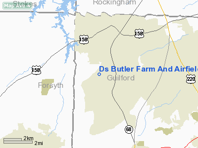
Ds Butler Farm And Airfield Airport |
Location & QuickFacts
| FAA Information Effective: | 2008-09-25 |
| Airport Identifier: | N83 |
| Airport Status: | Operational |
| Longitude/Latitude: | 080-00-19.1410W/36-11-42.4900N
-80.005317/36.195136 (Estimated) |
| Elevation: | 950 ft / 289.56 m (Surveyed) |
| Land: | 13 acres |
| From nearest city: | 2 nautical miles NW of Oak Ridge, NC |
| Location: | Guilford County, NC |
| Magnetic Variation: | 06W (1985) |
Owner & Manager
| Ownership: | Privately owned |
| Owner: | Steve Butler |
| Address: | 8429 West Harrell Rd
Oak Ridge, NC 27310-9828 |
| Phone number: | 336-643-8176 |
| Manager: | Steve Butler |
| Address: | 8429 West Harrell Rd
Oak Ridge, NC 27310-9828 |
| Phone number: | 336-215-1435
EMERGENCY PHONE: 336-362-0055. |
Airport Operations and Facilities
| Airport Use: | Open to public |
| Wind indicator: | No |
| Segmented Circle: | No |
| Control Tower: | No |
| Landing fee charge: | No |
| Sectional chart: | Cincinnati |
| Region: | ASO - Southern |
| Boundary ARTCC: | ZTL - Atlanta |
| Tie-in FSS: | RDU - Raleigh |
| FSS on Airport: | No |
| FSS Toll Free: | 1-800-WX-BRIEF |
| NOTAMs Facility: | RDU (NOTAM-d service avaliable) |
Airport Communications
Airport Services
| Bottled Oxygen: | NONE |
| Bulk Oxygen: | NONE |
Runway Information
Runway 01/19
| Dimension: | 2000 x 60 ft / 609.6 x 18.3 m |
| Surface: | TURF, Good Condition |
| |
Runway 01 |
Runway 19 |
| Traffic Pattern: | Left | Left |
| Obstruction: | 70 ft trees, 70 ft right of centerline | 45 ft trees, 0.0 ft from runway |
|
Radio Navigation Aids
| ID |
Type |
Name |
Ch |
Freq |
Var |
Dist |
| OQA | FAN MARKER | Rockingham County | | | | 16.3 nm |
| SIF | NDB | Slammer | | 423.00 | 07W | 16.2 nm |
| UV | NDB | Bales | | 396.00 | 07W | 24.1 nm |
| HB | NDB | Himun | | 361.00 | 08W | 24.2 nm |
| DVZ | NDB | Davie | | 354.00 | 06W | 27.7 nm |
| AZW | NDB | Mount Airy | | 223.00 | 07W | 28.2 nm |
| SEN | NDB | Swearing/dcmsnd | | 260.00 | 06W | 28.7 nm |
| CQJ | NDB | City Lake | | 266.00 | 08W | 29.6 nm |
| ZEF | NDB | Zephyr | | 326.00 | 05W | 35.5 nm |
| RU | NDB | Rovdy | | 275.00 | 06W | 36.4 nm |
| TOX | NDB | Siler City | | 371.00 | 07W | 37.1 nm |
| VU | NDB | Aller | | 346.00 | 06W | 42.6 nm |
| HUR | NDB | Person | | 220.00 | 08W | 45.6 nm |
| DAN | VOR | Danville | | 113.10 | 06W | 39.4 nm |
| GSO | VORTAC | Greensboro | 109X | 116.20 | 03W | 9.1 nm |
| LIB | VORTAC | Liberty | 077X | 113.00 | 03W | 29.9 nm |
Remarks
- DUE TO SLOPING RYS - TAKEOFFS RY 19 AND LANDINGS RY 01.
- RY 19 WIRE MARKERS ON PLINE 180' FROM THR; WIRE MARKERS +35' ABOVE THR; ROAD APRXLY 10' ABOVE THR.
- 70' TREES ALONG BOTH SIDES OF RWY 70' FROM CENTERLINE.
- HELICOPTER ACTIVITY .5 NM W OF RY 01/19 CNTRLN.
- VFR OPERATIONS ONLY. ESTABLISH COMPATIBLE OPERATIONS WITH GREENSBORO ATCT. NO IFR PROCEDURES TO BE ESTABLISHED.
Images and information placed above are from
http://www.airport-data.com/airport/N83/
We thank them for the data!
| General Info
|
| Country |
United States
|
| State |
NORTH CAROLINA
|
| FAA ID |
N83
|
| Latitude |
36-11-42.490N
|
| Longitude |
080-00-19.141W
|
| Elevation |
950 feet
|
| Near City |
OAK RIDGE
|
We don't guarantee the information is fresh and accurate. The data may
be wrong or outdated.
For more up-to-date information please refer to other sources.
|
|


