 |
|
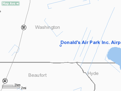
Donald's Air Park Inc. Airport |
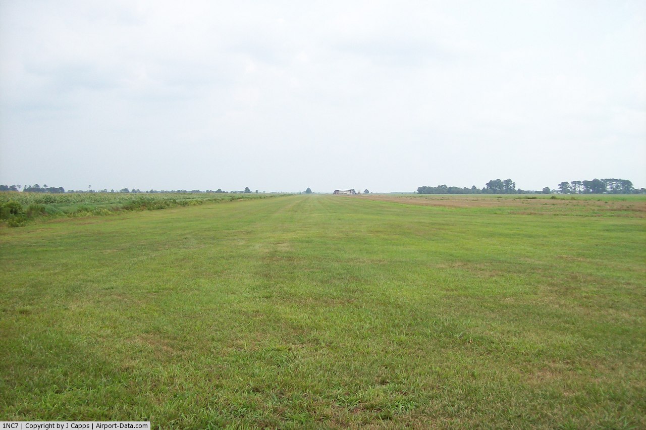 |
(Click on the photo to enlarge) |
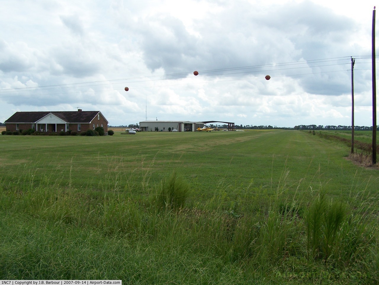 |
(Click on the photo to enlarge) |
Location & QuickFacts
| FAA Information Effective: | 2008-09-25 |
| Airport Identifier: | 1NC7 |
| Airport Status: | Operational |
| Longitude/Latitude: | 076-40-10.7810W/35-44-00.5870N
-76.669661/35.733496 (Estimated) |
| Elevation: | 18 ft / 5.49 m (Estimated) |
| Land: | 0 acres |
| From nearest city: | 8 nautical miles SE of Plymouth, NC |
| Location: | Washington County, NC |
| Magnetic Variation: | 09W (1985) |
Owner & Manager
| Ownership: | Privately owned |
| Owner: | Donald L. Stotesberry |
| Address: | 5230 Nc Hwy 99 South
Pantego, NC 27860-8916 |
| Phone number: | 252-935-5000 |
| Manager: | Donald L. Stotesberry |
| Address: | 5212 Nc Hwy 99 South
Pantego, NC 27860-8916 |
| Phone number: | 252-943-7568 |
Airport Operations and Facilities
| Airport Use: | Private |
| Wind indicator: | Yes |
| Segmented Circle: | No |
| Control Tower: | No |
| Landing fee charge: | No |
| Sectional chart: | Charlotte |
| Region: | ASO - Southern |
| Boundary ARTCC: | ZDC - Washington |
| Tie-in FSS: | RDU - Raleigh |
| FSS on Airport: | No |
| FSS Toll Free: | 1-800-WX-BRIEF |
Airport Services
| Fuel available: | 100LL |
| Airframe Repair: | MAJOR |
Runway Information
Runway 04/22
| Dimension: | 4000 x 100 ft / 1219.2 x 30.5 m |
| Surface: | TURF, |
| |
Runway 04 |
Runway 22 |
| Traffic Pattern: | Left | Left |
| Obstruction: | | 40 ft pline, 0.0 ft from runway |
|
Radio Navigation Aids
| ID |
Type |
Name |
Ch |
Freq |
Var |
Dist |
| PGV | FAN MARKER | Belvoir | | | 06W | 35.3 nm |
| PMZ | NDB | Plymouth | | 221.00 | 10W | 6.5 nm |
| EDE | NDB | Edenton | | 265.00 | 10W | 18.3 nm |
| RNW | NDB | Chocowinity | | 388.00 | 07W | 25.2 nm |
| MCZ | NDB | Williamston | | 336.00 | 09W | 25.9 nm |
| AQE | NDB | Alwood | | 230.00 | 09W | 34.3 nm |
| LLW | NDB | Woodville | | 254.00 | 10W | 36.6 nm |
| ASJ | NDB | Ahoskie | | 415.00 | 10W | 42.0 nm |
| ETC | NDB | Tarboro | | 257.00 | 08W | 44.4 nm |
| MQI | NDB | Manteo | | 370.00 | 09W | 48.7 nm |
| OUC | NDB/DME | Pamlico/dcmsnd | 034X | 404.00 | 09W | 49.9 nm |
| ECG | VOR/DME | Elizabeth City | 072X | 112.50 | 07W | 39.6 nm |
| EWN | VOR/DME | New Bern | 083X | 113.60 | 08W | 43.7 nm |
| RBX | VOR/DME | Wright Brothers | 053X | 111.60 | 08W | 48.7 nm |
| CVI | VORTAC | Cofield | 093X | 114.60 | 09W | 39.7 nm |
| ISO | VORTAC | Kinston | 033X | 109.60 | 05W | 48.6 nm |
Remarks
- HEAVY AGRICULTURAL ACFT OPERATIONS MARCH-NOVEMBER.
- A & P AVBL
- VFR; PRIVATE USE ONLY.
Images and information placed above are from
http://www.airport-data.com/airport/1NC7/
We thank them for the data!
| General Info
|
| Country |
United States
|
| State |
NORTH CAROLINA
|
| FAA ID |
1NC7
|
| Latitude |
35-44-00.587N
|
| Longitude |
076-40-10.781W
|
| Elevation |
18 feet
|
| Near City |
PLYMOUTH
|
We don't guarantee the information is fresh and accurate. The data may
be wrong or outdated.
For more up-to-date information please refer to other sources.
|
|


