 |
|
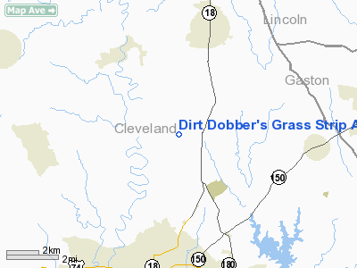
Dirt Dobber's Grass Strip Airport |
Location & QuickFacts
| FAA Information Effective: | 2008-09-25 |
| Airport Identifier: | NC97 |
| Airport Status: | Operational |
| Longitude/Latitude: | 081-31-21.0000W/35-22-08.0000N
-81.522500/35.368889 (Estimated) |
| Elevation: | 930 ft / 283.46 m (Estimated) |
| Land: | 33 acres |
| From nearest city: | 3 nautical miles N of Shelby, NC |
| Location: | Cleveland County, NC |
| Magnetic Variation: | () |
Owner & Manager
| Ownership: | Privately owned |
| Owner: | Randall Hendrick |
| Address: | 1168 W. Stagecoach Tr.
Lawndale, NC 28090 |
| Phone number: | 704-538-0095 |
| Manager: | Randall Hendrick |
| Address: | 1168 W. Stagecoach Tr.
Lawndale, NC 28090 |
| Phone number: | 704-538-0095 |
Airport Operations and Facilities
| Airport Use: | Private |
| Wind indicator: | Yes |
| Control Tower: | No |
| Sectional chart: | Charlotte |
| Region: | ASO - Southern |
| Boundary ARTCC: | ZTL - Atlanta |
| Tie-in FSS: | RDU - Raleigh |
| FSS Toll Free: | 1-800-WX-BRIEF |
Runway Information
Runway 08/26
| Dimension: | 1600 x 1000 ft / 487.7 x 304.8 m |
| Surface: | TURF, |
| |
Runway 08 |
Runway 26 |
| Traffic Pattern: | Left | Left |
| Obstruction: | 40 ft trees, 1100.0 ft from runway | 30 ft pline, 600.0 ft from runway |
|
Radio Navigation Aids
| ID |
Type |
Name |
Ch |
Freq |
Var |
Dist |
| MRN | FAN MARKER | Lenoir | | | 03W | 26.2 nm |
| SLP | NDB | First River | | 417.00 | 06W | 7.9 nm |
| GHJ | NDB | Stonia | | 260.00 | 06W | 20.9 nm |
| RFE | NDB | Rutherford | | 344.00 | 05W | 21.1 nm |
| FIQ | NDB | Fiddlers | | 391.00 | 07W | 21.8 nm |
| IZN | NDB | Lincolnton | | 432.00 | 06W | 23.6 nm |
| HK | NDB | Tawba | | 332.00 | 06W | 27.3 nm |
| VW | NDB | Temky | | 280.00 | 05W | 33.1 nm |
| UZ | NDB | Rally | | 227.00 | 05W | 36.1 nm |
| FRT | NDB | Fairmont | | 248.00 | 05W | 36.1 nm |
| DCM | NDB | Chester | | 220.00 | 06W | 38.4 nm |
| UOT | NDB | Union County | | 326.00 | 04W | 41.6 nm |
| BRA | NDB | Broad River | | 379.00 | 04W | 46.9 nm |
| TWL | NDB | Wesley | | 204.00 | 06W | 47.3 nm |
| UKF | NDB | Wilki | | 209.00 | 06W | 49.3 nm |
| CLT | VOR/DME | Charlotte | 097X | 115.00 | 05W | 30.0 nm |
| BZM | VOR/DME | Barretts Mountain | 045X | 110.80 | 06W | 33.1 nm |
| SPA | VORTAC | Spartanburg | 104X | 115.70 | 02W | 28.3 nm |
| FML | VORTAC | Fort Mill | 071X | 112.40 | 02W | 36.0 nm |
| SUG | VORTAC | Sugarloaf Mountain | 059X | 112.20 | 02W | 36.6 nm |
| HKY | VOT | Hickory Regional | | 110.00 | | 23.2 nm |
| CLT | VOT | Charlotte | | 112.00 | | 30.1 nm |
Remarks
- PRVDD VFR OPNS AND PVT USE.
Images and information placed above are from
http://www.airport-data.com/airport/NC97/
We thank them for the data!
|
|


