 |
|
| Davidson County Airport |
| IATA: none – ICAO: KEXX – FAA LID: EXX |
| Summary |
| Airport type |
Davidson County Airport Authority |
| Operator |
Lexington, North Carolina |
| Location |
733 |
| Elevation AMSL |
223.4 ft / m |
| Coordinates |
35°46′52″N 080°18′14″W / 35.78111°N 80.30389°W / 35.78111; -80.30389Coordinates: 35°46′52″N 080°18′14″W / 35.78111°N 80.30389°W / 35.78111; -80.30389 |
| Runways |
| Direction |
Length |
Surface |
| ft |
m |
| 6/24 |
5,000 |
1,524 |
Asphalt |
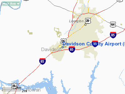
Davidson County Airport (ICAO: KEXX, FAA LID: EXX) is a public airport located three miles (5 km) southwest of the central business district (CBD) of Lexington, a city in Davidson County, North Carolina, USA. This general aviation airport covers 75 acres and has one runway.
The above content comes from Wikipedia and is published under free licenses – click here to read more.
Location & QuickFacts
| FAA Information Effective: | 2008-09-25 |
| Airport Identifier: | EXX |
| Airport Status: | Operational |
| Longitude/Latitude: | 080-18-13.6150W/35-46-52.1050N
-80.303782/35.781140 (Estimated) |
| Elevation: | 733 ft / 223.42 m (Estimated) |
| Land: | 75 acres |
| From nearest city: | 3 nautical miles SW of Lexington, NC |
| Location: | Davidson County, NC |
| Magnetic Variation: | 07W (2000) |
Owner & Manager
| Ownership: | Publicly owned |
| Owner: | Davidson County Arpt Auth |
| Address: | 1673 Aviation Way
Lexington, NC 27292 |
| Phone number: | 336-249-6856 |
| Manager: | Carolina Aero Service, Llc |
| Address: | 1673 Aviation Way
Lexington, NC 27292 |
| Phone number: | 336-956-7774 |
Airport Operations and Facilities
| Airport Use: | Open to public |
| Wind indicator: | Yes |
| Segmented Circle: | Yes |
| Control Tower: | No |
| Lighting Schedule: | DUSK-DAWN
AFTER 0000 ACTVT PAPI RYS 06 & 24 AND REIL RYS 06 & 24 - CTAF. |
| Beacon Color: | Clear-Green (lighted land airport) |
| Landing fee charge: | No |
| Sectional chart: | Charlotte |
| Region: | ASO - Southern |
| Boundary ARTCC: | ZTL - Atlanta |
| Tie-in FSS: | RDU - Raleigh |
| FSS on Airport: | No |
| FSS Toll Free: | 1-800-WX-BRIEF |
| NOTAMs Facility: | EXX (NOTAM-d service avaliable) |
| Federal Agreements: | N |
Airport Communications
| CTAF: | 122.800 |
| Unicom: | 122.800 |
Airport Services
| Fuel available: | 100LLA+ |
| Airframe Repair: | MAJOR |
| Power Plant Repair: | MAJOR |
| Bottled Oxygen: | NONE |
| Bulk Oxygen: | NONE |
Runway Information
Runway 06/24
| Dimension: | 5000 x 100 ft / 1524.0 x 30.5 m |
| Surface: | ASPH, Good Condition |
| Edge Lights: | Medium |
| |
Runway 06 |
Runway 24 |
| Longitude: | 080-18-37.0900W | 080-17-50.1400W |
| Latitude: | 35-46-36.4400N | 35-47-07.7700N |
| Elevation: | 733.00 ft | 702.00 ft |
| Alignment: | 51 | 127 |
| ILS Type: | ILS/DME
| |
| Traffic Pattern: | Left | Left |
| Markings: | Basic, Good Condition | Basic, Good Condition |
| Crossing Height: | 0.00 ft | 35.00 ft |
| VASI: | 2-light PAPI on left side | 2-light PAPI on left side |
| Visual Glide Angle: | 0.00° | 3.50° |
| Runway End Identifier: | Yes | Yes |
| Obstruction: | 27 ft tree, 1133.0 ft from runway, 123 ft left of centerline, 34:1 slope to clear | 38 ft trees, 1270.0 ft from runway, 336 ft right of centerline, 28:1 slope to clear |
|
Radio Navigation Aids
| ID |
Type |
Name |
Ch |
Freq |
Var |
Dist |
| OQA | FAN MARKER | Rockingham County | | | | 45.1 nm |
| SEN | NDB | Swearing/dcmsnd | | 260.00 | 06W | 0.3 nm |
| RU | NDB | Rovdy | | 275.00 | 06W | 9.5 nm |
| DVZ | NDB | Davie | | 354.00 | 06W | 10.9 nm |
| VU | NDB | Aller | | 346.00 | 06W | 20.7 nm |
| CQJ | NDB | City Lake | | 266.00 | 08W | 21.7 nm |
| HB | NDB | Himun | | 361.00 | 08W | 37.0 nm |
| VW | NDB | Temky | | 280.00 | 05W | 37.1 nm |
| AZW | NDB | Mount Airy | | 223.00 | 07W | 37.8 nm |
| ZEF | NDB | Zephyr | | 326.00 | 05W | 37.9 nm |
| IZN | NDB | Lincolnton | | 432.00 | 06W | 40.9 nm |
| TOX | NDB | Siler City | | 371.00 | 07W | 41.1 nm |
| UKF | NDB | Wilki | | 209.00 | 06W | 43.5 nm |
| SIF | NDB | Slammer | | 423.00 | 07W | 44.7 nm |
| AFP | NDB | Anson County | | 283.00 | 07W | 46.8 nm |
| HK | NDB | Tawba | | 332.00 | 06W | 48.9 nm |
| BZM | VOR/DME | Barretts Mountain | 045X | 110.80 | 06W | 46.0 nm |
| CLT | VOR/DME | Charlotte | 097X | 115.00 | 05W | 47.6 nm |
| GSO | VORTAC | Greensboro | 109X | 116.20 | 03W | 22.5 nm |
| LIB | VORTAC | Liberty | 077X | 113.00 | 03W | 33.7 nm |
| SDZ | VORTAC | Sandhills | 055X | 111.80 | 03W | 48.8 nm |
| CLT | VOT | Charlotte | | 112.00 | | 46.1 nm |
Remarks
- PAEW ADJ TO RY 06/24 INDEFLY.
- GCO AVBL ON FREQ 135.075 THRU GSO CD & FLT SVCS.
- MAX RAMP WT 30,000 LBS SINGLE WHEEL, 60,000 LBS DUAL WHEEL.
- FOLLOW TAXIWAY CNTRLN TO PARKING.
Images and information placed above are from
http://www.airport-data.com/airport/EXX/
We thank them for the data!
| General Info
|
| Country |
United States
|
| State |
NORTH CAROLINA
|
| FAA ID |
EXX
|
| Latitude |
35-46-52.105N
|
| Longitude |
080-18-13.615W
|
| Elevation |
733 feet
|
| Near City |
LEXINGTON
|
We don't guarantee the information is fresh and accurate. The data may
be wrong or outdated.
For more up-to-date information please refer to other sources.
|
|


