|
|
Craven County Rgnl Airport |
| Coastal Carolina Regional Airport |
| IATA: EWN – ICAO: KEWN – FAA LID: EWN |
| Summary |
| Airport type |
Craven County |
| Owner |
Craven County |
| Operator |
New Bern, North Carolina |
| Serves |
New Bern, Craven, Carteret, Jones, Pamlico Counties |
| Location |
18 |
| Elevation AMSL |
5.5 ft / m |
| Coordinates |
35°04′23″N 77°02′35″W / 35.07306°N 77.04306°W / 35.07306; -77.04306Coordinates: 35°04′23″N 77°02′35″W / 35.07306°N 77.04306°W / 35.07306; -77.04306 |
| Runways |
| Direction |
Length |
Surface |
| ft |
m |
| 4/22 |
6,004 |
1,830 |
Asphalt |
| 13/31 |
4,000 |
1,219 |
Asphalt |
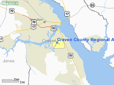
Coastal Carolina Regional Airport (IATA: EWN, ICAO: KEWN, FAA LID: EWN) is a public airport located three miles (5 km) southeast of central business district (CBD) of New Bern, a town in Craven County, North Carolina, USA.
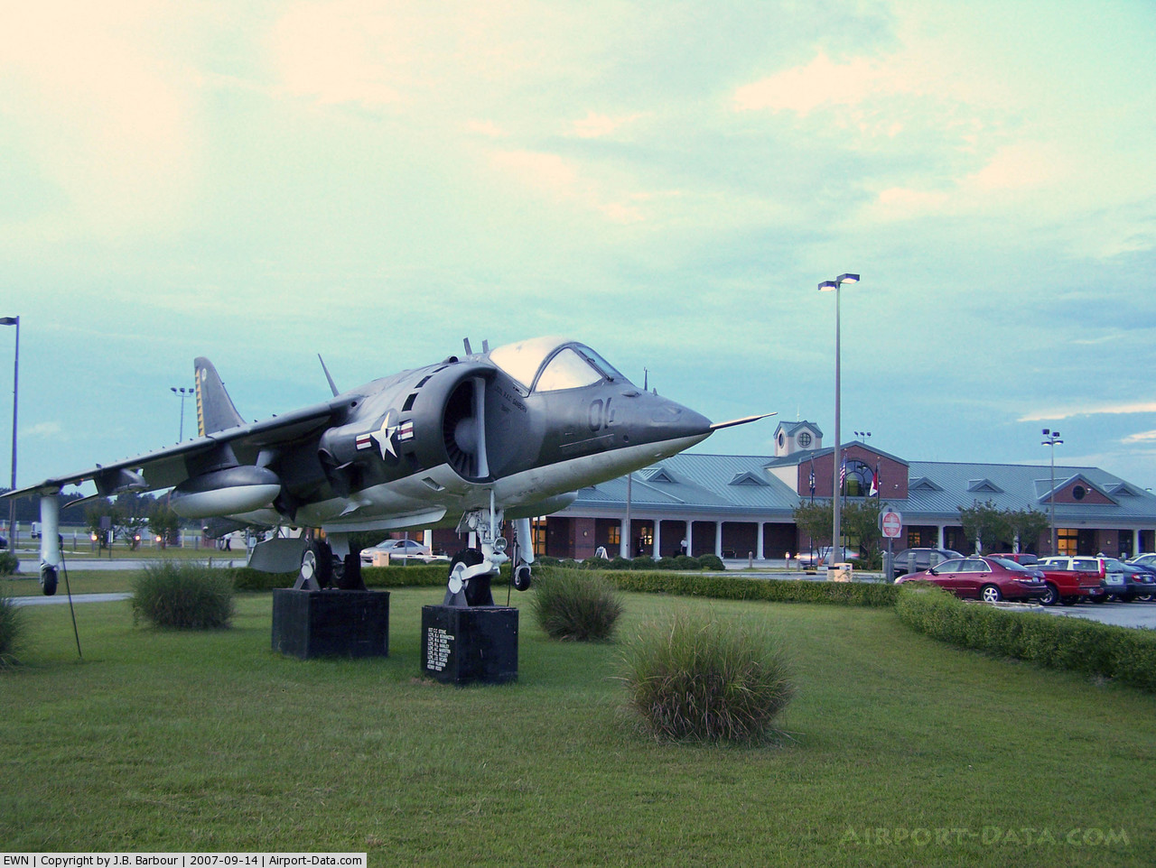
Coastal Carolina Regional Airport serves four counties in Eastern North Carolina. They include Craven County, Pamlico County, Carteret County, and Jones County. The total population encachment area of the four counties as of the June 2004 census was 176,851. Coastal Carolina Regional Airport is the main connection to Crystal Coast North Carolina destinations such as Marine Corps Air Station Cherry Point, Atlantic Beach, North Carolina, various seasonal camps including Camp Seagull/Seafarer and Camp Don Lee, and Emerald Isle, North Carolina.
On July 10, 2008 the North Carolina General Assembly ratified a bill that will allow the Craven County Airport to change its name to the Coastal Carolina Regional Airport. The name change became effective on August 15, 2008. History
The airport was previously named Craven County Regional Airport, Simmons-Nott Airport, and New Bern Regional Airport. Simmons-Nott came from North Carolina Senator Furnifold McLendel Simmons who was present at the 1931 dedication of the new terminal. During an air performance for the dedication, United States Marine Corps First Lieutenant Joel Nott was killed. Senator Simmons required that 1stLt Nott's named be added to the airport to pay homage for the fallen military officer.
On August 8, 1941, the Marine Corps leased the airport to become an outlying field of Marine Corps Air Station Cherry Point and named it OLF Camp Mitchell. In the beginning of 1942 the Army Air Forces used the field for anti-submarine patrols. The field was later closed for seven months during 1942 while two hard surface runways and a runway lighting system were installed. The first Marine aviation units began to arrive at the field in February of 1943. Among the units to train at the field during the war was Marine Aircraft Group 34 and fighter squadrons VMF-324 and VMF-511. In January 1944, plans were announced to expand the field. However these plans were abandoned because the Marine Corps acquired surplus Army fields.
Craven Regional Airport has previously been serviced by Midway Airlines, American Airlines, Piedmont Airlines, Charter Express and National Airlines.
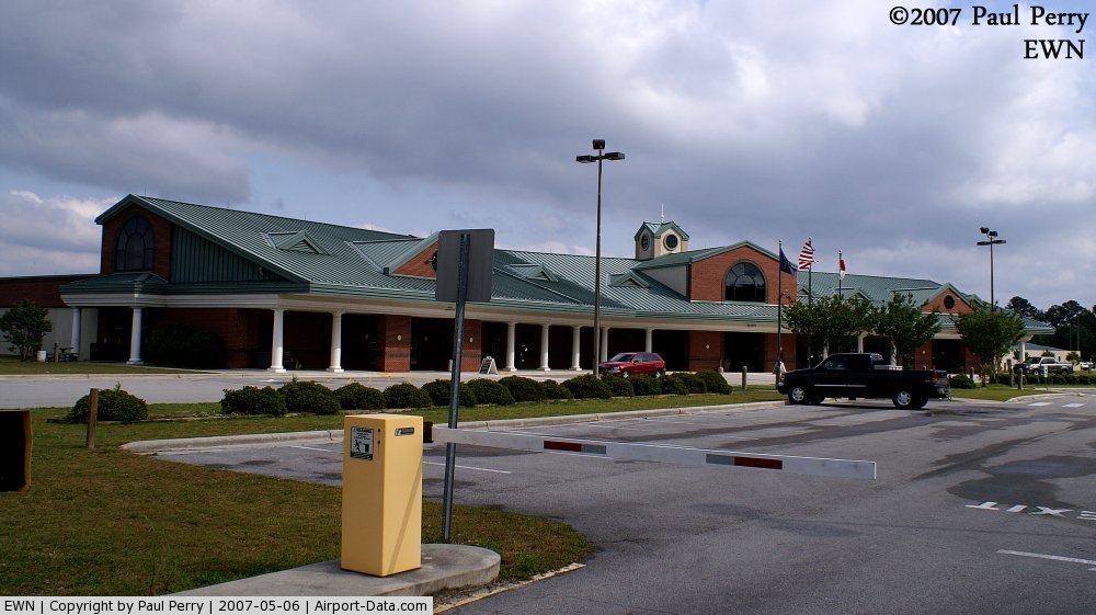
Terminal
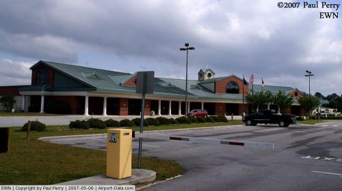
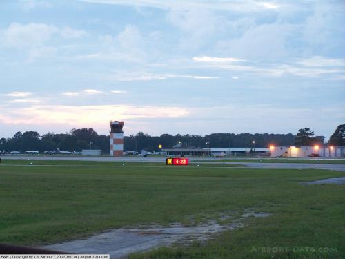
Coastal Carolina Regional Airport currently has three gates for use by airlines, all of which are located on the central pier and share a common boarding area. The $17 million terminal for EWN was completed on November 5, 1999 by the LPA Group. As of June 2006, Coastal Carolina Regional has approved their 20 year Master Plan: an extension of the main runway, the runway safety area expansion, a larger noise zone, and a new control tower. Also located in the terminal is an eatery (Glenburnie Grill), and several car rental agencies.
Airlines and destinations
 | |
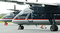
US Airways Express Dash-8 at Craven County Regional Airport |
| Airlines |
Destinations |
| Delta Connection operated by Atlantic Southeast Airlines |
Atlanta |
| US Airways Express operated by Piedmont Airlines |
Charlotte |
| US Airways Express operated by PSA Airlines |
Charlotte |
| US Airways Express operated by Air Wisconsin |
Charlotte |
Cargo airlines
| Airlines |
Destinations |
| Business AirFreight |
Raleigh-Durham |
| FedEx Feeder operated by Mountain Air Cargo |
Greensboro |
| UPS Airlines operated by Martinaire |
Raleigh-Durham |
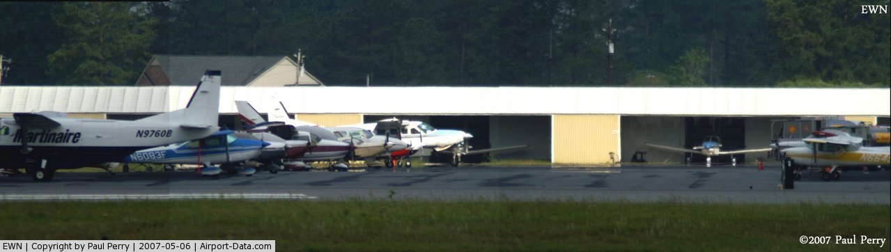
General aviation
Coastal Carolina Regional is mostly used for general aviation but is also served by two commercial airlines. There are currently an average of 131 aircraft movements (take-offs and landings) at EWN, of which 16-20 are commercial airline movements. EWN is currently looking for additional airlines to provide service due to the increase in flying passengers that pass through EWN yearly.
General aviation provides most of the aircraft movements at EWN. The Fixed Based Operators at EWN are Tidewater Air, LLC and Tradewind International. A Parachute Jumping school is currently seeking approval to be based at EWN.
In September, 2007, Coastal Carolina Regional Airport awarded a $677,000 contract to build a new 4,000 sq ft (370 m) general aviation terminal for Tidewater Aviation. The new terminal has a lobby, greeting area, restrooms, showers, conference room, crew resting areas, work areas, and storage area. The terminal has the same facade and visually identical to the main terminal building. The new General Aviation terminal was dedicated on July 9, 2008.
The above content comes from Wikipedia and is published under free licenses – click here to read more.
 |
(Click on the photo to enlarge) |
 |
(Click on the photo to enlarge) |
 |
(Click on the photo to enlarge) |
 |
(Click on the photo to enlarge) |
 |
(Click on the photo to enlarge) |
Location & QuickFacts
| FAA Information Effective: | 2008-09-25 |
| Airport Identifier: | EWN |
| Airport Status: | Operational |
| Longitude/Latitude: | 077-02-34.6000W/35-04-22.7000N
-77.042944/35.072972 (Estimated) |
| Elevation: | 18 ft / 5.49 m (Surveyed) |
| Land: | 785 acres |
| From nearest city: | 3 nautical miles SE of New Bern, NC |
| Location: | Craven County, NC |
| Magnetic Variation: | 08W (1985) |
Owner & Manager
| Ownership: | Publicly owned |
| Owner: | Craven County |
| Address: | Po Box 3258
New Bern, NC 28560 |
| Phone number: | 252-638-8591 |
| Manager: | Tom Braaten |
| Address: | 200 Terminal Drive
New Bern, NC 28562-6455 |
| Phone number: | 252-638-8591 |
Airport Operations and Facilities
| Airport Use: | Open to public |
| Wind indicator: | Yes |
| Segmented Circle: | No |
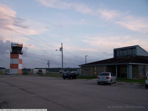
| Control Tower: | Yes |
| Lighting Schedule: | DUSK-DAWN
ACTVT HIRL, REIL RY 04/22, MIRL & REIL RY 14/32 - CTAF. PAPI RYS 04, 22 14 & 32 OPER 24 HRS. |
| Beacon Color: | Clear-Green (lighted land airport) |
| Landing fee charge: | No |
| Sectional chart: | Charlotte |
| Region: | ASO - Southern |
| Boundary ARTCC: | ZDC - Washington |
| Tie-in FSS: | RDU - Raleigh |
| FSS on Airport: | No |
| FSS Toll Free: | 1-800-WX-BRIEF |
| NOTAMs Facility: | EWN (NOTAM-d service avaliable) |
| Certification type/date: | I A S 05/1973
CLSD TO UNSKED ACR OPNS WITH MORE THAN 30 PSGR SEATS EXCP 24 HR PPR CALL AMGR 252-638-8591. |
| Federal Agreements: | NGY3 |
Airport Communications
Airport Services
| Fuel available: | 100LLA |
| Airframe Repair: | MAJOR |
| Power Plant Repair: | MAJOR |
| Bottled Oxygen: | NONE |
| Bulk Oxygen: | NONE |
Runway Information
Runway 04/22
| Dimension: | 6004 x 150 ft / 1830.0 x 45.7 m |
| Surface: | ASPH, Good Condition |
| Surface Treatment: | Saw-cut or plastic Grooved |
| Weight Limit: | Single wheel: 30000 lbs.
Dual wheel: 62000 lbs.
Dual tandem wheel: 140000 lbs. |
| Edge Lights: | High |
| |
Runway 04 |
Runway 22 |
| Longitude: | 077-02-53.8089W | 077-02-16.9256W |
| Latitude: | 35-03-55.5752N | 35-04-46.6275N |
| Elevation: | 14.00 ft | 14.00 ft |
| Alignment: | 31 | 127 |
| ILS Type: | ILS
| |
| Traffic Pattern: | Left | Left |
| Markings: | Precision instrument, Good Condition
RY 04 MARKINGS FADED. | Precision instrument, Good Condition
RY 22 MARKINGS FADED. |
| VASI: | 4-light PAPI on left side | 4-light PAPI on left side |
| Runway End Identifier: | Yes | Yes |
| Obstruction: | , 50:1 slope to clear | 68 ft trees, 2543.0 ft from runway, 558 ft left of centerline, 34:1 slope to clear |
|
Runway 14/32
| Dimension: | 4000 x 150 ft / 1219.2 x 45.7 m |
| Surface: | ASPH, Good Condition |
| Weight Limit: | Single wheel: 28000 lbs.
Dual wheel: 45000 lbs. |
| Edge Lights: | Medium |
| |
Runway 14 |
Runway 32 |
| Longitude: | 077-02-52.3150W | 077-02-14.3623W |
| Latitude: | 35-04-37.3480N | 35-04-13.0223N |
| Elevation: | 12.00 ft | 18.00 ft |
| Alignment: | 127 | 127 |
| Traffic Pattern: | Left | Left |
| Markings: | Non-precision instrument, Good Condition | Non-precision instrument, Good Condition |
| VASI: | 2-light PAPI on left side
RY 14 PAPI OTS INDEFLY. | 2-light PAPI on left side |
| Runway End Identifier: | Yes | Yes |
| Obstruction: | 28 ft trees, 1000.0 ft from runway, 500 ft right of centerline, 20:1 slope to clear | 26 ft tree, 862.0 ft from runway, 80 ft left of centerline, 25:1 slope to clear |
|
Radio Navigation Aids
| ID |
Type |
Name |
Ch |
Freq |
Var |
Dist |
| PGV | FAN MARKER | Belvoir | | | 06W | 37.9 nm |
| RNW | NDB | Chocowinity | | 388.00 | 07W | 26.4 nm |
| MRH | NDB | Morehead | | 269.00 | 08W | 27.8 nm |
| NCA | NDB | New River | | 356.00 | 08W | 28.4 nm |
| AQE | NDB | Alwood | | 230.00 | 09W | 41.4 nm |
| DKA | NDB | Kenan | | 332.00 | 07W | 43.1 nm |
| PMZ | NDB | Plymouth | | 221.00 | 10W | 46.4 nm |
| MCZ | NDB | Williamston | | 336.00 | 09W | 47.7 nm |
| DIW | NDB/DME | Dixon | 107X | 198.00 | 08W | 36.5 nm |
| NKT | TACAN | Cherry Point | 075X | | 09W | 13.2 nm |
| NJM | TACAN | Bogue Mcalf | 067X | | 08W | 23.1 nm |
| NCA | TACAN | New River | 101X | | 08W | 29.5 nm |
| GSB | TACAN | Seymour Johnson | 112X | | 08W | 48.3 nm |
| EWN | VOR/DME | New Bern | 083X | 113.60 | 08W | 0.1 nm |
| ISO | VORTAC | Kinston | 033X | 109.60 | 05W | 31.0 nm |
Remarks
Images and information placed above are from
http://www.airport-data.com/airport/EWN/
We thank them for the data!
| General Info
|
| Country |
United States
|
| State |
NORTH CAROLINA
|
| FAA ID |
EWN
|
| Latitude |
35-04-22.700N
|
| Longitude |
077-02-34.600W
|
| Elevation |
18 feet
|
| Near City |
NEW BERN
|
We don't guarantee the information is fresh and accurate. The data may
be wrong or outdated.
For more up-to-date information please refer to other sources.
|
|