|
|
 |
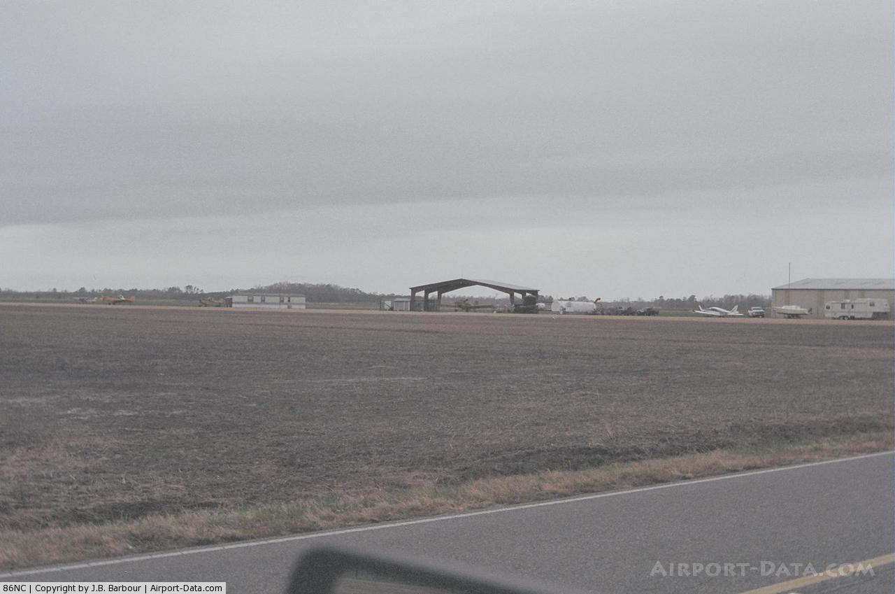
(Click on the photo to enlarge) |
Location & QuickFacts
| FAA Information Effective: | 2008-09-25 |
| Airport Identifier: | 86NC |
| Airport Status: | Operational |
| Longitude/Latitude: | 076-29-36.0000W/36-15-49.0000N
-76.493333/36.263611 (Estimated) |
| Elevation: | 14 ft / 4.27 m (Estimated) |
| Land: | 17 acres |
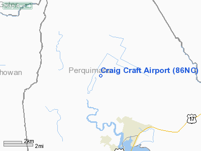
| From nearest city: | 5 nautical miles N of Hertford, NC |
| Location: | Washington County, NC |
| Magnetic Variation: | 10W (2000) |
Owner & Manager
| Ownership: | Privately owned |
| Owner: | Craig D Craft |
| Address: | 865 Swamp Rd
Hertford, NC 27944 |
| Phone number: | 252-426-2676 |
| Manager: | Craig D Craft |
| Address: | 865 Swamp Rd
Hertford, NC 27944 |
| Phone number: | 252-426-2676 |
Airport Operations and Facilities
| Airport Use: | Private |
| Wind indicator: | Yes |
| Segmented Circle: | No |
| Control Tower: | No |
| Sectional chart: | Washington |
| Region: | ASO - Southern |
| Boundary ARTCC: | ZDC - Washington |
| Tie-in FSS: | RDU - Raleigh |
| FSS Toll Free: | 1-800-WX-BRIEF |
Runway Information
Runway 04/22
| Dimension: | 2900 x 100 ft / 883.9 x 30.5 m |
| Surface: | TURF, |
| |
Runway 04 |
Runway 22 |
| Traffic Pattern: | Left | Left |
| Displaced threshold: | 0.00 ft | 825.00 ft |
| Obstruction: | | 50 ft pline, 175.0 ft from runway |
|
Radio Navigation Aids
| ID |
Type |
Name |
Ch |
Freq |
Var |
Dist |
| LLW | NDB | Woodville | | 254.00 | 10W | 9.5 nm |
| EDE | NDB | Edenton | | 265.00 | 10W | 14.7 nm |
| EY | NDB | Chesi | | 233.00 | 09W | 20.9 nm |
| RK | NDB | Waley | | 249.00 | 10W | 21.5 nm |
| PMZ | NDB | Plymouth | | 221.00 | 10W | 30.3 nm |
| PVG | NDB | Portsmouth | | 241.00 | 10W | 31.1 nm |
| ASJ | NDB | Ahoskie | | 415.00 | 10W | 33.1 nm |
| MCZ | NDB | Williamston | | 336.00 | 09W | 41.2 nm |
| MQI | NDB | Manteo | | 370.00 | 09W | 44.1 nm |
| AKQ | NDB | Wakefield | | 274.00 | 09W | 49.7 nm |
| ELQ | NDB | Emporia | | 261.00 | 10W | 49.9 nm |
| NTU | TACAN | Oceana | 113X | | 10W | 40.3 nm |
| NGU | TACAN | Chambers | 048X | | 10W | 42.0 nm |
| LFI | TACAN | Langley | 070X | | 10W | 49.8 nm |
| ECG | VOR/DME | Elizabeth City | 072X | 112.50 | 07W | 15.4 nm |
| RBX | VOR/DME | Wright Brothers | 053X | 111.60 | 08W | 43.8 nm |
| CVI | VORTAC | Cofield | 093X | 114.60 | 09W | 19.5 nm |
| FKN | VORTAC | Franklin | 043X | 110.60 | 09W | 36.9 nm |
| ORF | VORTAC | Norfolk | 116X | 116.90 | 07W | 40.3 nm |
Remarks
- INTENSIVE AGRICULTURE OPNS INVOF ARPT.
- OWNER DESIRES CHARTING.
- PROVIDED VFR OPNS, PRIVATE USE, AND LANDING AREA IS LIMITED TO CATEGORY B ACFT SO AS TO NOT CONFLICT WITH THE TRAFFIC PATTERN AT DILLARD AIRPORT, WINFALL, NC.
Images and information placed above are from
http://www.airport-data.com/airport/86NC/
We thank them for the data!
| General Info
|
| Country |
United States
|
| State |
NORTH CAROLINA
|
| FAA ID |
86NC
|
| Latitude |
36-15-49.000N
|
| Longitude |
076-29-36.000W
|
| Elevation |
14 feet
|
| Near City |
HERTFORD
|
We don't guarantee the information is fresh and accurate. The data may
be wrong or outdated.
For more up-to-date information please refer to other sources.
|
|