|
|

 |
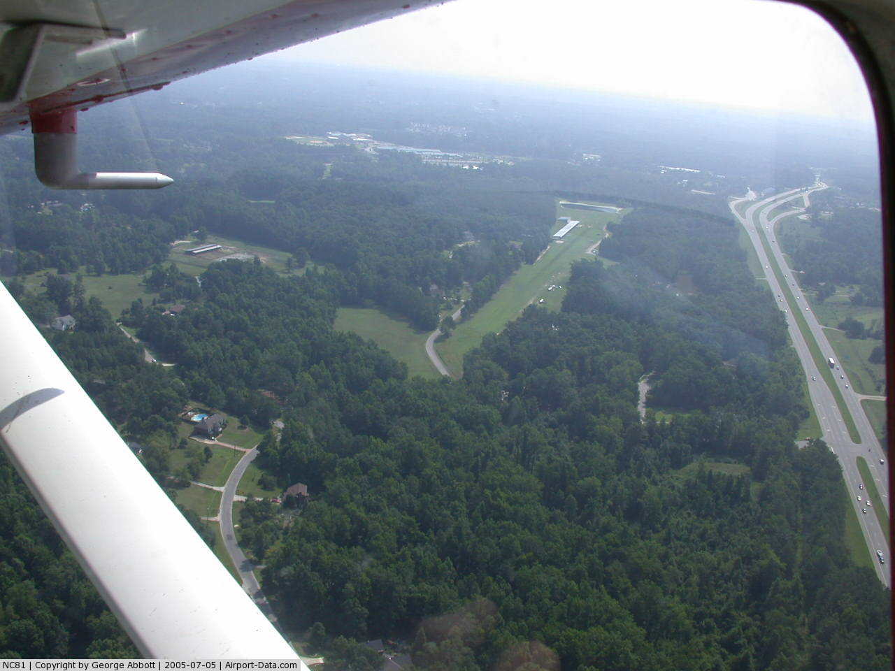
(Click on the photo to enlarge) |
 |
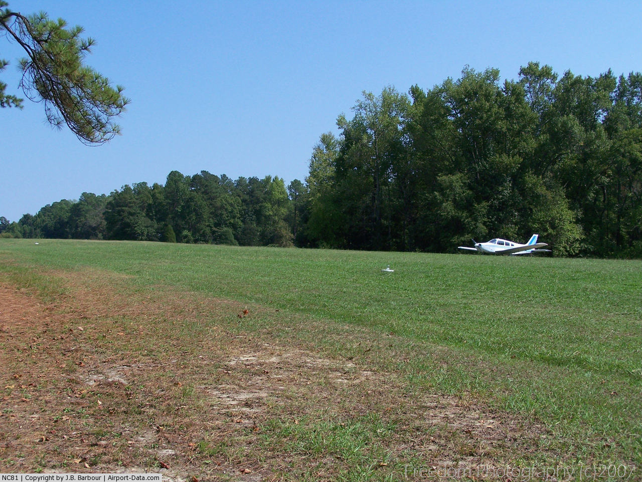
(Click on the photo to enlarge) |
 |
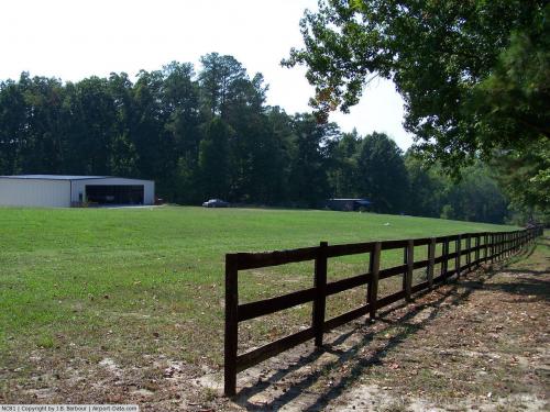
(Click on the photo to enlarge) |
Location & QuickFacts
| FAA Information Effective: | 2008-09-25 |
| Airport Identifier: | NC81 |
| Airport Status: | Operational |
| Longitude/Latitude: | 078-51-35.0260W/35-45-06.5440N
-78.859729/35.751818 (Estimated) |
| Elevation: | 455 ft / 138.68 m (Estimated) |
| Land: | 0 acres |
| From nearest city: | 1 nautical miles N of Apex, NC |
| Location: | Wake County, NC |
| Magnetic Variation: | 07W (1985) |
Owner & Manager
| Ownership: | Privately owned |
| Owner: | Vernon L. Cox |
| Address: | 1616 Hwy 64 West
Apex, NC 27523-8991 |
| Phone number: | 919-362-9301 |
| Manager: | Vernon L. Cox |
| Address: | 1616 Hwy 64 West
Apex, NC 27523-8991 |
| Phone number: | 919-362-9301 |
Airport Operations and Facilities
| Airport Use: | Private |
| Wind indicator: | Yes |
| Segmented Circle: | No |
| Control Tower: | No |
| Landing fee charge: | No |
| Sectional chart: | Charlotte |
| Region: | ASO - Southern |
| Boundary ARTCC: | ZDC - Washington |
| Tie-in FSS: | RDU - Raleigh |
| FSS on Airport: | No |
| FSS Toll Free: | 1-800-WX-BRIEF |
Airport Services
Runway Information
Runway 09/27
| Dimension: | 2450 x 75 ft / 746.8 x 22.9 m |
| Surface: | TURF, |
| |
Runway 09 |
Runway 27 |
| Traffic Pattern: | Right | Left |
|
Radio Navigation Aids
| ID |
Type |
Name |
Ch |
Freq |
Var |
Dist |
| LE | NDB | Leevy | | 350.00 | 07W | 12.5 nm |
| TT | NDB | Leeco | | 406.00 | 08W | 20.5 nm |
| HQT | NDB | Harnett | | 417.00 | 08W | 21.2 nm |
| EUU | NDB | Jnall | | 251.00 | 07W | 26.2 nm |
| JN | NDB | Jurly | | 263.00 | 09W | 27.0 nm |
| EEJ | NDB | Lee County/dcmsnd | | 428.00 | 07W | 28.9 nm |
| TOX | NDB | Siler City | | 371.00 | 07W | 29.4 nm |
| HUR | NDB | Person | | 220.00 | 08W | 30.6 nm |
| POB | NDB | Pope | | 338.00 | 07W | 31.9 nm |
| HXO | NDB | Huntsboro | | 271.00 | 07W | 35.0 nm |
| FGP | NDB | Fort Bragg | | 393.00 | 07W | 36.9 nm |
| HB | NDB | Himun | | 361.00 | 08W | 37.8 nm |
| RW | NDB | Jambe | | 235.00 | 09W | 43.7 nm |
| JYN | NDB | Wayne | | 208.00 | 08W | 48.8 nm |
| CQJ | NDB | City Lake | | 266.00 | 08W | 49.1 nm |
| POB | TACAN | Pope | 085X | | 07W | 36.5 nm |
| FAY | VOR/DME | Fayetteville | 025X | 108.80 | 04W | 46.1 nm |
| RDU | VORTAC | Raleigh/durham | 119X | 117.20 | 04W | 8.2 nm |
| LIB | VORTAC | Liberty | 077X | 113.00 | 03W | 36.9 nm |
| SDZ | VORTAC | Sandhills | 055X | 111.80 | 03W | 48.1 nm |
Remarks
- (E111-3) RALEIGH PMSN RQRD WHEN CEILING RPTRD LESS THAN 1000' AND VISIBILITY LESS THAN 3 MILES.
- OPNS LTD TO VFR WX; PVT USE; NR OF ACFT AUZD TO USE ARPT MUST NOT EXCEED 19; ACFT TFC PAT IS ESTABD ON THE SOUTH SIDE OF RWY AND RWY CNTRLN EXTNDD. 2-WAY RADIO COMS ESTABD WITH RALEIGH APCH CTL PRIOR TO ENTERING RALEIGH CTL ZONE. WZ FOR CTL ZONE CAN BE OBTAINED FROM RALEIGH ATIS.
Images and information placed above are from
http://www.airport-data.com/airport/NC81/
We thank them for the data!
| General Info
|
| Country |
United States
|
| State |
NORTH CAROLINA
|
| FAA ID |
NC81
|
| Latitude |
35-45-06.544N
|
| Longitude |
078-51-35.026W
|
| Elevation |
455 feet
|
| Near City |
APEX
|
We don't guarantee the information is fresh and accurate. The data may
be wrong or outdated.
For more up-to-date information please refer to other sources.
|
|