 |
|
Location & QuickFacts
| FAA Information Effective: | 2008-09-25 |
| Airport Identifier: | 88NC |
| Airport Status: | Operational |
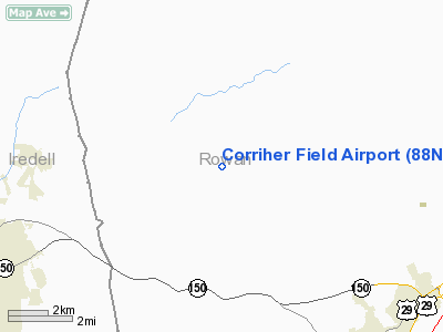
| Longitude/Latitude: | 080-41-07.0000W/35-37-57.0000N
-80.685278/35.632500 (Estimated) |
| Elevation: | 840 ft / 256.03 m (Estimated) |
| Land: | 0 acres |
| From nearest city: | 11 nautical miles W of Salisbury, NC |
| Location: | Rowan County, NC |
| Magnetic Variation: | () |
Owner & Manager
| Ownership: | Privately owned |
| Owner: | Ronald Corriher |
| Address: | 11812 Mooresville Road
Mt. Ulla, NC 28125 |
| Phone number: | 704-630-6988 |
| Manager: | Ronald Corriher |
| Address: | 11812 Mooresville Road
Mt. Ulla, NC 28125 |
| Phone number: | 704-798-0789 |
Airport Operations and Facilities
| Airport Use: | Private |
| Control Tower: | No |
| Sectional chart: | Charlotte |
| Region: | ASO - Southern |
| Boundary ARTCC: | ZTL - Atlanta |
| Tie-in FSS: | RDU - Raleigh |
| FSS Toll Free: | 1-800-WX-BRIEF |
Runway Information
Runway 18/36
| Dimension: | 2000 x 40 ft / 609.6 x 12.2 m |
| Surface: | TURF, |
| |
Runway 18 |
Runway 36 |
| Traffic Pattern: | Right | Left |
| Obstruction: | 100 ft pline, 1500.0 ft from runway | |
|
Radio Navigation Aids
| ID |
Type |
Name |
Ch |
Freq |
Var |
Dist |
| MRN | FAN MARKER | Lenoir | | | 03W | 46.9 nm |
| RU | NDB | Rovdy | | 275.00 | 06W | 11.3 nm |
| DVZ | NDB | Davie | | 354.00 | 06W | 20.3 nm |
| VW | NDB | Temky | | 280.00 | 05W | 20.4 nm |
| IZN | NDB | Lincolnton | | 432.00 | 06W | 20.4 nm |
| SEN | NDB | Swearing/dcmsnd | | 260.00 | 06W | 20.9 nm |
| VU | NDB | Aller | | 346.00 | 06W | 30.8 nm |
| HK | NDB | Tawba | | 332.00 | 06W | 31.7 nm |
| GHJ | NDB | Stonia | | 260.00 | 06W | 35.2 nm |
| UKF | NDB | Wilki | | 209.00 | 06W | 35.2 nm |
| CQJ | NDB | City Lake | | 266.00 | 08W | 40.4 nm |
| TWL | NDB | Wesley | | 204.00 | 06W | 40.9 nm |
| ZEF | NDB | Zephyr | | 326.00 | 05W | 41.0 nm |
| AZW | NDB | Mount Airy | | 223.00 | 07W | 45.5 nm |
| AFP | NDB | Anson County | | 283.00 | 07W | 47.0 nm |
| FIQ | NDB | Fiddlers | | 391.00 | 07W | 48.4 nm |
| UZ | NDB | Rally | | 227.00 | 05W | 48.7 nm |
| CLT | VOR/DME | Charlotte | 097X | 115.00 | 05W | 29.6 nm |
| BZM | VOR/DME | Barretts Mountain | 045X | 110.80 | 06W | 30.6 nm |
| FML | VORTAC | Fort Mill | 071X | 112.40 | 02W | 40.9 nm |
| GSO | VORTAC | Greensboro | 109X | 116.20 | 03W | 42.5 nm |
| CLT | VOT | Charlotte | | 112.00 | | 28.0 nm |
| HKY | VOT | Hickory Regional | | 110.00 | | 35.1 nm |
Remarks
- ALL TRAFFIC PATTERN OPNS REMAIN WEST OF ARPT.
- PRVDD VFR OPNS; PVT USE; EST LOA WITH MILLER AIRPARK, AND ALL TRAFFIC REMAIN WEST OF ARPT.
Images and information placed above are from
http://www.airport-data.com/airport/88NC/
We thank them for the data!
|
|


