|
|
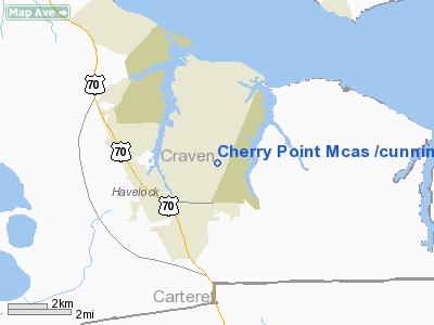
Cherry Point Mcas /cunningham Field/ Airport |
Coordinates: 34°54′03″N 076°52′51″W / 34.90083°N 76.88083°W / 34.90083; -76.88083
MCAS Cherry Point
Cunningham Field |
 |
| MCAS Cherry Point insignia |
 |
| IATA: NKT – ICAO: KNKT – FAA LID: NKT |
| Summary |
| Airport type |
Military |
| Operator |
United States Marine Corps |
| Location |
Havelock, North Carolina |
| Built |
1942 |
| In use |
May 20, 1942 - present |
| Commander |
Col Douglas Denn |
| Occupants |
2nd Marine Aircraft Wing |
| Elevation AMSL |
29 ft / 9 m |
| Website |
www.cherrypoint.usmc.mil |
| Runways |
| Direction |
Length |
Surface |
| ft |
m |
| 5L/23R |
7,553 |
2,302 |
Asphalt |
| 5R/23L |
8,188 |
2,496 |
Asphalt |
| 14L/32R |
8,984 |
2,738 |
Asphalt |
| 14R/32L |
8,399 |
2,560 |
Asphalt |
| Sources: Official website and FAA |
Marine Corps Air Station Cherry Point or MCAS Cherry Point(*34°54′03″N 76°52′51″W / 34.9009°N 76.8807°W / 34.9009; -76.8807) (IATA: NKT, ICAO: KNKT, FAA LID: NKT) is a United States Marine Corps airfield located in Havelock, North Carolina, USA, in the eastern part of the state. It was built in 1941, and was commissioned in 1942 and is currently home to the 2nd Marine Aircraft Wing. Resident units
- Headquarters and Headquarters Squadron
- 2nd Marine Aircraft Wing
- Marine Aircraft Group 14
- Marine Wing Support Group 27
- Marine Air Control Group 28
- Combat Logistics Company 21
- Fleet Readiness Center (East)
MCAS Cherry Point also maintains a satellite field at MCALF Bogue, in Bogue, North Carolina. Several former outlying landing fields have been converted to regional airports, such as MCOF Greenville, MCAA Kinston, and MCOF New Bern.
History
Congress authorized Marine Corps Air Station Cherry Point on July 9, 1941, with an initial appropriation of $14,990,000 for construction and clearing of an 8,000 acre (32 km²) tract of swamps, farms and timberland.
Actual clearing of the site began on August 6, 1941, with extensive drainage and malaria control work. Construction began in November just 17 days before the attack on Pearl Harbor.
On May 20, 1942, the facility was commissioned Cunningham Field, named in honor of the Marine Corps' first aviator, Lieutenant Colonel Alfred A. Cunningham. The completed facility was later renamed Marine Corps Air Station Cherry Point, after a local post office situated among cherry trees.
Cherry Point's primary World War II mission was to train units and individual Marines for service to the Pacific theater. The air station also served as a base for anti-submarine operations, with an Army Air Corps (22d Antisubmarine Squadron) and later a Navy squadron each being responsible for the sinking of a German U-boat just off the North Carolina coast during 1943.
Cherry Point's contribution to the Korean War effort was to provide a steady stream of trained aviators and air crewmen as well as maintenance and support personnel as replacements to forward deployed aviation units.
During the Vietnam War, Cherry Point deployed three A-6 Intruder squadrons to the Far East and again provided a constant source of replacements for aircrews and enlisted aviation personnel.
In Operation Desert Storm, Cherry Point was a major contributor to the victory in Southwest Asia by supporting the deployment of three AV-8B Harrier squadrons, two A-6E Intruder squadrons, one KC-130 Hercules squadron, one EA-6B Prowler squadron, and headquarters detachments from Marine Aircraft Group 14, Marine Aircraft Group 32, and the 2nd Marine Aircraft Wing.
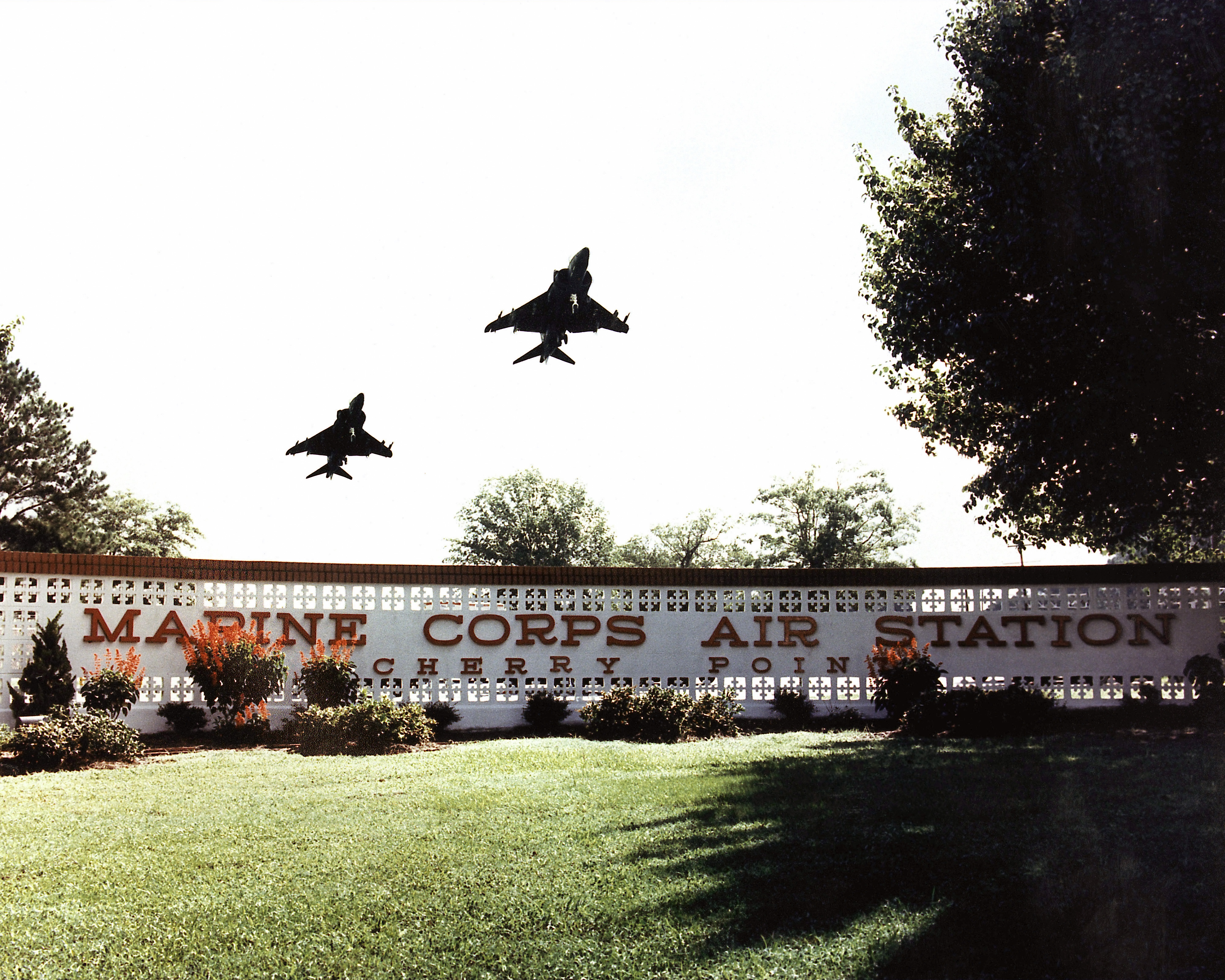
 | |
Harriers from VMA-231 over the front sign of the air station in 1990. |
Cherry Point Marines and Sailors participated in strike missions and follow-on operations in Afghanistan and its surrounding region during Operation Enduring Freedom, which was initiated on October 7, 2001.
On September 8, 2007, the headquarters building (198) was gutted by a fire. The groundbreaking ceremony for the new Headquarters Building was on 29 July 2009, with completion planned for sometime in 2011.
The air station and its associated support locations occupy more than 29,000 acres (120 km²). Its runway system is so large that the air station serves as an alternate emergency landing site for the space shuttle launches out of Cape Canaveral, Florida.
The above content comes from Wikipedia and is published under free licenses – click here to read more.
 |
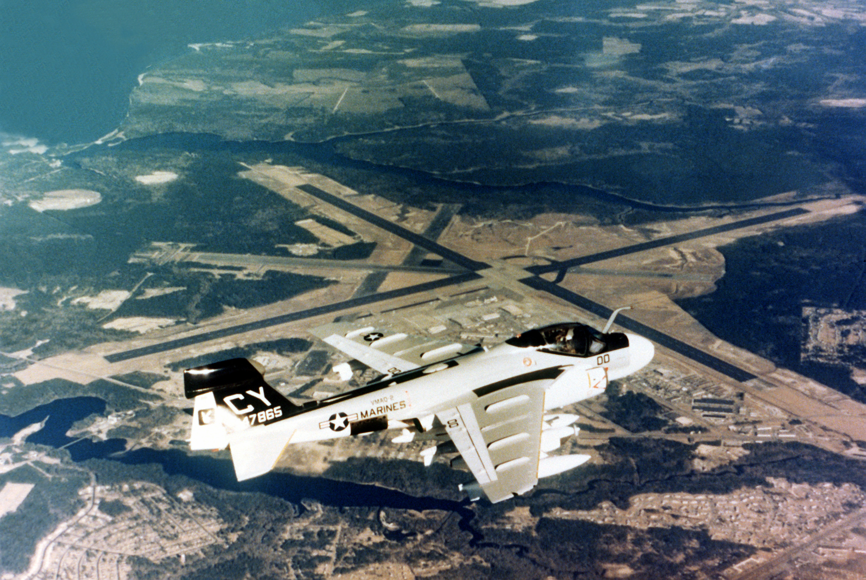
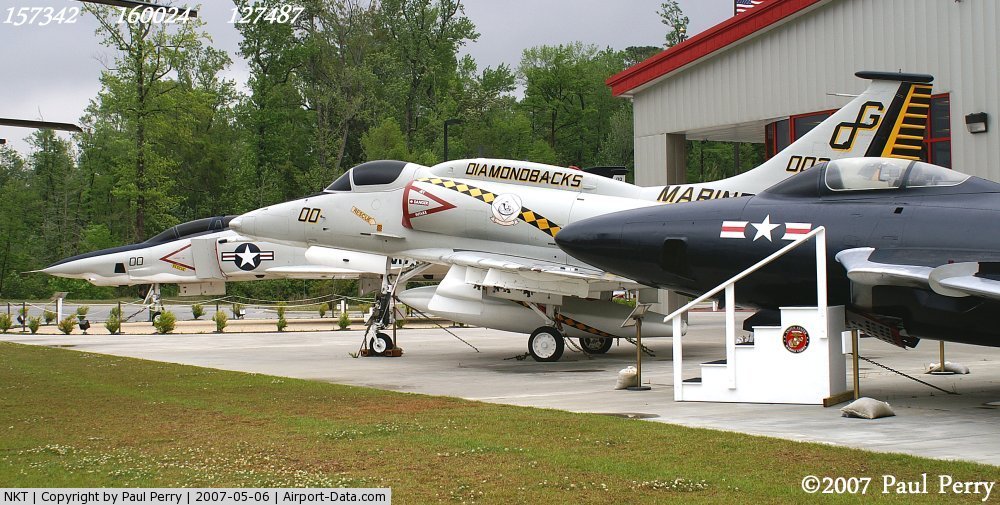
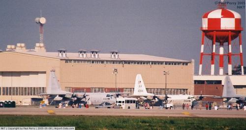
(Click on the photo to enlarge) |
 |
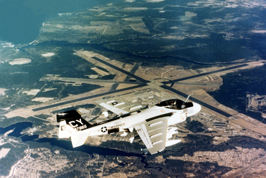
(Click on the photo to enlarge) |
 |
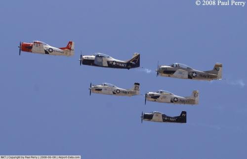
(Click on the photo to enlarge) |
Location & QuickFacts
| FAA Information Effective: | 2008-09-25 |
| Airport Identifier: | NKT |
| Airport Status: | Operational |
| Longitude/Latitude: | 076-52-50.6400W/34-54-03.1430N
-76.880733/34.900873 (Estimated) |
| Elevation: | 29 ft / 8.84 m (Estimated) |
| Land: | 0 acres |
| From nearest city: | 2 nautical miles NE of Cherry Point, NC |
| Location: | Pamlico County, NC |
| Magnetic Variation: | 09W (1990) |
Owner & Manager
| Ownership: | Navy owned |
| Owner: | Us Navy |
| Address: | Oceanographic Ofc-code 3142
Washington, DC 20373 |
| Manager: | Commanding Officer |
| Address: | Marine Corps Air Station
Cherry Point, NC 28533 |
Airport Operations and Facilities
| Airport Use: | Private |
| Segmented Circle: | No |
| Control Tower: | Yes |
| Lighting Schedule: | DUSK-DAWN |
| Beacon Color: | Split-Clear-Green (lighted military airport) |
| Sectional chart: | Charlotte |
| Region: | ASO - Southern |
| Boundary ARTCC: | ZDC - Washington |
| Tie-in FSS: | NKT - Cherry Point Mcas |
| FSS on Airport: | No |
| FSS Toll Free: | 1-800-WX-BRIEF |
| NOTAMs Facility: | RDU (NOTAM-d service avaliable) |
| Certification type/date: | I L U 08/1990 |
Airport Services
| Fuel available: | 100LL
FUEL: HOT PIT REFUL AVBL. J5. |
| Bottled Oxygen: | NONE |
| Bulk Oxygen: | HIGH/LOW |
Runway Information
Runway 05L/23R
| Dimension: | 7553 x 200 ft / 2302.2 x 61.0 m |
| Surface: | ASPH, |
| Pavement Class: | 62 /R/B/W/T |
| Weight Limit: | Single wheel: 141000 lbs.
Dual wheel: 313000 lbs.
Dual tandem wheel: 554000 lbs.
Dual dual tandem wheel: 1120000 lbs. |
| Edge Lights: | High |
| |
Runway 05L |
Runway 23R |
| Latitude: | 34-54-14.0740N | |
| Elevation: | 28.00 ft | 0.00 ft |
| ILS Type: | | ILS/DME
|
| Traffic Pattern: | Left | Left |
| Arresting: | | E28 |
| Crossing Height: | 0.00 ft | 74.00 ft |
| Displaced threshold: | 0.00 ft | 882.00 ft |
| VASI: | | 4-light PAPI on left side |
| Visual Glide Angle: | 0.00° | 3.00° |
|
Runway 05R/23L
| Dimension: | 8188 x 196 ft / 2495.7 x 59.7 m |
| Surface: | ASPH, |
| Pavement Class: | 55 /R/B/W/T |
| Weight Limit: | Single wheel: 122000 lbs.
Dual wheel: 313000 lbs.
Dual tandem wheel: 500000 lbs.
Dual dual tandem wheel: 856000 lbs. |
| Edge Lights: | High |
| |
Runway 05R |
Runway 23L |
| Longitude: | 076-53-51.7800W | 076-52-41.6600W |
| Latitude: | 34-53-16.9070N | 34-54-13.6690N |
| Traffic Pattern: | Left | Left |
| Arresting: | E28 | |
|
Runway 14L/32R
| Dimension: | 8984 x 200 ft / 2738.3 x 61.0 m |
| Surface: | ASPH, |
| Pavement Class: | 52 /R/B/W/T |
| Weight Limit: | Single wheel: 78000 lbs.
Dual wheel: 185000 lbs.
Dual tandem wheel: 328000 lbs.
Dual dual tandem wheel: 680000 lbs. |
| Edge Lights: | High |
| |
Runway 14L |
Runway 32R |
| Longitude: | 076-53-59.9410W | 076-52-44.3770W |
| Latitude: | 34-55-10.8490N | 34-54-07.4410N |
| Traffic Pattern: | Left | Left |
| Arresting: | E28 | |
|
Runway 14R/32L
| Dimension: | 8399 x 200 ft / 2560.0 x 61.0 m |
| Surface: | ASPH, |
| Pavement Class: | 52 /R/B/W/T |
| Weight Limit: | Single wheel: 101000 lbs.
Dual wheel: 261000 lbs.
Dual tandem wheel: 462000 lbs.
Dual dual tandem wheel: 958000 lbs. |
| Edge Lights: | High |
| |
Runway 14R |
Runway 32L |
| Longitude: | 076-52-56.9440W | 076-51-46.2780W |
| Latitude: | 34-54-10.9430N | 34-53-11.6880N |
| Traffic Pattern: | Left | Left |
| Arresting: | | E28 |
| Crossing Height: | 0.00 ft | 78.00 ft |
| Displaced threshold: | 0.00 ft | 795.00 ft |
| VASI: | | 4-light PAPI on left side |
| Visual Glide Angle: | 0.00° | 3.00° |
| Approach lights: | | ALSF1 |
| Centerline Lights: | Yes | Yes |
| Touchdown Lights: | No | No |
|
Radio Navigation Aids
| ID |
Type |
Name |
Ch |
Freq |
Var |
Dist |
| MRH | NDB | Morehead | | 269.00 | 08W | 14.8 nm |
| NCA | NDB | New River | | 356.00 | 08W | 29.2 nm |
| RNW | NDB | Chocowinity | | 388.00 | 07W | 38.2 nm |
| DIW | NDB/DME | Dixon | 107X | 198.00 | 08W | 34.6 nm |
| OUC | NDB/DME | Pamlico/dcmsnd | 034X | 404.00 | 09W | 45.9 nm |
| NKT | TACAN | Cherry Point | 075X | | 09W | 0.3 nm |
| NJM | TACAN | Bogue Mcalf | 067X | | 08W | 14.7 nm |
| NCA | TACAN | New River | 101X | | 08W | 30.0 nm |
| EWN | VOR/DME | New Bern | 083X | 113.60 | 08W | 13.1 nm |
| ISO | VORTAC | Kinston | 033X | 109.60 | 05W | 43.7 nm |
Remarks
- PPR WKENDS CTC OPNS DUTY OFFICER; V582-3632/5025.
- LGT: PORTABLE LGT-MOBILE FLOOD LGT.
- A-GEAR: ALL E-28(B) IN RAISED POSN EXC ON LDG RWY. RQR 15 MIN PN.
- JASU: 2 WORKING DAYS PN RQR. 2(GTC-85) 1(NCPP-105)
- FLUID: SP PRESAIR HPOX LOX
- TRAN ALERT: LTD TRAN MAINT AVBL 1200-2100Z++ MON-FRI. NO LAVATORY SVC AVBL.
- SEE FLIP AP/1 SUPPLEMENTARY ARPT RMK.
- RSTD: PPR ALL TRAN ACFT (MIN 24 HR NTC). CALL BASE OPS DSN 582-2233, C252-466-2233. FLT PLANNING/BASE OPS OPR 24 HR. ALL RWY AND TWY, EXC TWY A AND C, WILL SUPPORT ALL ACFT AT ALL WT.
- CAUTION: EXTV STU JET TRNG (V/STOL) VCNTY ARPT. TRAN ACFT EXP STR-IN FULL STOP LDG ONLY DUR PEAK STU TRNG PERIODS. BIRD HAZ OCT-APR. DRAINAGE DITCHES PARL ALL RWY. WILDLIFE HAZ ON ARPT, ESPECIALLY SS-SR. OBST APRX 200' NEAR NKT R-205/3.
- TFC PAT: LDG/TAXI LGT RQR ALL LDG. REDUCED RWY SEPARATION IN EFF FOR USN/USMC ACFT.
- CSTMS/AG/IMG: CSTMS, AG AVBL WITH 24 HR PN.
- MISC: 24 HR PN RQR OF ALL DV CODES, CTC BASE OPS DSN 582-2233, C252-466-2233. ALL ACFT WITH PAX/CARGO/DV CTC PTD 20 MIN PRIOR TO LDG.
- OPR EXP FLD CLOSURE ON NATL HOL WKEND.
- TSNT ALERT: TSNT ACFT WITH INERT ORDNANCE, HOT PIT REFUEL LIMITED TO F18 AND USAF F15, F16 AND A10 ACFT ONLY. HOT PIT REFUEL WITH INERT ORDNANCE AVAILABLE 1200-0300Z++ MON-FRI; 1700-0059Z++ SAT, SUN.
- CAUTION: OBSTACLE UNLIT TWR AT NKT200006 549 FT.
- ACFT RESTRICTED FM TAXIING ON TWY 'K' BTN RY 23R & TEST CELL. TOWING OPERATIONS ONLY. ATC TERMINOLOGY "CENTERMAT" IS DEFINED AS THE CENTER OF THE AIRFIELD WHERE THE FOUR RY'S INTERSECT.
- ALL ACFT ENROUTE TO CHERRY POINT MCAS RQRG SERVICING CONTACT BASE OPS WITH REQUEST.
- AIRCRAFT STRUCTURAL DE-ICING AVAILABLE.
Images and information placed above are from
http://www.airport-data.com/airport/NKT/
We thank them for the data!
| General Info
|
| Country |
United States
|
| State |
NORTH CAROLINA
|
| FAA ID |
NKT
|
| Latitude |
34-54-09.577N
|
| Longitude |
076-52-51.784W
|
| Elevation |
28 feet
|
| Near City |
CHERRY POINT
|
We don't guarantee the information is fresh and accurate. The data may
be wrong or outdated.
For more up-to-date information please refer to other sources.
|
|