 |
|
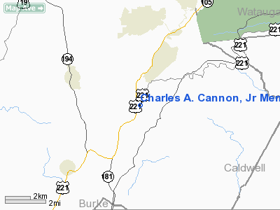
Charles A. Cannon, Jr Memorial Hospital Heliport |
Location & QuickFacts
| FAA Information Effective: | 2008-09-25 |
| Airport Identifier: | NC07 |
| Airport Status: | Operational |
| Longitude/Latitude: | 081-52-00.0000W/36-04-00.0000N
-81.866667/36.066667 (Estimated) |
| Elevation: | 3000 ft / 914.40 m (Estimated) |
| Land: | 0 acres |
| From nearest city: | 1 nautical miles SE of Banner Elk, NC |
| Location: | Avery County, NC |
| Magnetic Variation: | 04W (1985) |
Owner & Manager
| Ownership: | Privately owned |
| Owner: | Charles A. Cannon Jr Mem Hosp |
| Address: | Po Box 787
Linville, NC 28646 |
| Phone number: | 828-737-7000 |
| Manager: | Edward C. Greene |
| Address: | 434 Hospital Drive
Linville, NC 28646 |
| Phone number: | 828-737-7600 |
Airport Operations and Facilities
| Airport Use: | Private
MEDICAL USE |
| Wind indicator: | Yes |
| Segmented Circle: | No |
| Control Tower: | No |
| Sectional chart: | Washington |
| Region: | ASO - Southern |
| Boundary ARTCC: | ZTL - Atlanta |
| Tie-in FSS: | RDU - Raleigh |
| FSS Toll Free: | 1-800-WX-BRIEF |
Runway Information
Helipad H1
| Dimension: | 50 x 50 ft / 15.2 x 15.2 m |
| Surface: | CONC, |
| |
Runway H1 |
Runway |
| Traffic Pattern: | Left | Left |
|
Radio Navigation Aids
| ID |
Type |
Name |
Ch |
Freq |
Var |
Dist |
| MRN | FAN MARKER | Lenoir | | | 03W | 20.1 nm |
| BAR | NDB | Hemlock | | 320.00 | 02W | 5.3 nm |
| JJO | NDB | Mountain City | | 396.00 | 04W | 21.1 nm |
| FIQ | NDB | Fiddlers | | 391.00 | 07W | 23.4 nm |
| EZT | NDB | Elizabethton | | 275.00 | 02W | 24.7 nm |
| HK | NDB | Tawba | | 332.00 | 06W | 32.1 nm |
| JU | NDB | Ashee | | 410.00 | 07W | 34.4 nm |
| BO | NDB | Booie | | 221.00 | 04W | 36.5 nm |
| UKF | NDB | Wilki | | 209.00 | 06W | 37.4 nm |
| VJ | NDB | Whine | | 236.00 | 05W | 40.3 nm |
| VW | NDB | Temky | | 280.00 | 05W | 42.8 nm |
| RFE | NDB | Rutherford | | 344.00 | 05W | 43.3 nm |
| IZN | NDB | Lincolnton | | 432.00 | 06W | 49.6 nm |
| DYQ | NDB | Dulaney | | 263.00 | 04W | 49.9 nm |
| BZM | VOR/DME | Barretts Mountain | 045X | 110.80 | 06W | 32.7 nm |
| GZG | VOR/DME | Glade Spring | 039X | 110.20 | 02W | 46.7 nm |
| HMV | VORTAC | Holston Mountain | 093X | 114.60 | 04W | 25.7 nm |
| SUG | VORTAC | Sugarloaf Mountain | 059X | 112.20 | 02W | 44.3 nm |
| HKY | VOT | Hickory Regional | | 110.00 | | 30.3 nm |
Remarks
- VFR; PROVATE USE; APCH/DEP ROUTES ARE FROM 130 DEGREES TO 320 DEGREES; AREA IS MARKED; WIND INDICATOR IS MAINTAINED
Images and information placed above are from
http://www.airport-data.com/airport/NC07/
We thank them for the data!
| General Info
|
| Country |
United States
|
| State |
NORTH CAROLINA
|
| FAA ID |
NC07
|
| Latitude |
36-09-24.454N
|
| Longitude |
081-52-01.405W
|
| Elevation |
3500 feet
|
| Near City |
BANNER ELK
|
We don't guarantee the information is fresh and accurate. The data may
be wrong or outdated.
For more up-to-date information please refer to other sources.
|
|


