|
|
 |
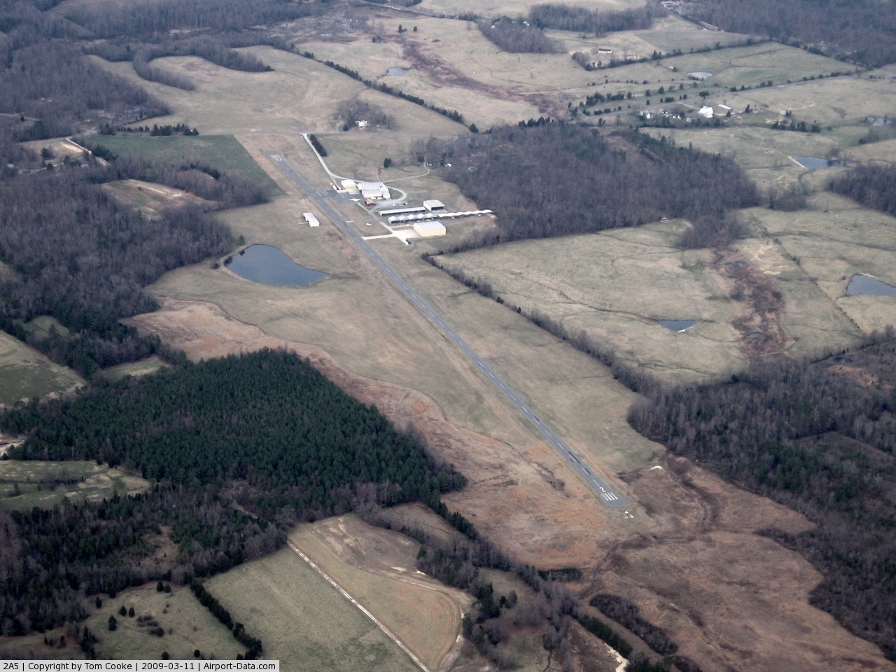
(Click on the photo to enlarge) |
 |
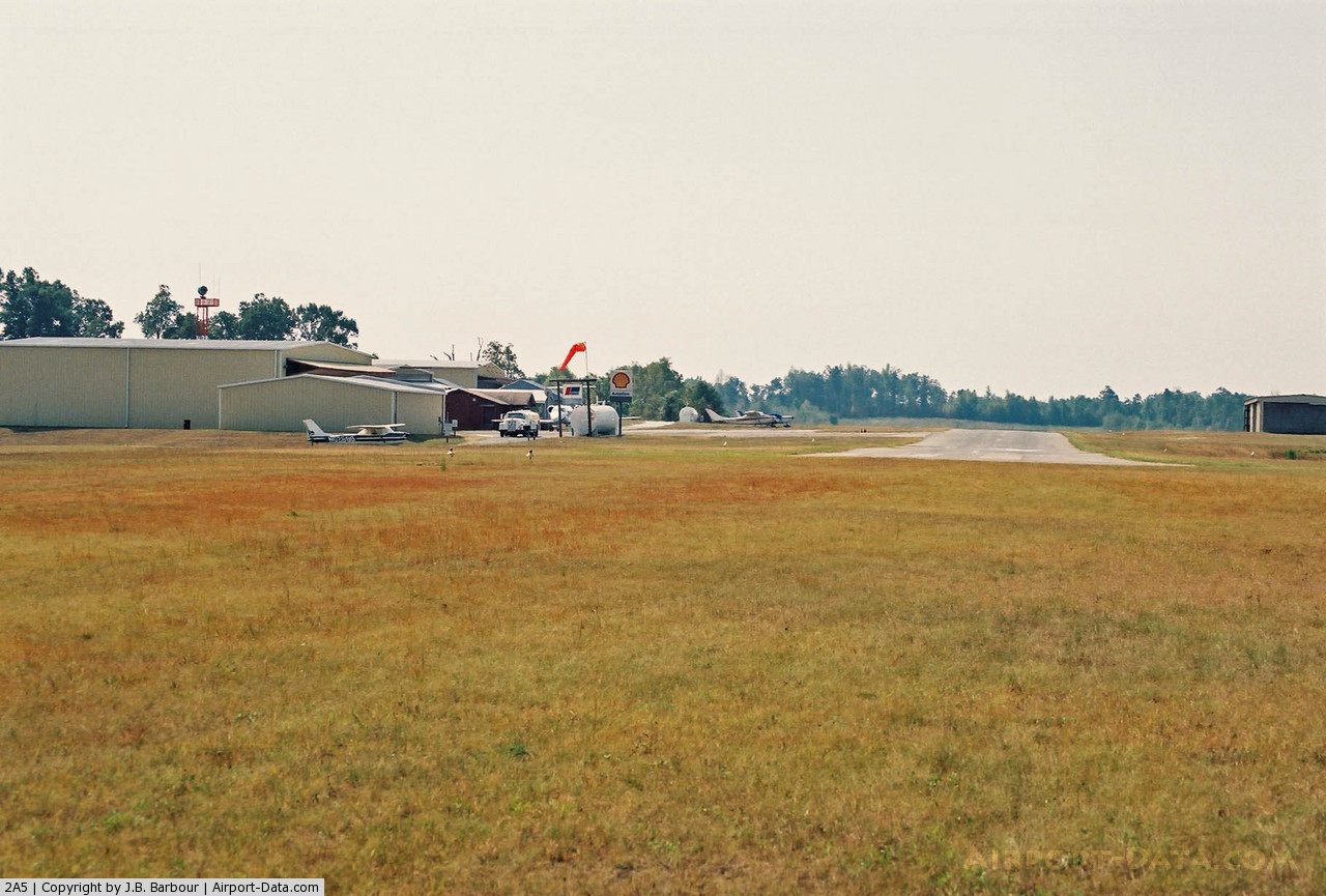
(Click on the photo to enlarge) |
Location & QuickFacts
| FAA Information Effective: | 2008-09-25 |
| Airport Identifier: | 2A5 |
| Airport Status: | Operational |
| Longitude/Latitude: | 079-37-03.5240W/35-54-42.4280N
-79.617646/35.911786 (Estimated) |
| Elevation: | 723 ft / 220.37 m (Surveyed) |
| Land: | 50 acres |
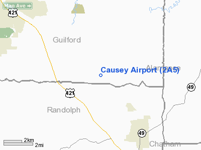
| From nearest city: | 4 nautical miles NW of Liberty, NC |
| Location: | Guilford County, NC |
| Magnetic Variation: | 08W (2005) |
Owner & Manager
| Ownership: | Privately owned |
| Owner: | Winfield Causey |
| Address: | 6120 Smithwood Rd
Liberty, NC 27298 |
| Phone number: | 336-685-4308 |
| Manager: | Winfield Causey |
| Address: | 6120 Smithwood Rd
Liberty, NC 27298 |
| Phone number: | 336-685-4423 |
Airport Operations and Facilities
| Airport Use: | Open to public |
| Wind indicator: | Yes |
| Segmented Circle: | No |
| Control Tower: | No |
| Lighting Schedule: | DUSK-DAWN |
| Beacon Color: | Clear-Green (lighted land airport) |
| Landing fee charge: | No |
| Sectional chart: | Charlotte |
| Region: | ASO - Southern |
| Boundary ARTCC: | ZDC - Washington |
| Responsible ARTCC: | ZTL - Atlanta |
| Tie-in FSS: | RDU - Raleigh |
| FSS on Airport: | No |
| FSS Toll Free: | 1-800-WX-BRIEF |
| NOTAMs Facility: | RDU (NOTAM-d service avaliable) |
Airport Communications
| CTAF: | 122.800 |
| Unicom: | 122.800 |
Airport Services
| Fuel available: | 100LLA1+ |
| Airframe Repair: | MAJOR |
| Power Plant Repair: | MAJOR |
| Bottled Oxygen: | NONE |
| Bulk Oxygen: | HIGH |
Runway Information
Runway 02/20
| Dimension: | 3800 x 40 ft / 1158.2 x 12.2 m |
| Surface: | ASPH, Good Condition |
| Weight Limit: | Single wheel: 8000 lbs. |
| Edge Lights: | Non-standard lighting system
NSTD LIRL; LGTS SMALLER THAN STD & 20 FT FM PAVEMENT EDGE. |
| |
Runway 02 |
Runway 20 |
| Longitude: | 079-37-10.0080W | 079-36-57.0400W |
| Latitude: | 35-54-24.3940N | 35-55-00.4620N |
| Elevation: | 721.00 ft | 717.00 ft |
| Alignment: | 16 | 127 |
| Traffic Pattern: | Left | Left |
| Markings: | Nonstandard, Good Condition
NSTD NPI MARKINGS; SMALLER THAN NORMAL. | Nonstandard, Good Condition
RY 20 NSTD MARKINGS; SMALLER THAN NORMAL. |
| Obstruction: | 433 ft tree, 4925.0 ft from runway, 745 ft right of centerline, 10:1 slope to clear | 30 ft trees, 357.0 ft from runway, 218 ft left of centerline, 5:1 slope to clear
+30 FT TREES 0-200 FT FM THLD 245L. |
|
Radio Navigation Aids
| ID |
Type |
Name |
Ch |
Freq |
Var |
Dist |
| OQA | FAN MARKER | Rockingham County | | | | 32.6 nm |
| HB | NDB | Himun | | 361.00 | 08W | 4.3 nm |
| TOX | NDB | Siler City | | 371.00 | 07W | 11.8 nm |
| CQJ | NDB | City Lake | | 266.00 | 08W | 16.8 nm |
| SIF | NDB | Slammer | | 423.00 | 07W | 29.1 nm |
| HUR | NDB | Person | | 220.00 | 08W | 33.0 nm |
| VU | NDB | Aller | | 346.00 | 06W | 34.0 nm |
| SEN | NDB | Swearing/dcmsnd | | 260.00 | 06W | 34.1 nm |
| TT | NDB | Leeco | | 406.00 | 08W | 34.1 nm |
| EEJ | NDB | Lee County/dcmsnd | | 428.00 | 07W | 37.7 nm |
| DVZ | NDB | Davie | | 354.00 | 06W | 40.8 nm |
| UV | NDB | Bales | | 396.00 | 07W | 43.3 nm |
| LE | NDB | Leevy | | 350.00 | 07W | 43.6 nm |
| RU | NDB | Rovdy | | 275.00 | 06W | 43.8 nm |
| DAN | VOR | Danville | | 113.10 | 06W | 41.8 nm |
| LIB | VORTAC | Liberty | 077X | 113.00 | 03W | 6.0 nm |
| GSO | VORTAC | Greensboro | 109X | 116.20 | 03W | 19.2 nm |
| RDU | VORTAC | Raleigh/durham | 119X | 117.20 | 04W | 40.7 nm |
| SDZ | VORTAC | Sandhills | 055X | 111.80 | 03W | 41.9 nm |
Remarks
- NUMEROUS OBSTRUCTIONS IN THE APPROACH AND SAFETY AREA OF RY.
- BUILDING AND PARKED ACFT WITHIN 90' OF CNTRLN AT NORTH END OF RY.
- SOFT DIRT ALL RY EDGES; EXIT RAMP & TWY.
- FUEL TANK LCTD 500 FT FROM RY 20 THLD & 125 FT LEFT.
Images and information placed above are from
http://www.airport-data.com/airport/2A5/
We thank them for the data!
| General Info
|
| Country |
United States
|
| State |
NORTH CAROLINA
|
| FAA ID |
2A5
|
| Latitude |
35-54-46.191N
|
| Longitude |
079-37-02.189W
|
| Elevation |
723 feet
|
| Near City |
LIBERTY
|
We don't guarantee the information is fresh and accurate. The data may
be wrong or outdated.
For more up-to-date information please refer to other sources.
|
|