 |
|
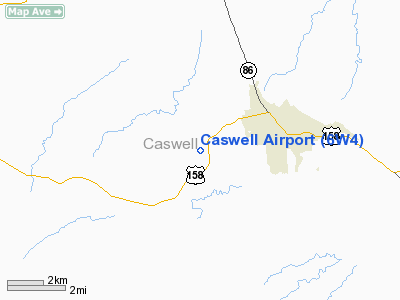
Location & QuickFacts
| FAA Information Effective: | 2008-09-25 |
| Airport Identifier: | 6W4 |
| Airport Status: | Operational |
| Longitude/Latitude: | 079-23-34.0550W/36-23-58.7500N
-79.392793/36.399653 (Estimated) |
| Elevation: | 648 ft / 197.51 m (Surveyed) |
| Land: | 10 acres |
| From nearest city: | 2 nautical miles W of Yanceyville, NC |
| Location: | Caswell County, NC |
| Magnetic Variation: | 07W (1985) |
Owner & Manager
| Ownership: | Privately owned |
| Owner: | Dr. G. Allison Page - Trustee |
| Address: | 2960 Us Hwy 158w
Yanceyville, NC 27379 |
| Phone number: | 336-694-4815 |
| Manager: | Dr. G. Allison Page |
| Address: | 2960 Us Hwy 158 W
Yanceyville, NC 27379 |
| Phone number: | 336-694-4815 |
Airport Operations and Facilities
| Airport Use: | Open to public |
| Wind indicator: | Yes |
| Segmented Circle: | No |
| Control Tower: | No |
| Landing fee charge: | No |
| Sectional chart: | Cincinnati |
| Region: | ASO - Southern |
| Boundary ARTCC: | ZDC - Washington |
| Tie-in FSS: | RDU - Raleigh |
| FSS on Airport: | No |
| FSS Toll Free: | 1-800-WX-BRIEF |
| NOTAMs Facility: | RDU (NOTAM-d service avaliable) |
Airport Communications
Airport Services
| Airframe Repair: | NONE |
| Power Plant Repair: | NONE |
| Bottled Oxygen: | NONE |
| Bulk Oxygen: | NONE |
Runway Information
Runway 04/22
| Dimension: | 1735 x 150 ft / 528.8 x 45.7 m |
| Surface: | TURF, Good Condition |
| |
Runway 04 |
Runway 22 |
| Traffic Pattern: | Left | Left |
| Obstruction: | 65 ft tree, 30 ft left of centerline | 70 ft trees, 0.0 ft from runway, 35 ft right of centerline |
|
Radio Navigation Aids
| ID |
Type |
Name |
Ch |
Freq |
Var |
Dist |
| OQA | FAN MARKER | Rockingham County | | | | 21.2 nm |
| SIF | NDB | Slammer | | 423.00 | 07W | 18.0 nm |
| HUR | NDB | Person | | 220.00 | 08W | 18.7 nm |
| HB | NDB | Himun | | 361.00 | 08W | 27.0 nm |
| UV | NDB | Bales | | 396.00 | 07W | 27.8 nm |
| HXO | NDB | Huntsboro | | 271.00 | 07W | 38.0 nm |
| TOX | NDB | Siler City | | 371.00 | 07W | 38.5 nm |
| LE | NDB | Leevy | | 350.00 | 07W | 43.2 nm |
| CQJ | NDB | City Lake | | 266.00 | 08W | 47.1 nm |
| DAN | VOR | Danville | | 113.10 | 06W | 10.5 nm |
| SBV | VORTAC | South Boston | 041X | 110.40 | 05W | 24.7 nm |
| GSO | VORTAC | Greensboro | 109X | 116.20 | 03W | 35.4 nm |
| LIB | VORTAC | Liberty | 077X | 113.00 | 03W | 36.9 nm |
| RDU | VORTAC | Raleigh/durham | 119X | 117.20 | 04W | 43.3 nm |
Remarks
- DEER ON AND INVOF ARPT.
- +4 FT FENCE 20 FT FROM THLD ON DIAGONAL.
- OCNL NIGHTTIME MILITARY OPNS.
- MODEL ACFT ACTIVITY ON ARPT.
- RY 04/22 +50-70 FT TREES ALONG BOTH SIDES OF RY.
- EXISTED PRIOR TO 1959.
Images and information placed above are from
http://www.airport-data.com/airport/6W4/
We thank them for the data!
| General Info
|
| Country |
United States
|
| State |
NORTH CAROLINA
|
| FAA ID |
6W4
|
| Latitude |
36-23-58.750N
|
| Longitude |
079-23-34.055W
|
| Elevation |
648 feet
|
| Near City |
YANCEYVILLE
|
We don't guarantee the information is fresh and accurate. The data may
be wrong or outdated.
For more up-to-date information please refer to other sources.
|
|


