 |
|
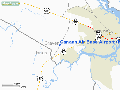
Location & QuickFacts
| FAA Information Effective: | 2008-09-25 |
| Airport Identifier: | NC20 |
| Airport Status: | Operational |
| Longitude/Latitude: | 077-10-15.0000W/35-05-23.5000N
-77.170833/35.089861 (Estimated) |
| Elevation: | 33 ft / 10.06 m (Estimated) |
| Land: | 35 acres |
| From nearest city: | 4 nautical miles W of New Bern, NC |
| Location: | Craven County, NC |
| Magnetic Variation: | () |
Owner & Manager
| Ownership: | Privately owned |
| Owner: | Calvary Baptist Church |
| Address: | P. O. Box 1089
New Burn, NC 28563 |
| Manager: | Jack D. Hunt |
| Address: | 100 Cannn Ln
New Burn, NC 28562 |
| Phone number: | 252-633-0328 |
Airport Operations and Facilities
| Airport Use: | Private |
| Control Tower: | No |
| Sectional chart: | Charlotte |
| Region: | ASO - Southern |
| Boundary ARTCC: | ZDC - Washington |
| Tie-in FSS: | RDU - Raleigh |
| FSS Toll Free: | 1-800-WX-BRIEF |
Runway Information
Runway 09/27
| Dimension: | 1840 x 40 ft / 560.8 x 12.2 m |
| Surface: | ASPH, |
| |
Runway 09 |
Runway 27 |
| Traffic Pattern: | Left | Left |
| Obstruction: | 50 ft trees, 700.0 ft from runway | 25 ft bldg, 400.0 ft from runway |
|
Radio Navigation Aids
| ID |
Type |
Name |
Ch |
Freq |
Var |
Dist |
| PGV | FAN MARKER | Belvoir | | | 06W | 34.7 nm |
| RNW | NDB | Chocowinity | | 388.00 | 07W | 25.4 nm |
| NCA | NDB | New River | | 356.00 | 08W | 25.5 nm |
| MRH | NDB | Morehead | | 269.00 | 08W | 33.1 nm |
| DKA | NDB | Kenan | | 332.00 | 07W | 36.8 nm |
| AQE | NDB | Alwood | | 230.00 | 09W | 38.4 nm |
| JYN | NDB | Wayne | | 208.00 | 08W | 44.4 nm |
| MCZ | NDB | Williamston | | 336.00 | 09W | 46.2 nm |
| ACZ | NDB | Pendy | | 379.00 | 09W | 46.8 nm |
| PMZ | NDB | Plymouth | | 221.00 | 10W | 47.7 nm |
| DIW | NDB/DME | Dixon | 107X | 198.00 | 08W | 34.3 nm |
| NKT | TACAN | Cherry Point | 075X | | 09W | 18.4 nm |
| NJM | TACAN | Bogue Mcalf | 067X | | 08W | 25.1 nm |
| NCA | TACAN | New River | 101X | | 08W | 26.6 nm |
| GSB | TACAN | Seymour Johnson | 112X | | 08W | 42.0 nm |
| EWN | VOR/DME | New Bern | 083X | 113.60 | 08W | 6.3 nm |
| ISO | VORTAC | Kinston | 033X | 109.60 | 05W | 25.4 nm |
Remarks
- PRVDD VFR OPNS & PVT USE.
Images and information placed above are from
http://www.airport-data.com/airport/NC20/
We thank them for the data!
| General Info
|
| Country |
United States
|
| State |
NORTH CAROLINA
|
| FAA ID |
NC20
|
| Latitude |
35-05-32.000N
|
| Longitude |
083-10-07.000W
|
| Elevation |
4110 feet
|
| Near City |
HIGHLANDS
|
We don't guarantee the information is fresh and accurate. The data may
be wrong or outdated.
For more up-to-date information please refer to other sources.
|
|


