 |
|
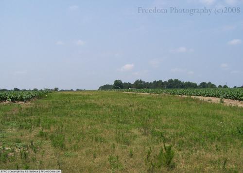 |
(Click on the photo to enlarge) |
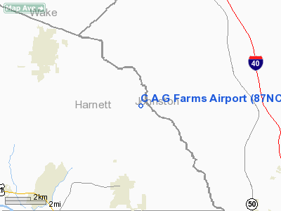
Location & QuickFacts
| FAA Information Effective: | 2008-09-25 |
| Airport Identifier: | 87NC |
| Airport Status: | Operational |
| Longitude/Latitude: | 078-39-16.0000W/35-28-10.0000N
-78.654444/35.469444 (Estimated) |
| Elevation: | 310 ft / 94.49 m (Estimated) |
| Land: | 0 acres |
| From nearest city: | 7 nautical miles SE of Angier, NC |
| Location: | Harnett County, NC |
| Magnetic Variation: | 08W (2000) |
Owner & Manager
| Ownership: | Privately owned |
| Owner: | Albert Gregory |
| Address: | 4009 Abattoir Road
Angier, NC 27501-7828 |
| Phone number: | 910-897-4040 |
| Manager: | Albert Gregory |
| Address: | 4009 Abattoir Road
Angier, NC 27501-7828 |
| Phone number: | 910-897-5480 |
Airport Operations and Facilities
| Airport Use: | Private |
| Segmented Circle: | No |
| Control Tower: | No |
| Sectional chart: | Charlotte |
| Region: | ASO - Southern |
| Boundary ARTCC: | ZDC - Washington |
| Tie-in FSS: | RDU - Raleigh |
| FSS Toll Free: | 1-800-WX-BRIEF |
Runway Information
Runway 06/24
| Dimension: | 2000 x 50 ft / 609.6 x 15.2 m |
| Surface: | TURF, |
| |
Runway 06 |
Runway 24 |
| Traffic Pattern: | Left | Left |
| Obstruction: | | 35 ft pline |
|
Radio Navigation Aids
| ID |
Type |
Name |
Ch |
Freq |
Var |
Dist |
| HQT | NDB | Harnett | | 417.00 | 08W | 2.4 nm |
| JN | NDB | Jurly | | 263.00 | 09W | 11.2 nm |
| EUU | NDB | Jnall | | 251.00 | 07W | 16.8 nm |
| POB | NDB | Pope | | 338.00 | 07W | 20.7 nm |
| FGP | NDB | Fort Bragg | | 393.00 | 07W | 21.3 nm |
| TT | NDB | Leeco | | 406.00 | 08W | 23.8 nm |
| LE | NDB | Leevy | | 350.00 | 07W | 27.7 nm |
| EEJ | NDB | Lee County/dcmsnd | | 428.00 | 07W | 28.4 nm |
| CTZ | NDB | Clinton | | 412.00 | 08W | 33.0 nm |
| JYN | NDB | Wayne | | 208.00 | 08W | 37.1 nm |
| RW | NDB | Jambe | | 235.00 | 09W | 38.2 nm |
| TOX | NDB | Siler City | | 371.00 | 07W | 43.2 nm |
| DKA | NDB | Kenan | | 332.00 | 07W | 43.3 nm |
| HFF | NDB | Mackall | | 278.00 | 06W | 48.7 nm |
| HXO | NDB | Huntsboro | | 271.00 | 07W | 50.0 nm |
| POB | TACAN | Pope | 085X | | 07W | 25.9 nm |
| GSB | TACAN | Seymour Johnson | 112X | | 08W | 34.4 nm |
| FAY | VOR/DME | Fayetteville | 025X | 108.80 | 04W | 31.0 nm |
| RDU | VORTAC | Raleigh/durham | 119X | 117.20 | 04W | 25.0 nm |
| SDZ | VORTAC | Sandhills | 055X | 111.80 | 03W | 48.2 nm |
Remarks
- OWNER DESIRES CHARTING.
- PROVIDED VFR OPNS, PRIVATE USE.
Images and information placed above are from
http://www.airport-data.com/airport/87NC/
We thank them for the data!
| General Info
|
| Country |
United States
|
| State |
NORTH CAROLINA
|
| FAA ID |
87NC
|
| Latitude |
35-28-10.000N
|
| Longitude |
078-39-16.000W
|
| Elevation |
310 feet
|
| Near City |
ANGIER
|
We don't guarantee the information is fresh and accurate. The data may
be wrong or outdated.
For more up-to-date information please refer to other sources.
|
|


